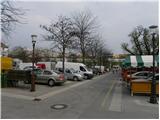
Vodnikov trg - Ljubljana Castle
Starting point: Vodnikov trg (293 m)
| Latitude/Longitude: | 46,05110°N 14,50940°E |
| |
Walking time: 15 min
Difficulty: easy marked way
Elevation gain: 83 m
Elevation difference along the route: 83 m
Map: Ljubljana - okolica 1:50.000
Recommended equipment (summer):
Recommended equipment (winter):
Views: 7.833
 | 3 people like this post |
Access to starting point:
A) From the main bus and railway station in Ljubljana, we drive onto Resljeva cesta, along which we drive to the Dragon Bridge. Immediately after the bridge, we turn right towards the Center market, where we park (parking is possible from Monday to Friday inclusive between 18:30 and 5:00, on Saturdays from 18:30 onwards and on Sundays and holidays all day until 5:00 the next day - data from April 2013).
B) To the starting point, we can also arrive from the direction of Poljanski nasip or by city bus LPP number 13.
Route description:
From the starting point, we first walk to the monument to Valentin Vodnik, where nearby we notice the mountain signs for the Castle, Šance and Roška cesta, which direct us onto a narrower street (Študentovska ulica), which first starts to ascend gently. When the houses end, the path becomes macadam and steeper. Higher up, the path splits into two parts, and we continue on the right path (also possible on the left). After a few minutes, the path flattens and brings us below Ljubljanski grad, where we step onto a kind of bridge, along which we walk to the parking lot at Ljubljanski grad.
From the parking lot, we walk to the castle palace from where we ascend numerous stairs to the lookout tower (ascent to the lookout tower is payable).
Photos:
 1
1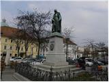 2
2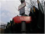 3
3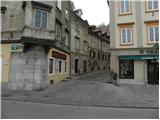 4
4 5
5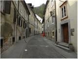 6
6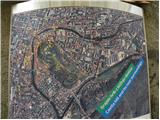 7
7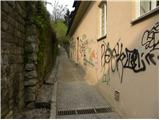 8
8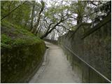 9
9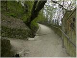 10
10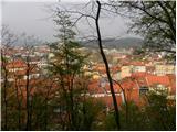 11
11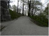 12
12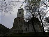 13
13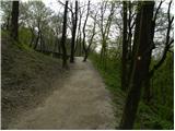 14
14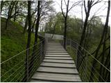 15
15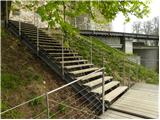 16
16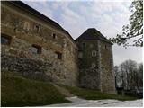 17
17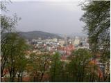 18
18
Discussion about the trip Vodnikov trg - Ljubljana Castle
|
| pelican14. 02. 2014 |
Yesterday during lunch access to the castle was blocked 
|
|
|
|
| toplar15. 02. 2014 |
How is this to be understood? Usually they let you climb to LG during lunch, but yesterday they didn't.
|
|
|
|
| pelican16. 02. 2014 |
What all can be done in half an hour, you can move from one chair to another and eat, or you can opt for a walk that is altogether shorter than half an hour. This time nature showed its teeth and it will show them.
|
|
|
|
| Duhec8. 03. 2015 |
When walking don't eat, you might choke 
|
|
|
To post a comment you must log in:
If you do not yet have a username, you must first
register.