Vojaška karavla - Golem Korab / Maja e Korabit
Starting point: Vojaška karavla (1473 m)
Walking time: 4 h
Difficulty: easy marked way
Elevation gain: 1291 m
Elevation difference along the route: 1291 m
Map:
Recommended equipment (summer):
Recommended equipment (winter):
Views: 19.152
 | 6 people like this post |
Access to starting point:
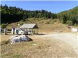
I'll describe the route in detail so it's easier for those who will go on the same trip. From the dam at Mavrovo Lake - Macedonia (Mavrovski Anovi) where there's also a junction, drive towards Debar. When in a right bend you see a tavern on the left side, drive another few hundred meters until you see a bridge on the right. Turn right here and drive across this bridge. From the dam (Mavrovski Anovi) to the bridge is 8 km. Then soon the macadam starts and since the road is very bad, you'll spend more than 30 minutes on this stretch. From the bridge to the police station, or rather the police office, is 10 km drive. We stopped here, the policeman came out of the station and we told him we intend to go to Golem Korab and asked him to issue a permit. He said we don't need a permit and that we can continue, and told us how to get to the starting point. From the police station drive another 1 km, then turn left and drive another 2 km, then you arrive at the abandoned military barracks where you can park your car without problems.
Route description:
From the starting point at the abandoned military barracks at an elevation of 1,473 m we set off at 09:30. Here I must warn that the path from the starting point is not marked at all. Therefore, tip: from the barracks where we parked the vehicle, go uphill (in the west direction) and after a few meters of uphill walking you will reach a macadam road. Follow it to the next left bend and there you will find the first marker. From the barracks to the first marker is only 100 meters, so no panic. From here onwards there are plenty of markers, so you can't get lost. The first short section of the path leads through the forest, then ahead of you is only meadow, so no shade possible. Take this into account and bring enough water, headgear, sunscreen etc. On the path we could admire the magnificent landscape, we encountered two snakes, some shepherds, sheep and shepherd dogs, but everything went without problems. For the path from the starting point to the summit we needed 3 hours and 50 minutes.
From the summit wonderful views opened towards Albania, Kosovo and Macedonia. It must be said that Golem Korab is a border mountain and we thus visited the highest mountain of Macedonia and Albania at once. On the summit a shepherd joined us, Albanian by nationality, who spoke Macedonian-Serbian-Croatian and we engaged in a short and interesting conversation. The descent followed the same path and for it we needed 2 hours and 45 minutes and thus arrived at the starting point at 17:00.

Photos:
 1
1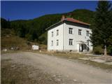 2
2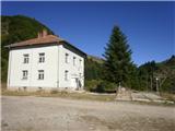 3
3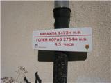 4
4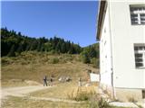 5
5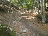 6
6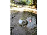 7
7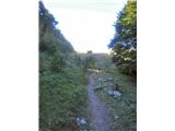 8
8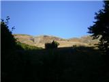 9
9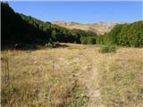 10
10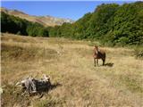 11
11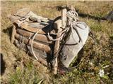 12
12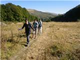 13
13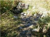 14
14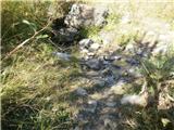 15
15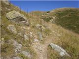 16
16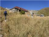 17
17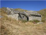 18
18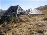 19
19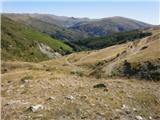 20
20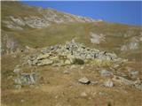 21
21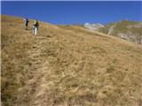 22
22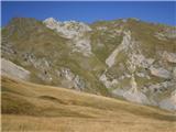 23
23 24
24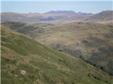 25
25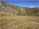 26
26 27
27 28
28 29
29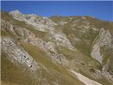 30
30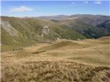 31
31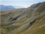 32
32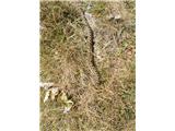 33
33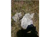 34
34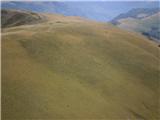 35
35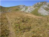 36
36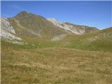 37
37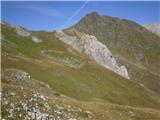 38
38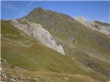 39
39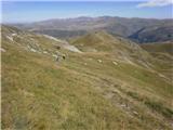 40
40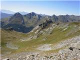 41
41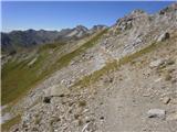 42
42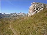 43
43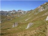 44
44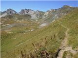 45
45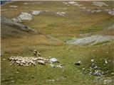 46
46 47
47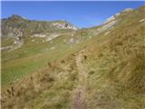 48
48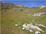 49
49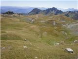 50
50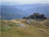 51
51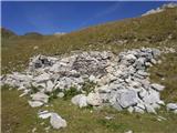 52
52 53
53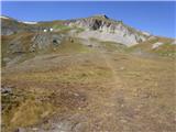 54
54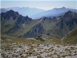 55
55 56
56 57
57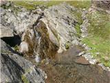 58
58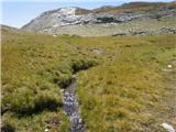 59
59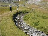 60
60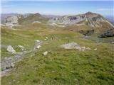 61
61 62
62 63
63 64
64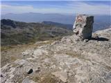 65
65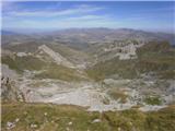 66
66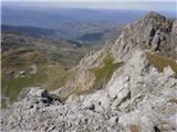 67
67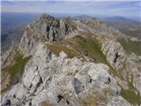 68
68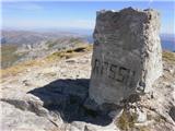 69
69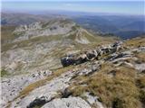 70
70 71
71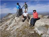 72
72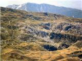 73
73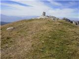 74
74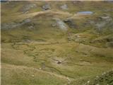 75
75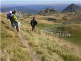 76
76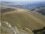 77
77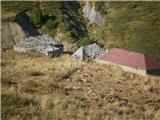 78
78 79
79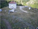 80
80
Discussion about the trip Vojaška karavla - Golem Korab / Maja e Korabit
|
| Johny7729. 11. 2010 |
Wasn't it called Titov vrh before??
|
|
|
|
| sjevnika30. 11. 2010 |
How many like the one in picture 33 have you seen?
|
|
|
|
| juki1. 12. 2010 |
I've wanted to conquer Korab for quite some time, is the path well marked? And is it safe?
|
|
|
|
| navrhu2. 12. 2010 |
Yes, yes, yes. In Slovenia there is no such well-marked hiking trail as the path to Golem Korab. Anyone with the stamina for a few hours of walking can safely reach Golem Korab. It's easiest to compare it to Velika Planina (grass, bushes, no cliffs...)
|
|
|
|
| atoamac2. 12. 2010 |
History teaches us that they fiercely defend against "conquerors" down there, but they are incredibly hospitable to guests.
|
|
|
|
| juki2. 12. 2010 |
Thanks for the reply, I'll work on it so that we conquer it next year. Regarding hospitality, I can say it holds true, as I lived under Popovo Šapka for 12 years.
|
|
|
|
| Damijan19. 02. 2011 |
Looks "easy-peasy", but it's only 100m lower than Triglav.
|
|
|
|
| skobi26. 09. 2012 |
Hi!
I'm wondering if you can get higher or closer with a 4x4, judging by the photos it seems yes. We're going to Korab this year mid-November (of course, if there's no snow!), it'll already be a short day and we don't want to risk a night hike!
|
|
|
|
| andrej.bg26. 09. 2012 |
Given that, especially with good views, it's a full-day tour, some experiences regarding overnight stays would be welcome.
|
|
|
|
| yogo2. 08. 2013 |
I searched the net for a long time for cheap accommodation in Mavrovo but didn't find any. Luckily the keeper of Konak house at Popova Šapka, where we stayed, arranged stay in hotel from ELEM company. Price Mavrovo 25 eur per room for sleeping. Price Popova Šapka 11 eur half-board.
Otherwise around Mavrovo they charge 30 to 60 eur per person.
Road drivable to Pobede, potholed but ok with normal car.
No snakes seen, partly cloudy, hot below, towards summit wind cooled the air.
On 19.7. still quite some snow but avoidable.
Met three Albanian shepherds with sheep on the way, even spoke some English words with the younger guy.
Recommended.
|
|
|
|
| grajena28. 05. 2014 |
WARNING!
The mentioned description is not realistic, perhaps fictional? Maybe it's a joke? If you follow this description you end up in another valley, the kilometers don't match, left-right directions don't either. I suggest deleting the ad and checking the user's other ads.
My advice: from Mavrovo after 6km turn right over the bridge to the ''monastery'' - the tavern described by the author is further on, and it takes you to another valley. Then stick to the main road along the valley. After the police station, at the third intersection turn 150° uphill, where a very poor road to the barracks starts. Safe path among many snakes, bears and illegals.
|
|
|
|
| majdicst21. 07. 2014 |
The sign 4.5 hours at the barracks is quite a realistic estimate. For less you have to walk quite fast, although it is possible to arrive also in 3 hours and 15 minutes - at least that's what our local guide claimed. Of course, it also depends on the size of the group. The larger it is, the longer it takes.
The path itself is pleasant, perhaps I would just add that along the path you have several opportunities to fill the "canteen", so you don't have to carry a huge supply of water with you. In the middle of the path there is quite a long section of walking on flat (or even slightly downhill, since you lose about 60 altitude meters), with fantastic views to the south.
On the descent you can slightly adjust the upper part to the remains of the shepherd's hut (picture 52) and go for some time along the ridge in the general direction south and only then descend straight down the slope into the valley that leads to the ruins. However, it is usually necessary on this path to cross snowfields below the ridge.
Last week on this path we didn't encounter any snake, only a few flocks of sheep with shepherds (two- and four-legged), and absolutely no other hiker. We also didn't see any bear or illegal ... 
|
|
|
|
| felix31. 01. 2022 10:38:34 |
I'm just planning to go to these areas, and the grajene comment bothered me a bit. Obviously wants people to hike only with Izimanija guidance?
|
|
|
|
| radokralj12. 06. 2022 20:26:42 |
To the starting point, i.e. the barracks, I would go with a motorhome (height 3m). I'm interested if it's possible to drive such a vehicle to the starting point. Thanks and best regards!
|
|
|
|
| bongo13. 06. 2022 10:56:31 |
Width might be more of a problem than height. I was there with a transporter and don't remember any overpass. The trickiest part is the left turn and the ascent from the "main" road to the barracks themselves, as it's quite steep - you might have to turn higher up somewhere (they might have widened it in between). There's plenty of parking space at the barracks. The path to Korab is beautiful and scenic, technically undemanding, just bring enough fluids. Best regards
|
|
|
|
| felix23. 06. 2022 11:18:59 |
On Sunday we visited Korab. We came by van, parked lower below the barracks since the road is in very poor condition. Driving with a motorhome or low-clearance car is for those who don't care about their vehicle at all. Otherwise the trail to Korab itself is nothing special, just physically demanding due to its length. We encountered no snakes.
|
|
|
|
| navdušena26. 12. 2022 20:25:48 |
Is the barracks called Stezimir?
|
|
|
|
| bongo26. 12. 2022 21:32:46 |
|
|
|
|
| Gorazd1120. 08. 2025 19:56:49 |
Visited Golem Korab today. Quite demanding in terms of fitness, not technically. Mandatory to pay 100 MKD (2 €) for national park entry before heading to the starting point. They turned me back and I had to drive up twice on a not very pleasant road. You can also pay online (www.npmavrovo.mk/tickets), but the problem is there's no signal at the police station. Everything else is ok, no snakes seen, no dogs either, no wild animals, no illegals either. Met sheep and two shepherds. Took me about 3.5 hours to the summit.
|
|
|
To post a comment you must log in:
If you do not yet have a username, you must first
register.