Vojnik - Sveti Tomaž above Vojnik
Starting point: Vojnik (286 m)
| Latitude/Longitude: | 46,29011°N 15,30086°E |
| |
Walking time: 1 h
Difficulty: easy marked way
Elevation gain: 158 m
Elevation difference along the route: 175 m
Map:
Recommended equipment (summer):
Recommended equipment (winter):
Views: 4.660
 | 2 people like this post |
Access to starting point:
We follow the Styrian motorway to the Celje-center exit, where we leave the motorway and head towards Vojnik. We follow the main road to Vojnik, where on the left we soon notice the Tuš supermarket. We park here. If parking here is not possible, we park at the beginning of Vojnik by the cemetery; this extends the path by 10 minutes.
Route description:
From Tuš we head towards Slov. Konjice and Dobrna, but we follow the main road only to the prominent Hunter's Pub inn (on the right side of the road), in front of which we turn right. Then on the right side we already notice the first mountain signpost. We follow this road until we notice a house with an illustration of the church of St. Jakob on Resnik. There the sign directs us left. We follow the road straight the whole time in the direction of the church of St. Florian. At the church the sign directs us right, uphill along the Way of the Cross towards the church of Mary of the Seven Sorrows. Here a magnificent view awaits us on Vojnik, the Celje Basin and the Zasavje Hills. Past the church we continue left on the asphalt road which leads past several chapels. We follow the road past the homestead to a crossroads, where the blazes direct us left uphill. At the sharp bend we continue straight into the forest, where a well-marked path awaits us, which brings us to a viewpoint at the edge of the forest. Here we turn left past the benches into the forest. The path runs along an indistinct ridge and rises and falls several times. Soon we descend to a macadam road and continue along it until we come to a crossroads with an asphalt road. Here the sign directs us straight, and from there signs and blazes lead us nicely to the church of St. Tomaž on the top.
Beside the church there are benches, by which there is a box with a logbook and a stamp. Just below the little church we descend the stairs to Koča pri Tomažu, a mountain hut which is open on Sundays and holidays.

Photos:
 1
1 2
2 3
3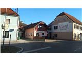 4
4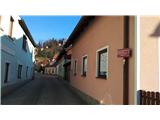 5
5 6
6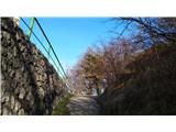 7
7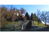 8
8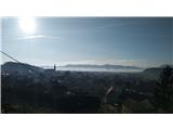 9
9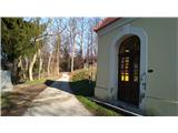 10
10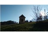 11
11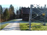 12
12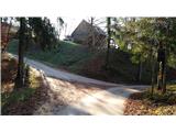 13
13 14
14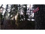 15
15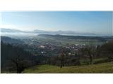 16
16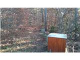 17
17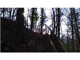 18
18 19
19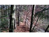 20
20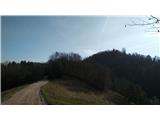 21
21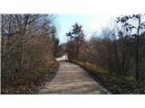 22
22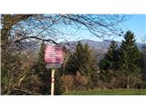 23
23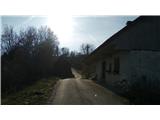 24
24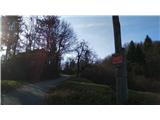 25
25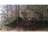 26
26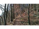 27
27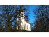 28
28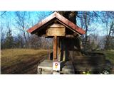 29
29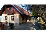 30
30 31
31
Discussion about the trip Vojnik - Sveti Tomaž above Vojnik
|
| slavkoo2. 05. 2021 16:02:18 |
Went on this trail today. That distinctive pub at the trail start is now a hostel, otherwise the trail is interesting, scenic, varied. Maybe two or three markings missing in the forest where there are several junctions.
Recommend, also to families with small children.
|
|
|
|
| tanjak3. 04. 2022 20:30:33 |
Despite poor weather we headed for the circular path from Vojnik. Path well marked, interesting (with cross path), scenic. Under church pleasant Koča pri Tomažu with friendly caretakers (mountaineers).
|
|
|
To post a comment you must log in:
If you do not yet have a username, you must first
register.