Starting point: Vojsko (1077 m)
| Latitude/Longitude: | 46,02370°N 13,90310°E |
| |
Walking time: 1 h 30 min
Difficulty: easy marked way
Elevation gain: 71 m
Elevation difference along the route: 200 m
Map: Škofjeloško in Cerkljansko hribovje 1:50.000
Recommended equipment (summer):
Recommended equipment (winter):
Views: 13.971
 | 1 person like this post |
Access to starting point:
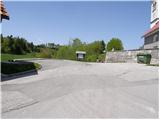
First, we drive to Idrija and then we continue driving in the direction of Vojsko. After approximately 14 km of driving from Idrija, along an initially quite ascending road, we arrive at the center of the village, where we park on the parking lot at the church of St. Joseph.
Route description:
From the parking lot at the church, we first descend the stairs to the nearby road, which we follow to the left, then we walk to the nearby inn with lodging Pri Medvedovih. Beyond the mentioned inn we notice signs for the printing works Tiskarna Slovenija, which direct us onto a slightly descending and initially still fully asphalted road. We follow the road, which with some shorter ascents and descents continues across the Vojskarska planota, in the direction of the partisan printing works Slovenija; then, when the road towards the mentioned printing works turns sharply right, we continue in the direction of Hudournik and partisan cemetery or mass grave. The road, which still continues across the Vojskarska planota, brings us after a while to a well-maintained partisan cemetery or mass grave. We continue along the road, following it past the last houses to the spot where signs for Hudournik direct us slightly to the right onto a gently sloping cart track. The cart track first crosses a strip of forest, then brings us to a larger meadow, where it changes into a pleasant footpath. We continue on the mentioned path, which in a few minutes of further walking across a panoramic grassy slope brings us to the panoramic and expansive Hudournik.

Photos:
 1
1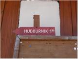 2
2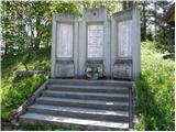 3
3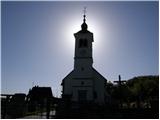 4
4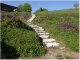 5
5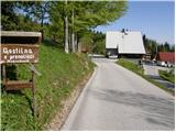 6
6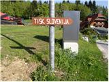 7
7 8
8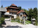 9
9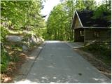 10
10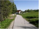 11
11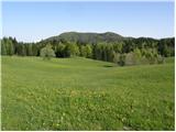 12
12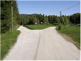 13
13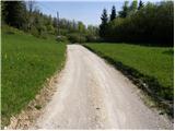 14
14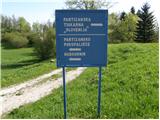 15
15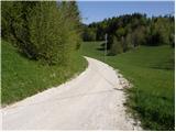 16
16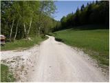 17
17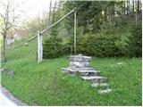 18
18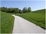 19
19 20
20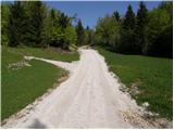 21
21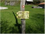 22
22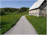 23
23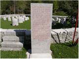 24
24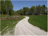 25
25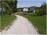 26
26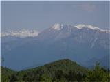 27
27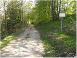 28
28 29
29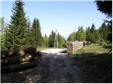 30
30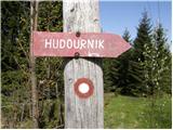 31
31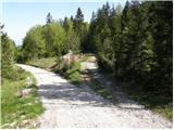 32
32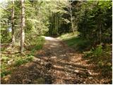 33
33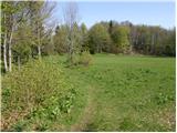 34
34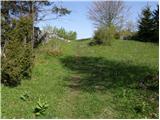 35
35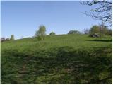 36
36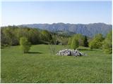 37
37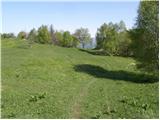 38
38 39
39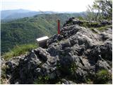 40
40 41
41
Discussion about the trip Vojsko - Hudournik
|
| klavdipo28. 02. 2013 |
Has anyone been up there after this heavy snowfall? Is the logbook box accessible? Best regards.
|
|
|
|
| klavdipo4. 03. 2013 |
I went alone to check, conditions are o.k., the box is accessible! Otherwise, Hudournik is really a nice viewpoint. LP
|
|
|
|
| miri4. 03. 2013 |
Me too. Snow well over a meter, but it holds a man on top. The neighbor says 4.70 m of it fell this winter. Lp
|
|
|
|
| ločanka27. 05. 2021 21:10:00 |
The mentioned inn at Medved's (6) hasn't existed for about 10 years.
Otherwise a very beautiful path! Some snapshots from the path across Vojskarska planota, current conditions . .
|
|
|
To post a comment you must log in:
If you do not yet have a username, you must first
register.