Starting point: Volče (600 m)
| Latitude/Longitude: | 45,67710°N 14,09570°E |
| |
Walking time: 1 h 30 min
Difficulty: easy marked way
Elevation gain: 427 m
Elevation difference along the route: 427 m
Map:
Recommended equipment (summer):
Recommended equipment (winter):
Views: 80.729
 | 6 people like this post |
Access to starting point:
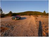
From the highway Ljubljana - Koper we go to the exit Postojna and we follow the road ahead towards Pivka and Ilirska Bistrica. Soon after the park of military history in Pivka, the road branches off to the right towards villages Kal, Neverke, Volče and Divača. We go on the mentioned road which we follow further in the direction of Divača. After a few kilometers of driving, we will get to a crossroad, where a narrower road branches off to the right towards the village Volče. Here we turn right and then we park on an appropriate place near the signposts for Vremščica.
Route description:
From the starting point, we continue on a relatively rough macadam road, and it quickly brings us to the upper parking lot. We continue the ascent on the left side of the water catchment, on a marked footpath which passes into a mostly pine forest. Ahead we are relatively gently ascending through a pine grove on the path, from which occasionally a view opens up. The path ahead passes onto the main and initially still forest-covered ridge of Vremščica, on and alongside which we then ascend for quite some time. After a good hour of walking, we step out of the forest and from the path nice views start opening up on Snežnik, Slavnik and Nanos. Higher, we cross a short lane of bushes, behind which we notice the new church of St. Urban. After the church, we again step out of the forest onto ample grassy slopes of Vremščica, on which then in less than 10 minutes of additional walking we ascend to Velika Vremščica, which is the highest peak of Vremščica.
Photos:
 1
1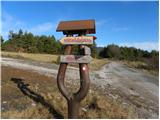 2
2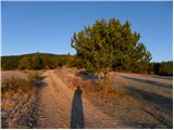 3
3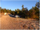 4
4 5
5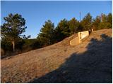 6
6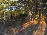 7
7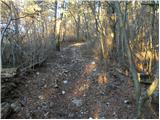 8
8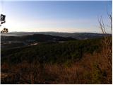 9
9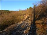 10
10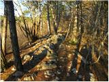 11
11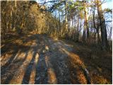 12
12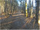 13
13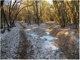 14
14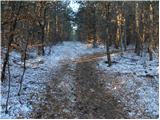 15
15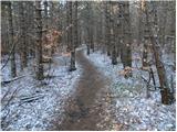 16
16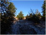 17
17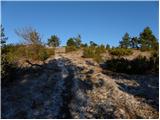 18
18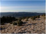 19
19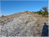 20
20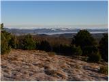 21
21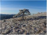 22
22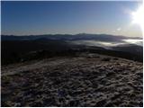 23
23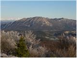 24
24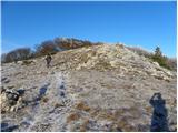 25
25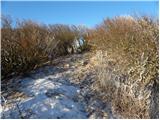 26
26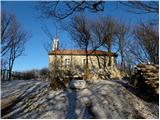 27
27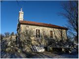 28
28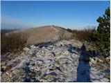 29
29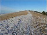 30
30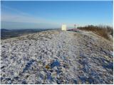 31
31 32
32
Discussion about the trip Volče - Vremščica
|
| NEIC00813. 03. 2009 |
On 12.3.2009 hiked the path in less than an hour. When will the church construction be finished?? 
|
|
|
|
| GITA13. 03. 2009 |
Is there still any snow on the path and at the summit? Is anything blooming yet?
|
|
|
|
| NEIC00814. 03. 2009 |
There's not even a trace of snow, and almost no blooming either.. But soon..
|
|
|
|
| Žan18. 05. 2009 |
The narcissuses have bloomed out, goldenroot and peonies are in full swing, the little church is (almost) finished. Next Sunday there will be a solemn blessing.
|
|
|
|
| Lj21. 06. 2009 |
For me the most beautiful approach to Vremščica. An additional pleasant surprise is the little church of Sv. Urban with extremely beautiful stone carving details. The master who made this is a true artist!
|
|
|
|
| m30. 12. 2009 |
Hello!
On Sunday, the sea was visible from Vremščica (just above the pines, in the direction from Volče), but the summit was then in fog and up there everything was in bloom (ivy). It was a bit windy, but not as much as it can blow up here . .
For me too, the best access is from Volče, once you reach the little church, then to the summit it's almost flat. The other paths are also nice and interesting; a bit steeper from Lezec, a bit longer from Senozec. And from the sheep farm it's also nice.
And the flora; narcissus or urbanscice in the second half of May, then in July gentian or edelweiss, goldenroot and various cudweeds,... no wonder professors go up there with students.
The master who takes care of the stone details is really a true artist, it's the priest Vid Premrl. He is also the 'author' of the little angels on Nanos.
|
|
|
|
| Lj30. 12. 2009 |
Hello "M", you mention the little angels on Nanos in plural - are there more? I found only one in the upper part of the steep path, and unfortunately that one is damaged. If you know of any other artwork in nature by this artist, I would appreciate the information. Best regards
|
|
|
|
| m1. 01. 2010 |
Hello!
On Nanos on 8.8.2009, on the rock by the last fixed rope, another little angel 'joined'. However, it is assumed that the same hand 'belonged' to it and broke off its nose and chin just a few days later. Vandalism knows no bounds! If it bothers someone, let them turn the page! If it bothers someone, let them turn the page!
Mr. Vid Premrl's work is also visible on the little church of Sv. Bric (below Nanos). If you go, from the direction of Po (through Hrusevje), turn at Pri Treh Hisah towards the village Strane and from there a nicely marked path leads to Sv. Bric (and further to Nanos). Or from the highway at Razdrtem head towards Po or towards Pri Treh Hisah.
Best regards.
|
|
|
|
| Lj1. 01. 2010 |
Thank you for the information, I've had this trail to Nanos past Sv. Brica planned for some time. But it's impossible to understand someone who destroys the beauty created by an artist with one blow. It doesn't matter if it's a priest or a punk, the products are still artworks and a joy to those who want to see their beauty.
|
|
|
|
| AndrejaT11. 04. 2010 |
On 10.4.2010 I walked the path in 1 hour and 10 min - moderate pace. The church is completed. Really nice little church. Best regards
|
|
|
|
| Lisica23. 04. 2011 |
If someone wants to come by train, get off at Košana station (first station from Pivka towards Sežana) and walk along the road to this starting point in the village Volče, I think it's about 15-20 min walk. The road is not very busy. A circular route can be made further to Divača or Ležeče.
|
|
|
|
| lynx.attentus6. 04. 2013 |
Today I ascended in good company of foresters along the described path. We had the 2nd traditional hike to Vremščica. The path is a bit muddy in the lower part, but no problem. Higher up there are snow patches, but they can be crossed without issues. At the top cold wind and fog. The church of St. Urban is worth seeing. It's worth donating a coin, you'll be surprised It seems to me we did the path in one hour.
|
|
|
|
| smatjaz16. 04. 2013 |
Does anyone know a good food option nearby, since there is no mountain hut on Vremščica and where should I watch out not to miss the path. Thank you kindly for the advice. 
|
|
|
|
| stasa_t17. 04. 2013 |
Gostilna Špelca in Gornja Košana - small village inn offering home-cooked food (most visited on weekends, but probably won't let you go hungry during the week either, closed on Mondays). The path to Vremščica from this direction is well described above and I think there's no worry about missing the route anywhere ...
|
|
|
|
| smatjaz17. 04. 2013 |
stasa_t, many thanks for the advice, my son and I will definitely visit them.
|
|
|
|
| Lisica15. 04. 2014 |
How is the path regarding the ice storm... Are the daffodils blooming already? Thanks.
|
|
|
|
| padez16. 04. 2014 |
All marked mountain paths to Vremščica are normally passable, except the mountain path Senožeče - Vremščica (to the junction of the path Škocjanske jame - summit Vremščica), which is also part of SPP and is impassable due to ice storm damage. Passage along the aforementioned route is life-threatening due to hanging trees and branches. The impassability of this mountain path is clearly marked with warning signs and posters at the starting points in Senožeče (parking lot by the main road - on both sides of the village street and also in the village center on the power pole in the direction of the path. Poster about impassability of the route is also at the junction of the Škocjanske jame - Senožeče trail below the summit of Vremščica. Warning about impassability of this path is posted on the PZS - KZP websites and was published in the magazine "Primorske novice" - valid until revoked.
For admiring blooming daffodils on this "Primorska Golica" it is still about a month too early...
|
|
|
|
| B.C.16. 04. 2014 |
I don't know about the daffodils along the path from Volče to Vremščica, but on the opposite side of Vremščica, on the grassy slopes around the Center of the Veterinary Faculty for natural recultivation, the first daffodils have already bloomed about a week ago. For now, blooming daffodils are still rare (photos of blooming daffodils from Slatna and Domače gore are posted on the forum Katera rožca je to?, page 87).
|
|
|
|
| Lisica16. 04. 2014 |
Thanks to both. Hope there will be time this weekend to go up. If the daffodils have already started blooming then they usually do so earlier on this side from Volče as it is sunnier.
|
|
|
|
| bizgo9328. 02. 2021 |
The path from Volče to Vremščica is not very steep, but it ascends quite steadily the entire way and practically doesn't level out anywhere until the last good 100 m from the church to the summit. Still, the path is suitable for everyone, and in fine weather the views from the summit are stunning, reaching Snežnik and surrounding hills, the valley of the Reka River, the entire Košana Valley, Pivška Basin, Javorniki, Nanos, Čičarija, and to the Julian Alps and Kamnik Alps and the Gulf of Trieste (I missed something ). Personally, I like to visit the summit before sunset, when the sun nicely sets into the sea. Below the summit there is also a beautiful church of St. Urban. Exceptionally nice hill with one of the best panoramas in the area.
|
|
|
|
| balon1. 02. 2024 10:02:29 |
What are the conditions on this trail? Is it quite icy?
|
|
|
|
| Milan611. 02. 2024 13:26:19 |
Conditions on Saturday 27.1.2024: the path is dry and normally passable.
|
|
|
|
| balon2. 02. 2024 09:54:50 |
|
|
|
|
| blazcr4. 02. 2024 08:04:39 |
Beautiful trail, easy and yesterday normally passable and quite frequented.
|
|
|
To post a comment you must log in:
If you do not yet have a username, you must first
register.