Volkzeinalm - Hochalmspitze (Villgraten)
Starting point: Volkzeinalm (1884 m)
| Latitude/Longitude: | 46,86760°N 12,43920°E |
| |
Walking time: 2 h 45 min
Difficulty: easy marked way
Elevation gain: 913 m
Elevation difference along the route: 913 m
Map:
Recommended equipment (summer):
Recommended equipment (winter): ice axe, crampons
Views: 5.801
 | 1 person like this post |
Access to starting point:
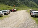
Through the Karawanks Tunnel, we drive into Austria, then continue driving towards Spittal and further towards Lienz (just after Spittal, the highway ends). Further on, we drive on a relatively nice and wide road through the Drau Valley. In the center of Lienz, at the main roundabout, we continue «left» and proceed driving towards Italy (exit from the roundabout in the direction of the villages Leisach, Anras, and Silian). In the village of Heinfels (the village is located in the immediate vicinity of the village of Silian), we will notice signs for the Villgratental valley, which direct us right onto an ascending road. A little higher, in the village of Außervillgraten, we continue right in the direction of the village of Winkeltal. We then follow the aforementioned road, which higher up loses its asphalt covering, to the parking lot at the end of the road (the road continues only to the nearby mountain hut).
Route description:
From the parking lot, we continue on the road, along which we ascend to the mountain hut Volkzeinerhütte in 2 minutes.
The marked path bypasses the aforementioned hut on the right side and then ascends across an initially gentle grassy slope. We soon reach a marked junction, where we continue right in the direction of »Hochalmspitze and Leisacher Alm« (left Gsaritzer Törl).
The path ahead crosses a torrential stream and then begins to ascend diagonally across increasingly steep slopes. The path, which runs through a thin forest, then descends on a slightly exposed slope into another gully and subsequently begins to ascend more steeply. The path ahead quickly transitions to grassy slopes, where it turns slightly to the left. Further on, we ascend along a scenic path, along which we can observe numerous alpine flowers. The path then approaches the stream, crosses it higher up, and flattens out. Only a few minutes of easy walking follow, and the path brings us to the scenic pasture Leisacher Alm, on which we notice a larger shepherd hut.
From the pasture, we continue on a somewhat less visible path, which further ascends slightly to the left. After a few minutes of ascent, the path turns even more to the left, then crosses a short rocky slope, after which we reach the area of smaller springs. Further on, the even less visible but well-marked path runs across extensive grassy slopes and gradually approaches the saddle, which is separated from us by a short, somewhat steeper ascent.
When we step onto the saddle Kleinitzer Lenke (2614 m), a beautiful view opens up of the highest peaks of the High Tauern, and we continue right along the steep ridge. The path ahead ascends steeply along the aforementioned ridge, which is full of granite slabs (some of which sway considerably). Higher up, the steepness eases slightly, and the path brings us to the edge of a pasture fence. After a few minutes, the path moves away from the fence slightly to the left and continues along an increasingly scenic ridge. We follow this pleasant ridge path, which in dry conditions poses no major danger (on the ridge, be careful not to get caught by a storm), all the way to the summit, which we reach after a few minutes of further walking.

Photos:
 1
1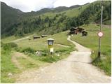 2
2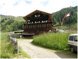 3
3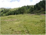 4
4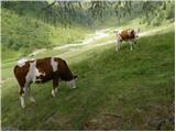 5
5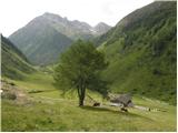 6
6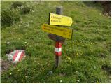 7
7 8
8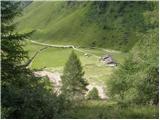 9
9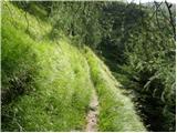 10
10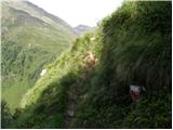 11
11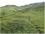 12
12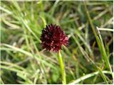 13
13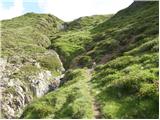 14
14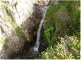 15
15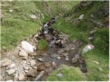 16
16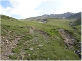 17
17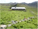 18
18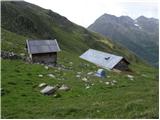 19
19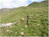 20
20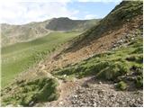 21
21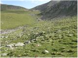 22
22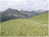 23
23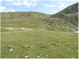 24
24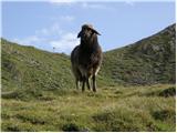 25
25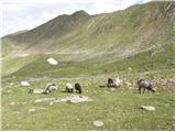 26
26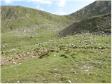 27
27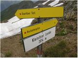 28
28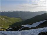 29
29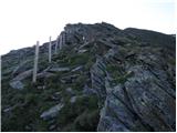 30
30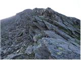 31
31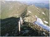 32
32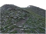 33
33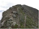 34
34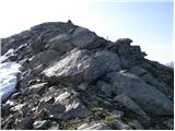 35
35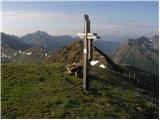 36
36
Discussion about the trip Volkzeinalm - Hochalmspitze (Villgraten)
|
| felix7. 08. 2013 |
Is there a route description somewhere for Hochalmspitze - queen of high tours 3360m?
|
|
|
To post a comment you must log in:
If you do not yet have a username, you must first
register.