Volovljek - Kranjska reber (on unmarked path)
Starting point: Volovljek (1029 m)
| Latitude/Longitude: | 46,28300°N 14,68840°E |
| |
Route name: on unmarked path
Walking time: 1 h 15 min
Difficulty: easy unmarked way
Elevation gain: 406 m
Elevation difference along the route: 406 m
Map: Kamniške in savinjske Alpe 1:50.000
Recommended equipment (summer):
Recommended equipment (winter): ice axe, crampons
Views: 2.346
 | 2 people like this post |
Access to starting point:
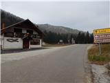
A) First, we drive to Kamnik, and then we continue driving in the direction of the mountain pass Črnivec. Just a few hundred meters before the mentioned mountain pass we notice signs for Kranjski Rak, which point us sharply left onto a narrow and at first also quite steep road. The road higher up flattens and then brings us to the mountain pass Volovljek, where near the inn Kranjski Rak we also park (parking in front of the inn is allowed only for guests). A little more space for parking is near the inn Štajerski Rak.
B) From Gornji Grad we drive towards Kamnik, and then just a few hundred meters after the mountain pass Črnivec we continue right in the direction of Kranjski Rak. Further, we follow the description above.
C) From the Savinja Valley we first drive to Luče, and then we continue driving towards Kamnik. When we come to the mountain pass Volovljek we park at an appropriate spot near the inn Kranjski Rak (parking in front of the inn is allowed only for guests). A little more space for parking is near the inn Štajerski Rak.
Route description:
From the mountain pass Volovljek we first walk to the snack bar Štajerski Rak (the snack bar is situated on the eastern side of the mountain pass Volovljek; on maps Štajerski Rak is marked at the spot where there used to be the homestead Štajerski Rak).
From the snack bar Štajerski Rak we continue on the forest road, which begins to ascend gently to moderately through the forest. From the road, which runs along the northern to northwestern slopes, a few cart tracks branch off to the right, which we count for easier orientation. When we arrive at the fourth cart track, we leave the road and continue the ascent to the right on the mentioned cart track. The relatively wide cart track first ascends transversely to the right, then turns slightly to the left and begins to ascend steeply up the slope straight upwards. Higher up, at the smaller junction, we continue straight ahead; then the quite steep cart track or track turns right and flattens somewhat. A transverse ascent to the right follows, and after a few minutes the cart track brings us out of the forest onto a relatively new clearing, from which a beautiful view opens up, reaching all the way from Kočna to Ojstrica and the Dleskovska Plateau. When the path returns to the forest, at the next smaller junction we continue left, and then in a few minutes we reach the marked path Črnivec - Kranjska reber.
We reach the marked path at the spot where it emerges from the forest onto panoramic slopes covered with ferns. The ferns are quickly replaced by lower grass, and the path leads us along a belt of sparse forest, where the signs for the summit direct us slightly right onto an increasingly panoramic path. From the path, in good weather, increasingly beautiful views open up, reaching all the way to Snežnik. A few more minutes of gentle to moderate ascent follow, and the path brings us, past a watering place for animals and without major difficulties, to the panoramic summit.
Description and pictures refer to the condition in the year 2014 (December).

Photos:
 1
1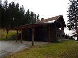 2
2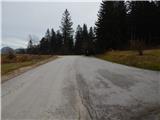 3
3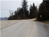 4
4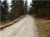 5
5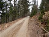 6
6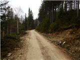 7
7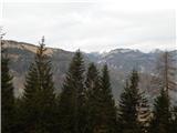 8
8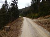 9
9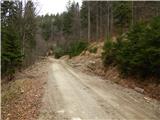 10
10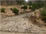 11
11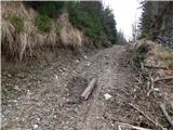 12
12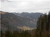 13
13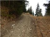 14
14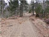 15
15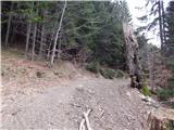 16
16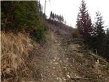 17
17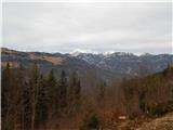 18
18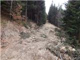 19
19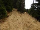 20
20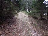 21
21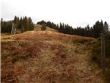 22
22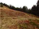 23
23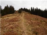 24
24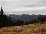 25
25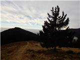 26
26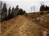 27
27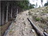 28
28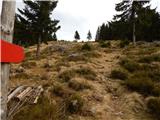 29
29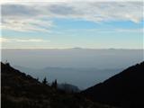 30
30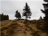 31
31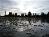 32
32 33
33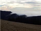 34
34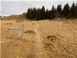 35
35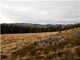 36
36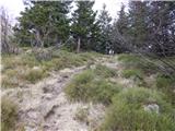 37
37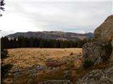 38
38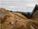 39
39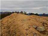 40
40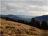 41
41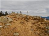 42
42 43
43
Discussion about the trip Volovljek - Kranjska reber (on unmarked path)
To post a comment you must log in:
If you do not yet have a username, you must first
register.