Vranček - Loibler Baba/Košutica (eastern way)
Starting point: Vranček (950 m)
| Latitude/Longitude: | 46,42790°N 14,27260°E |
| |
Route name: eastern way
Walking time: 2 h 50 min
Difficulty: difficult unmarked way
Elevation gain: 1018 m
Elevation difference along the route: 1018 m
Map: Karavanke - osrednji del 1:50.000
Recommended equipment (summer):
Recommended equipment (winter): ice axe, crampons
Views: 22.785
 | 3 people like this post |
Access to starting point:
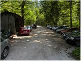
From the Ljubljana–Jesenice highway, take the Ljubelj exit and follow the road ahead towards the border crossing. When we leave the last tunnel (we recognise it by the fact that after the tunnel on the left side of the road there is scree) we will notice in the first sharp left turn a road maintenance hut and next to it a macadam road. Here we park on a smaller parking lot or we drive on a bad road further to the next parking lot, which is situated a little higher.
Route description:
From the parking lot, we go on a bad forest road and follow it ahead. The road higher crosses a torrent bed, after that slightly ascends and then brings us to the spot where it ends. Ahead we cross the bridge and continue on a cart track which moderately ascends on partly overgrown scree. The cart track makes a few sharp turns and brings us from the northern slopes of Košuta to the southern slopes of Košutica.
Further, we mostly ascend through the forest, which brings us to a larger clearing. Here the cart track turns sharply left and ascends towards the mountain pasture Korošica. A little before the mountain pasture we cross a grazing fence, where a beautiful view opens up. From the meadow we go slightly right below the hut, which we see above us. The path then turns left and in a few steps of ascent brings us to the hut on the mountain pasture Korošica.
From the hut, we go right in the direction of Veliki vrh towards Hajnževo sedlo. The path ahead crosses the slopes of Košutica mostly in a gentle ascent through increasingly sparse forest. We follow this increasingly scenic path to Hajnževo sedlo, where the path from Austria joins.
On the saddle, we go left and start to ascend quite steeply (right Veliki vrh). Initially we ascend on the Slovenian side of the ridge among dwarf pines, then the path runs for some time on a slightly exposed ridge. Next follows a shorter ascent on the Austrian side with the aid of a fixed cable and soon we reach the forepeak. From the forepeak we then descend a few metres with the aid of a fixed cable and immediately thereafter steeply ascend again to the summit, where there is also the summit logbook.
Starting point - Korošica 1:35, Korošica - Košutica 1:15.

Photos:
 1
1 2
2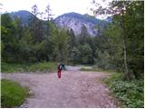 3
3 4
4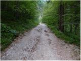 5
5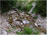 6
6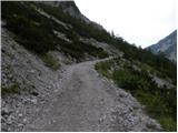 7
7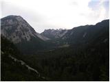 8
8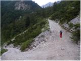 9
9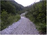 10
10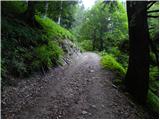 11
11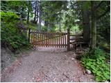 12
12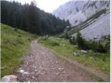 13
13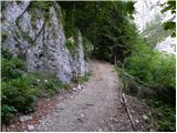 14
14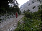 15
15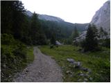 16
16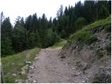 17
17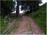 18
18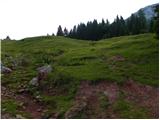 19
19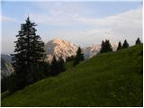 20
20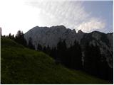 21
21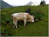 22
22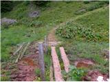 23
23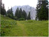 24
24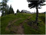 25
25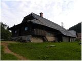 26
26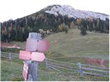 27
27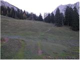 28
28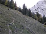 29
29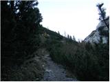 30
30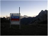 31
31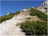 32
32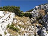 33
33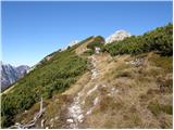 34
34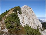 35
35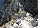 36
36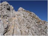 37
37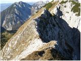 38
38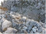 39
39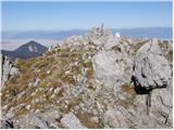 40
40
Discussion about the trip Vranček - Loibler Baba/Košutica (eastern way)
|
| andrej jerina23. 06. 2008 |
Today I did the mentioned trail. I fully agree with the trail description, just adding one remark. The trail is not marked or signposted. The caretaker at Planina Korošica said that a marker checked the trail last week and they will mark it soon. The same applies to the trail from Planina Korošica to the junction with the Ljubelj trail at the saddle. Best, Andrej
|
|
|
|
| gregorrr12. 09. 2008 |
For an average hiker it's a bit adrenaline-inducing, especially along the unprotected ridge and then the last half to Ljubeljska koča. In wet weather I don't recommend it due to slippery grass and scree.
|
|
|
|
| daniel24. 05. 2009 |
The path is still not marked today. But it's true that it's recommended to do it in dry weather.
|
|
|
|
| barjus28. 07. 2009 |
I was up there a week ago, don't remember about the markings but from the saddle up there's only one path, which you can't miss. But the path is really exposed and not for those afraid of heights. But for all who want some adrenaline
|
|
|
|
| klm18. 07. 2010 |
that old man will remember that this path was without cables three decades ago. back then it was demanding. now it's much tamer! the side path leads to the summit of Baba from Dovjakovo sedlo (1728 m), which connects Baba with Lokovnikov Grintovec. The path is not officially marked, yet it is marked with cairns and pointers. It goes through the northeast slope, first through scree. then a short wall, where you climb I-II difficulty (just like the above-described entry path without protections), then you ascend a steep scree gully to the top and approach the summit at the damn Austrian cross! what the hell is needed with these religious symbols in the mountains anyway!? cool tour, worth trying.
|
|
|
|
| Zvezdica <33. 07. 2011 |
Today we were at Košutica. Up the eastern path, down past the Ljubelj hut. Had the dog so struggled a bit in the hollows otherwise super hike. Just watch not to step in cow or horse dung. Weather was a bit cloudy, few drops fell and some wind. Otherwise enjoyed it lots. Highly recommend...... Weather was a bit cloudy, few drops fell and some wind. Otherwise enjoyed it lots. Highly recommend......
|
|
|
|
| mgrego2215. 04. 2012 |
With friends we did a circular route: start from Ljubelj, followed a pleasant path to the hut above Ljubelj. We continued to the hut on Korošica. This part of the trail is especially interesting, as you have to climb on "lojtrici". Refreshment at Planina Korošica, then back on the hunting trail. Next time we'll add the ascent to Baba.
|
|
|
|
| metod25. 12. 2012 |
Košutica was quite spring-like yesterday. The lower part up to the fence of the Korošica pasture was still frozen, but above it everything had thawed. From Korošica we followed footprints towards Košutica, which went almost directly to the summit. Through scrub, steep grass and rocks it was strenuous, but we managed. At the top windy and beautiful views. The marked path down was well trodden.
|
|
|
|
| MitjaBelak5. 11. 2018 |
Start, roadside shelter below Ljubelj. In the morning Korošica still in fog. From Hajneževo sedlo towards the summit nice path with some rock holds. Then a bit of adrenaline along the upper ridge. Some cables, secure step, and it goes. My wife and I were a bit hindered along the ridge by gusty wind. Great views from above, as many as there were above the fog. Northern part of Košuta above 1500m was looking out from the white sea, it's really nice to see this chain from this side too. Descent along the ridge towards old Ljubelj. Around the cow pastures it was quite slippery, fog added its part too, and it wasn't pleasant. Follows refreshment in the packed full hut at Ljubelj. And then descent along the road to the car, approx 3/4 hour. Nice trip, I recommend. Total trip without stops, good 5 hours.
|
|
|
|
| Enka30. 06. 2022 12:49:05 |
Is this path still unmarked? Is it nicely traceable?
|
|
|
|
| anica.zu12. 08. 2025 21:04:32 |
You can't go wrong. There's only one trail anyway.
I was up there today, ascent via the western trail, for descent along the ridge with some wire ropes and quite narrow ridges. Slowly, but it works.
|
|
|
|
| Enka13. 08. 2025 18:22:08 |
Anica, it seems to me that the path was marked some time ago. Am I wrong?
|
|
|
To post a comment you must log in:
If you do not yet have a username, you must first
register.