Vranček - Loibler Baba/Košutica (western way)
Starting point: Vranček (950 m)
| Latitude/Longitude: | 46,42790°N 14,27260°E |
| |
Route name: western way
Walking time: 2 h 50 min
Difficulty: partly demanding marked way
Elevation gain: 1018 m
Elevation difference along the route: 1018 m
Map: Karavanke - osrednji del 1:50.000
Recommended equipment (summer):
Recommended equipment (winter): ice axe, crampons
Views: 38.854
 | 4 people like this post |
Access to starting point:
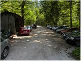
From the Ljubljana–Jesenice highway, take the Ljubelj exit and follow the road towards the border crossing. When we leave the last tunnel (recognised by the scree on the left side of the road after the tunnel), in the first sharp left turn we will notice a road hut and next to it a macadam road. Here we park on a smaller parking lot or we drive further on a bad road to the next parking lot, which is situated a little higher.
Route description:
From the parking lot, we head onto the bad forest road and follow it further. The road higher up crosses a torrent, then slightly ascends and brings us to the spot where it ends. Next we cross a bridge and continue on the cart track, which moderately ascends over partly overgrown scree. The cart track makes a few sharp turns and brings us from the northern slopes of Košuta to the southern slopes of Košutica.
Further, we mostly ascend through the forest, which brings us to a larger clearing. Here the cart track turns sharply left and ascends towards the Korošica mountain pasture. A little before the mountain pasture we cross a grazing fence, where a beautiful view opens up. From the meadow we go slightly right below the cottage, which we see above us. The path then turns left and in a few steps of ascent brings us to the cottage on the Korošica mountain pasture.
From the cottage we continue towards the north in the direction of Košutica (right Hajnževo sedlo). The path soon turns left and crosses the western slopes of Košutica. The relatively gentle path soon brings us to the border ridge, where the path from the Koča na Ljubelju hut joins from the left.
Here we go right and continue the ascent on an increasingly panoramic ridge. The path then becomes steep, the forest becomes sparser and gradually disappears entirely. Further, we ascend on a panoramic ridge, which is quite wide so there is no significant danger. The path then ascends through dwarf pines and brings us to the Austrian side. Here we ascend through a short but quite steep gully back to the ridge. Here we step onto steep grass-covered slopes on the Slovenian side (in wet, danger of slipping). After this ascent over grass we come to the summit somewhat exposed ridge, which we then follow to the peak.
Starting point - Korošica 1:35, Korošica - Košutica 1:15.

Photos:
 1
1 2
2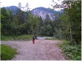 3
3 4
4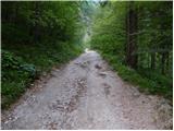 5
5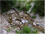 6
6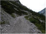 7
7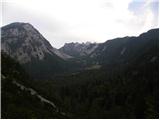 8
8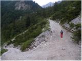 9
9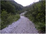 10
10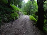 11
11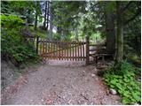 12
12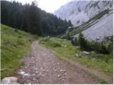 13
13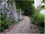 14
14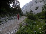 15
15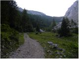 16
16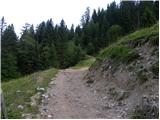 17
17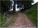 18
18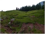 19
19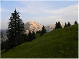 20
20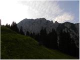 21
21 22
22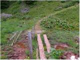 23
23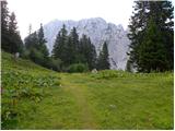 24
24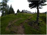 25
25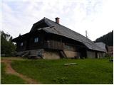 26
26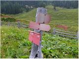 27
27 28
28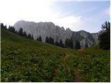 29
29 30
30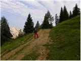 31
31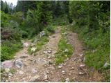 32
32 33
33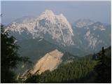 34
34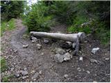 35
35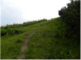 36
36 37
37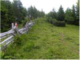 38
38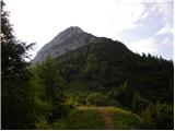 39
39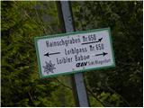 40
40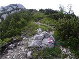 41
41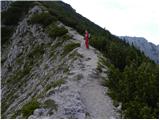 42
42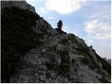 43
43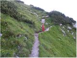 44
44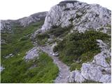 45
45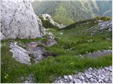 46
46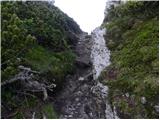 47
47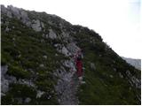 48
48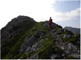 49
49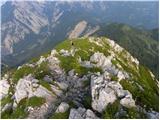 50
50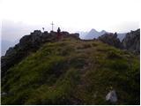 51
51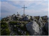 52
52 53
53
Discussion about the trip Vranček - Loibler Baba/Košutica (western way)
|
| Majdag22. 10. 2018 |
Vranček.. The steepness of the cart track is still the same. Just a bit more dilapidated. Larches along the path are glowing, but there aren't many. Beeches shedding colorful leaves and to me they are prettier than larches. Hut on Planina Korošica was open on Saturday. Hajnževo sedlo and paths through rocks, as usual. Descent along the ridge to the other side is easier, crumbly through dwarf pines. Nice, slightly spiced circular path. . .
https://jelenkamenmajdag.blogspot.com/2018/10/kosutica-ljubeljsa-baba-korosica-gora.html
|
|
|
|
| zbil7. 09. 2023 20:55:01 |
Hello!
Is the described path suitable for a dog?
Thank you for the answer
|
|
|
|
| ppegan7. 09. 2023 21:19:00 |
Yes
|
|
|
To post a comment you must log in:
If you do not yet have a username, you must first
register.