Starting point: Vransko (340 m)
| Latitude/Longitude: | 46,24540°N 14,95550°E |
| |
Walking time: 1 h 45 min
Difficulty: easy marked way
Elevation gain: 530 m
Elevation difference along the route: 530 m
Map: Zgornja Savinjska dolina 1:50.000
Recommended equipment (summer):
Recommended equipment (winter):
Views: 35.238
 | 1 person like this post |
Access to starting point:
From the Ljubljana–Celje motorway, take the Vransko exit. Continue driving on the old road towards Ljubljana, but only to the place where the road to Vransko branches off to the right. Park at the beginning of the village, where there is a large parking lot arranged by the cemetery.
Route description:
From the parking lot, we continue towards the center of the village to the church, where there is a crossroads. We continue on the right side of the church, where we notice the mountain trail markers for Čreta. A well-marked path through the village and over a bridge soon brings us to the last house in the village. Here we continue right on a footpath, which ascends past a cross and then goes into the forest. After walking this shorter ascent, the path soon brings us back onto the road. We continue upwards and at the crossroads continue in the direction of Čreta. When we come to the next cross by which there are signposts, we leave the road and head onto a footpath, which first crosses a meadow, then via steps descends into the forest. After a short descent, we come to the edge of a steep stream, by which with the help of steps we ascend and then over a small bridge cross the gorge of the stream. The steepness of the slopes then eases and the path continues in a traversing ascent through the forest. A little higher, the path brings us to the next hamlet, after which we step onto a macadam road. After a few minutes of walking on the road, which has some smaller crossings (well-marked), it changes into a cart track. The cart track then ascends more steeply and crosses a torrent gully. A traversing ascent follows and the path soon brings us to the next house by which there is a chapel. We continue on the road upwards again, which we leave after a few minutes. The blazes direct us sharply right into the spruce forest. After a few minutes, the steepness eases and the path brings us to the road, where we continue right. After a short walk on the road, a cart track branches off to the left upwards, which brings us to the Dom na Čreti in two minutes.
From the hut, we can walk to two churches, which are five or ten minutes away.

Photos:
 1
1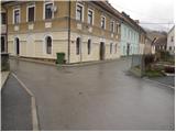 2
2 3
3 4
4 5
5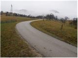 6
6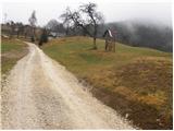 7
7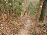 8
8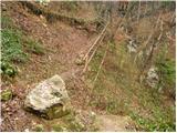 9
9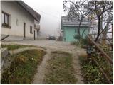 10
10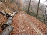 11
11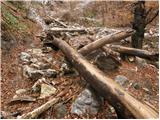 12
12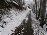 13
13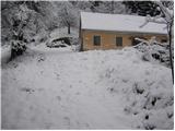 14
14 15
15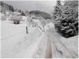 16
16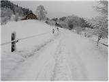 17
17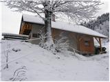 18
18
Discussion about the trip Vransko - Dom na Čreti
|
| lubi26. 05. 2008 |
We spiced up Youth Day with "trekking" through the forests and peaks above Vransko. Tolsti Vrh and Sv. Jošt are a nice choice for a full-day trip. At every step, memories of the past: NOB monument, English barracks, stories from the partisan period firsthand - we met one of the still living fighters who vividly and proudly revives recent history. Honor and glory to the fallen.
Most important - štruklji in the mountain hut. What all is in the filling, I won't reveal. It's worth the effort to go up. Since last year the hut has new caretakers. The right people in the right place. Visit them and have a good time.
Nadka
|
|
|
|
| valma12. 09. 2010 |
Today we went on a longer path for the first time, with our nine-month-old daughter in the backpack. We spent a wonderful Sunday; picturesque path, pleasant weather, at the top in the hut delicious vegetable soup, which tastes especially good when served by friendly caretakers. Really nice excursion spot.
We will definitely return...
|
|
|
|
| drganc.natasa@gmail.com14. 06. 2020 |
Today we visited Dom na Čreti for the first time. Very friendly staff, praise for the friendly hostess Natasa, excellent food, excellent buckwheat dumplings, strudel... everything delicious... praise to the cook. We'll return soon. The path was great and very well marked. Regards Natasa and Natasa
|
|
|
|
| Domen333. 10. 2020 |
I would praise the work of the trail markers in this area.
Normally I would stay quiet, but now I can't.
Disaster of service.
In the afternoon I arrived at the hut, really during the week and ordered žlikrofi, as there was nothing else except omelette.
I got 5-6 stretched žlikrofi on a large plate to the brim, so it looked like more plus some cracklings. So 5-6 slightly larger ravioli.
I ate them immediately and the snotty one asked me surprised if I was already done. Of course, since she gave me 5-6 ravioli. She charged me 7 euros for those few ravioli. Shame, if I went to a mid-range restaurant in Lj I would get more for the same money just for starter. I wanted to at least eat a little.
Already 3 years ago I had a negative experience, so they won't see me anymore. The only hut with which I had 2 negative experiences.
|
|
|
To post a comment you must log in:
If you do not yet have a username, you must first
register.