Vrčice - Dom na Mirni gori (by road)
Starting point: Vrčice (481 m)
| Latitude/Longitude: | 45,64790°N 15,14150°E |
| |
Route name: by road
Walking time: 2 h 15 min
Difficulty: easy marked way
Elevation gain: 519 m
Elevation difference along the route: 550 m
Map: Dolenjska - Gorjanci, Kočevski Rog 1:50.000
Recommended equipment (summer):
Recommended equipment (winter):
Views: 15.995
 | 5 people like this post |
Access to starting point:
A) From the Ljubljana–Brežice highway, take the Ivančna Gorica exit, then continue driving in the direction of Črnomelj. After Črmošnjice, the road still ascends for a short time, then starts descending more steeply and brings us to the village Vrčice, where the described path begins. In the settlement there are no arranged parking spots for mountaineers. The arranged parking lot is in the settlement Blatnik pri Črmošnjicah.
B) From the Brežice–Ljubljana highway, take the Novo mesto exit, then continue driving in the direction of Dolenjske Toplice and Podturn pri Dolenjskih Toplicah. In Podturn, join the main road Ivančna Gorica–Črnomelj and follow it to the left in the direction of Črnomelj. After Črmošnjice, the road still ascends for a short time, then starts descending more steeply and brings us to the village Vrčice, where the described path begins. In the settlement there are no arranged parking spots for mountaineers. The arranged parking lot is in the settlement Blatnik pri Črmošnjicah.
C) From Bela krajina, first drive to Semič, then continue driving towards Črmošnjice and Soteska. Still before the road starts descending, we arrive in Vrčice, where the described path begins. In the settlement there are no arranged parking spots for mountaineers. The arranged parking lot is in the settlement Blatnik pri Črmošnjicah.
Route description:
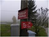
From Vrčice we head onto the macadam road in the direction of Kleč, Planina and Mirna gora. The macadam road quickly descends to the church of St. Martin, before which we step onto the asphalt road that leads to Mirna gora, and we follow it to the right. The road first leads past a few houses, then enters the forest, where it starts to ascend more steeply. Only a little after the asphalt ends, we arrive at a marked intersection, where we continue on the right road (left access to Mirna gora with a car), and the hiking signposts also direct us there. Further on, we ascend for some time along the macadam road, then the marked path leaves it for a while and returns to it at the memorial plaque or stone. We continue the ascent along the road, which gradually levels out and brings us from the forest to a less vegetated area named Kleč.
Here the path leads past the nearby hunting house Kleč and the ruins of the former church, to the next intersection.
At the intersection, where there are numerous signposts, we choose the left path (right Mirna gora via Škrilj), which continues on a slightly ascending macadam road. The road then completely levels out and brings us to the church of St. Ilija in a few minutes of further walking.
From the church we continue along the road, then arrive at numerous signs and marks. Here a marked footpath branches off to the right to Mirna gora, and we continue on the road, which soon brings us above the village. At the intersections, follow the road in the direction of Dom na Mirni gori, which higher up ascends steeply, crosses a strip of forest, and then brings us to the already mentioned mountain hut.

The trip can be extended to the following destinations: Mirna gora
Photos:
 1
1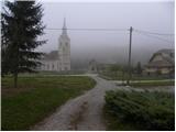 2
2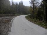 3
3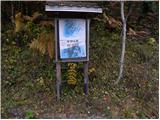 4
4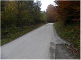 5
5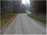 6
6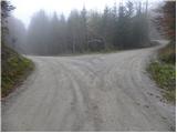 7
7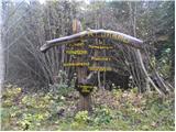 8
8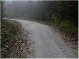 9
9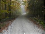 10
10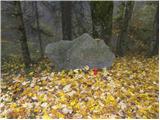 11
11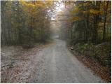 12
12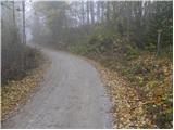 13
13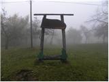 14
14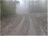 15
15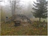 16
16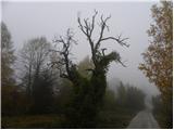 17
17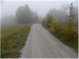 18
18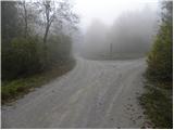 19
19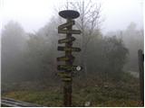 20
20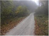 21
21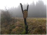 22
22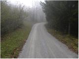 23
23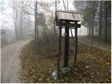 24
24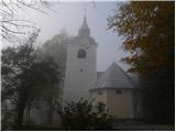 25
25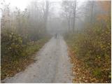 26
26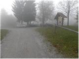 27
27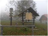 28
28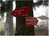 29
29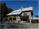 30
30
Discussion about the trip Vrčice - Dom na Mirni gori (by road)
|
| Gost7. 09. 2006 |
And from Mirna gora there is a beautiful view of Bela krajina. The path from Gač is also very nice. It's longer and beautiful in summer when meadows bloom. But we must be loud because bears roam here. Even nicer is Mirna gora in winter. I leave the car at Vrčice, because the path is truly fairy-tale like. On the sun-facing slopes, snowflakes compete with telohi - there are so many that the slopes are white. Invited to this corner of our little country and good luck.
|
|
|
|
| aleš4323. 01. 2011 |
Judging by the number of comments, no one goes to these areas. Is it perhaps because of bears? Hm, but I have Mirna gora in mind to visit it these sunny days.
|
|
|
|
| Lj23. 01. 2011 |
This road variant from Vrčice is really pleasant in winter, we are quite often in this area. There are always enough hikers, but I haven't seen a bear here even from afar.
|
|
|
|
| hribovska23. 01. 2011 |
Today there were probably a lot of hikers on Mirna gora judging by the parked cars at Vrčice, it's a real winter idyll there
|
|
|
|
| nanica23. 01. 2011 |
Aleš, just visit Mirna gora, so you'll see how strongly you were mistaken in the first sentence.
|
|
|
|
| maremarcus23. 01. 2011 |
hi,
Mirna gora is quite well visited. Every day there are quite a few hikers who come up, even more on weekends. There are also groups that regularly go on certain days of the week (Wednesdayers, Thursdayers.....). If you plan to go to Mirna gora, just drive to Črnomelj and start there. The path is well marked, part of the path goes past the White Carniola wine cellars..... I'd gladly go with you if you decide.... best regards
|
|
|
|
| joža x24. 01. 2011 |
Is it possible to halve the tour (1 hour walk), so that I drive higher by car. With my children, tours of 1 to 1.5 hours one way work best, since M. Gora is unknown to me, I wouldn't want to go blindly with the children...
|
|
|
|
| rjudnic24. 01. 2011 |
you can leave the car anywhere and thus shorten the path. If you leave it at Planina, you have 15 minutes to the top, from Kleču 30 minutes etc.
|
|
|
|
| nanica24. 01. 2011 |
From Planina there is a very nice and interesting forest educational path to the top. Recommended for children in warmer months, when they can see the trees and other vegetation and read the educational signs on the boards.
|
|
|
|
| aleš439. 02. 2011 |
I was on Mirna gora on 6.2.2.11. It was a fantastic day, peace, snowy idyll, educational hike past Kočevje villages , (Škrilj) trip ideal for afternoon walks with dogs (for those who have them). At the hut I met quite a few! Friendly people. ..well, I'll come again for sure
|
|
|
|
| aktevc4. 03. 2011 |
Can someone tell me if there are sleeping capacities at Mirna as well. For around 15 people? We need for 2 nights. Also interested in the price. Thanks!
|
|
|
|
| starakapa8. 04. 2011 |
Yesterday I was on Mirna gora. I have to say I was pleasantly surprised by the new caretakers. They were very friendly, not to mention the mushroom soup and buckwheat porridge. From the conversation I soon realized that they are mountaineers and not some profiteers. I hope they stay on the mountain for a long time. I also saw that they were laying new cobblestones and that the hut is being somewhat renovated.
|
|
|
To post a comment you must log in:
If you do not yet have a username, you must first
register.