Vrčice - Dom na Mirni gori (via Planina)
Starting point: Vrčice (481 m)
| Latitude/Longitude: | 45,64790°N 15,14150°E |
| |
Route name: via Planina
Walking time: 2 h
Difficulty: easy marked way
Elevation gain: 519 m
Elevation difference along the route: 550 m
Map: Dolenjska - Gorjanci, Kočevski Rog 1:50.000
Recommended equipment (summer):
Recommended equipment (winter):
Views: 10.200
 | 1 person like this post |
Access to starting point:
A) From the highway Ljubljana - Brežice, we take the exit Ivančna Gorica, then continue driving in the direction of Črnomelj. After Črmošnjice, the road ascends for a short time longer, then starts to descend more steeply and brings us to the village Vrčice, where the described path begins. There are no arranged parking spots for hikers in the settlement. The arranged parking lot is in the settlement Blatnik pri Črmošnjicah.
B) From the highway Brežice - Ljubljana, we take the exit Novo mesto, then continue driving in the direction of Dolenjske Toplice and Podturn pri Dolenjskih Toplicah. In Podturn, we join the main road Ivančna Gorica - Črnomelj and follow it to the left in the direction of Črnomelj. After Črmošnjice, the road ascends for a short time longer, then starts to descend more steeply and brings us to the village Vrčice, where the described path begins. There are no arranged parking spots for hikers in the settlement. The arranged parking lot is in the settlement Blatnik pri Črmošnjicah.
C) From Bela krajina, we first drive to Semič, then continue driving towards Črmošnjice and Soteska. Still before the road starts descending, we arrive in Vrčice, where the described path begins. There are no arranged parking spots for hikers in the settlement. The arranged parking lot is in the settlement Blatnik pri Črmošnjicah.
Route description:
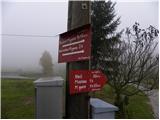
From Vrčice we head onto the macadam road in the direction of Kleč, Planina and Mirna gora. The macadam road quickly descends to the church of St. Martin, before which we step onto the asphalt road leading to Mirna gora, which we follow to the right. The road first leads past a few houses, then enters the forest, where it starts to ascend more steeply. Shortly after the asphalt ends, we arrive at a marked intersection, where we continue on the right road (left: access to Mirna gora by car), and the hiking signposts also direct us there. Further on, we ascend for some time along the macadam road, then the marked path leaves it temporarily and returns to it at the memorial plaque or stone. We continue the ascent along the road, which gradually flattens and leads us out of the forest to a less vegetated area called Kleč.
Here the path leads past the nearby hunting lodge Kleč and the ruins of the former chapel to the next intersection.
At the intersection, where there are numerous signposts, we choose the left path (right: Mirna gora via Škrilj), which continues along a slightly ascending macadam road. The road then flattens out completely and brings us to the church of St. Ilija in a few minutes of further walking.
From the church we continue along the road for a short time, then arrive at numerous signs and markers. We proceed in the direction of Mirna gora and continue along the forest educational trail, which leads past a few houses. Above the houses, the path also leads past an abandoned water trough, then gradually enters the forest through which it ascends moderately to occasionally steeply. The well-marked path, alongside which there are numerous educational boards, turns slightly right higher up and brings us to the mountain hut Dom na Mirni gori.

Along the route: Kleč (645m), Sveti Lija (Planina) (747m)
The trip can be extended to the following destinations: Mirna gora
Photos:
 1
1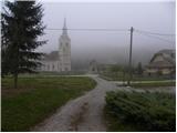 2
2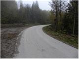 3
3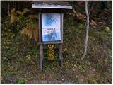 4
4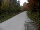 5
5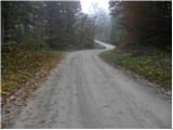 6
6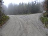 7
7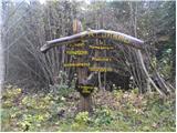 8
8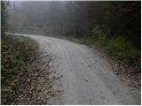 9
9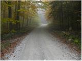 10
10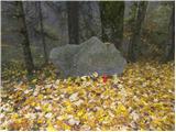 11
11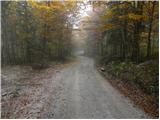 12
12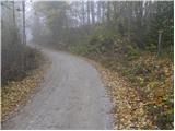 13
13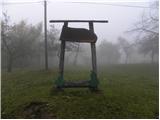 14
14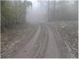 15
15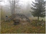 16
16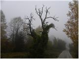 17
17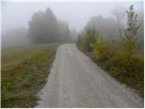 18
18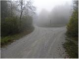 19
19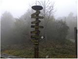 20
20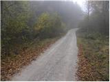 21
21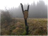 22
22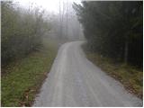 23
23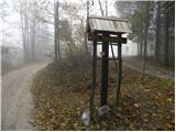 24
24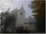 25
25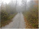 26
26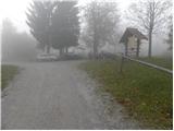 27
27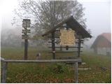 28
28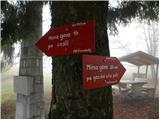 29
29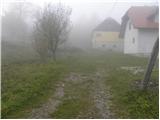 30
30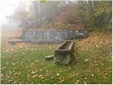 31
31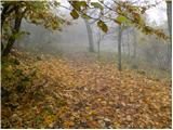 32
32 33
33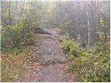 34
34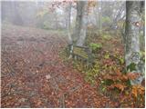 35
35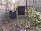 36
36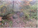 37
37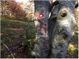 38
38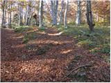 39
39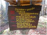 40
40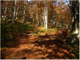 41
41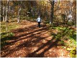 42
42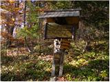 43
43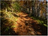 44
44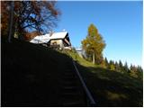 45
45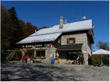 46
46
Discussion about the trip Vrčice - Dom na Mirni gori (via Planina)
|
| Kokta8. 04. 2012 |
Really nice path, especially from Planina onwards along the educational trail. But today there was quite a bit of fresh snow. The path looked really fairy-tale like. In the hut good kitchen and service. All praise. Highly recommend visiting these parts.
|
|
|
|
| marinka6718. 08. 2014 |
Dom na Mirni gori deserves 5+. Fun and smiling host and same cook (hostess) who cared for "women's" matters at WC too. Food excellent of course!
Also very nice, almost kitschy educational trail.
In short, beautiful spot in Bela krajina, pity we're from the other end of SLO.
|
|
|
To post a comment you must log in:
If you do not yet have a username, you must first
register.