Vrhnika - Koča na Planini nad Vrhniko (via Špica)
Starting point: Vrhnika (300 m)
| Latitude/Longitude: | 45,96360°N 14,27520°E |
| |
Route name: via Špica
Walking time: 1 h
Difficulty: easy marked way
Elevation gain: 433 m
Elevation difference along the route: 433 m
Map:
Recommended equipment (summer):
Recommended equipment (winter):
Views: 45.141
 | 2 people like this post |
Access to starting point:
From the highway Ljubljana - Koper, take the exit Vrhnika, then continue driving on the old road towards Logatec. At the last traffic light in Vrhnika, which we recognize by the nearby bank and pharmacy, we turn right in the direction of Planina. At all next crossroads, we continue driving straight, and we follow the road to the parking lot near the signposts for the shelter Zavetišče na Planini nad Vrhniko.
Route description:
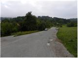
At the starting point, we notice signposts for Planina, which point us on an ascending footpath. Already after a short ascent, first through bushes, then over the edge of a meadow, we step onto a macadam road, which we follow to the left, and walk along it to Petkov Storž (a log cabin with self-service drinks). Only a few meters ahead, signs for Planina and Zaplana direct us left onto a wide footpath, which turns right from the road into a dense strip of bushes. Further on, we ascend along a relatively gentle path that continues through dense shade. Higher up, we step onto a wide cart track, which gradually narrows and brings us higher to a marked junction, beside which stands Županova klop bench.
We continue the ascent on the right path in the direction "Planina - Špico" (left Planina via Bukev), which for a short time is still gentle, then begins to ascend steeply through the forest. Soon we join the wider path from Stara Vrhnika, where the path flattens for a while. There follow a few minutes of easy walking to the Špica bench, then the path turns slightly left and gradually begins to ascend more steeply. We follow this further relatively steep path all the way to the shelter Zavetišče na Planini nad Vrhniko, which we reach after about 10 minutes of further walking.
Description and pictures refer to the condition in August 2010.

Photos:
 1
1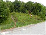 2
2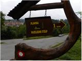 3
3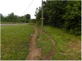 4
4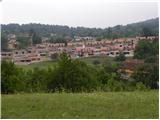 5
5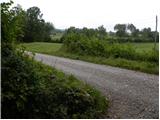 6
6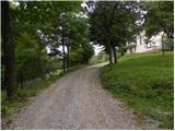 7
7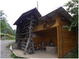 8
8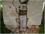 9
9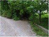 10
10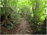 11
11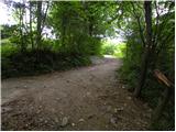 12
12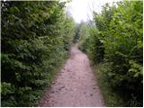 13
13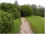 14
14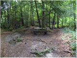 15
15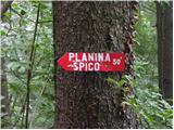 16
16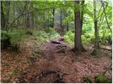 17
17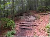 18
18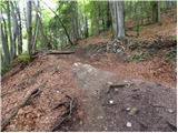 19
19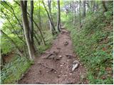 20
20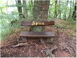 21
21 22
22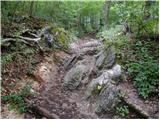 23
23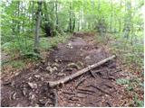 24
24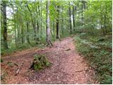 25
25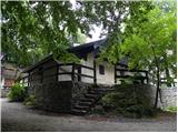 26
26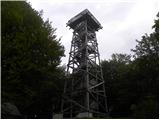 27
27 28
28 29
29
Discussion about the trip Vrhnika - Koča na Planini nad Vrhniko (via Špica)
|
| trdi13. 04. 2019 |
Those pictures are already very old... Now there is a nicely arranged parking lot at the starting point, the road to the tower is asphalted, the shelter on the Planina is renovated, only the houses in picture 5 are still in the same construction phase....
|
|
|
|
| donat14. 04. 2019 |
The path from Stari Maln is also quite changed and renovated (after tree felling), new steps on the steep part and protections, routed along the right edge,..especially the new hut at the top, which is open all week except Monday. Time to replace some pictures. Best regards.
|
|
|
|
| zaplancek9. 03. 2020 |
Does anyone else think that since they have the new hut and septic tank it stinks unbearably around the hut! Even the path under the septic tank itself a little before the end, that muddy part, started to smell horribly! Quite disappointed 
|
|
|
To post a comment you must log in:
If you do not yet have a username, you must first
register.