Starting point: Vršič (1611 m)
| Latitude/Longitude: | 46,43360°N 13,74350°E |
| |
Walking time: 1 h
Difficulty: easy unmarked way
Elevation gain: 330 m
Elevation difference along the route: 330 m
Map: Kranjska Gora 1:30.000
Recommended equipment (summer):
Recommended equipment (winter): ice axe, crampons
Views: 20.171
 | 2 people like this post |
Access to starting point:
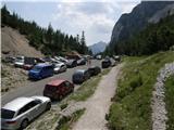
From Kranjska Gora we drive towards Bovec or vice versa, but only as far as the Vršič pass, where we park.
Route description:
From the Vršič pass we turn onto the path in the direction of Slemenova špica, the Hanzova path to Mala Mojstrovka and the Tamar valley (left Mala Mojstrovka - usual path) along the path that begins to climb transversely to the right. During the ascent, which takes place along the slopes of Šitna glava, we cross several smaller scree slopes and torrents, then the path from Erjavčeva koča at Vršič joins us from the right.
Here we continue straight and, passing a viewpoint a few meters away, we climb in a few minutes to the Vratca pass (1799 m), where the next marked junction is.
Here we continue to the right (left Hanzova path to Mala Mojstrovka, straight Slemenova špica) along the unmarked path, which first gently ascends across a smaller grassy slope, then leads us into the steeper terrain of Robičje. The path ahead steeply ascends across a short scree slope, then turns slightly to the left, where it leads us into an extensive belt of dwarf pines. Further on we climb relatively steeply along a well traceable but quite overgrown path, which higher up brings us to the ridge of Robičje. We follow this scenic and occasionally quite overgrown ridge path, which avoids the more difficult places on the left side, all the way to the summit of Prednje Robičje.
Vršič Pass - Vratca 0:35, Vratca - Prednje Robičje 0:25.

Along the route: Razpotje pod Vratci (1705m), Vratca (1800m)
Photos:
 1
1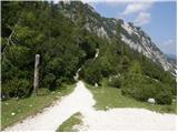 2
2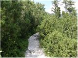 3
3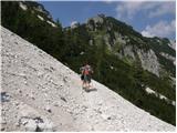 4
4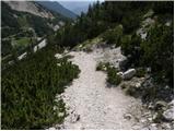 5
5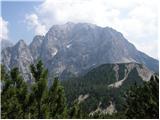 6
6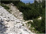 7
7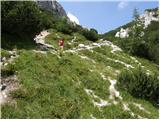 8
8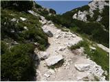 9
9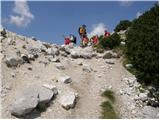 10
10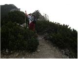 11
11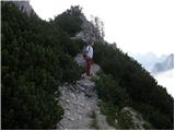 12
12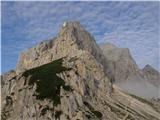 13
13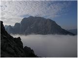 14
14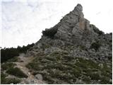 15
15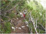 16
16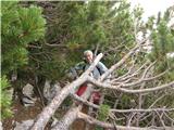 17
17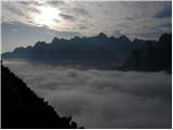 18
18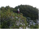 19
19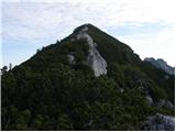 20
20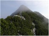 21
21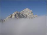 22
22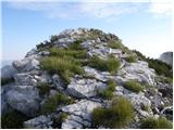 23
23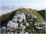 24
24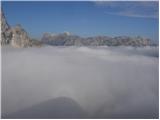 25
25
Discussion about the trip Vršič - Prednje Robičje
|
| krist29. 07. 2010 |
I strongly advise against this trip due to the extremely dense dwarf pine thickets. ;-)
|
|
|
|
| joze549. 07. 2010 |
I completely agree with -krist2-. I almost grabbed the axe. I just turned back. That was enough for that day!
|
|
|
|
| JusAvgustin31. 01. 2011 |
I recommend it to everyone in winter. It's a crazy viewpoint... 
|
|
|
|
| robter23. 10. 2012 |
Was there yesterday.
I recommend it, because the views are really nice, even in this autumn time. I believe it's very crowded there in summer, as the trail is uncrowded. Long pants and long sleeves are obligatory, because otherwise pushing through can be painful.
|
|
|
|
| ljubitelj gora12. 05. 2015 |
The path to Prednje Rubičeje is fine, the brushwood is also cut back, not exactly 2m wide, but enough to go normally.
|
|
|
|
| ločanka12. 10. 2015 |
It's true what LG says, the path is fine, the bushes cut down, fantastic viewpoint, the summit marked with a very original cross. At the summit there is also a summit book from 2006. I headed there
from the path to Slemenova špica. I recommend a visit!
|
|
|
|
| Daaam12. 10. 2015 |
I agree.. just from the junction at Vratci you have to zig-zag quite a bit for a few dozen meters among all the scree on the ground in ...if we know the chamois scramble, this junction would be quite grandma's ...if we know the chamois scramble, this junction would be quite grandma's  
|
|
|
|
| pikica113. 10. 2015 |
Where do you grandpas have it? The scramble, I mean.
|
|
|
|
| Daaam13. 10. 2015 |
ah ..we grandpas have it all along the path 
|
|
|
|
| pikica113. 10. 2015 |
Yes, it's right that you mark your own track, then you know how to get back.
|
|
|
|
| Daaam13. 10. 2015 |
If I tweak the proverb a bit one could say "who doesn't have it in the head has it between the legs"
|
|
|
|
| Majdag23. 06. 2019 |
Prednje Robičje, Slemenova špica - on the first summer day... The path to P. Robičje is a bit slippery at the beginning, when the rocky section starts it's fine. The cross on the top was taken by winter, the logbook is also not usable. Under the walls of Mojstrovke there is still a lot of snow. In the morning it was hard and I used small crampons. The lower path is snow-free. Slemenova špica has many visitors.
https://jelenkamenmajdag.blogspot.com/2019/06/prednje-robicje-slemenova-spica-vrsic.html
|
|
|
|
| G3426. 12. 2022 16:57:10 |
Is there any snow up there?
|
|
|
|
| Fapo27. 12. 2022 14:39:53 |
I haven't been up there but I can guarantee you that it is
|
|
|
To post a comment you must log in:
If you do not yet have a username, you must first
register.