Starting point: Vršič (1611 m)
| Latitude/Longitude: | 46,43360°N 13,74350°E |
| |
Walking time: 5 h 30 min
Difficulty: very difficult marked way
Via ferrata: C
Elevation gain: 990 m
Elevation difference along the route: 1350 m
Map: Triglav 1:25.000
Recommended equipment (summer): helmet, self belay set
Recommended equipment (winter): helmet, self belay set, ice axe, crampons
Views: 117.392
 | 9 people like this post |
Access to starting point:
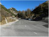
From Kranjska Gora we drive towards Bovec or vice versa, but only to the Vršič pass, where we park.
Route description:
From the parking lot we head onto the road in the direction of Trenta and at the end of the parking lot we reach a small intersection, where we continue left onto a side road, which after a short ascent brings us to Tičarjev dom na Vršiču.
From Tičarjev dom we continue along the gravel road along which there are signs for Poštarski dom and along which we begin to ascend moderately through scenic slopes. With views of the surrounding peaks, we quickly reach a marked junction.
Here we continue right in the direction of Prisanka and Razor (straight along the road to Poštarski dom and the summit of Vršič) and continue on a well-trodden mountain path, which for some time continues along a gentle and scenic ridge. After a few minutes the path begins to ascend more steeply through a sparser belt of dwarf pines, then it levels out and brings us right below the summit of the grassy Sovna glava.
From Sovna glava follows a short descent to Sedlo za Sovno glavo and we are already at the next junction, where we continue straight or slightly right (left leads the path to Prisank through Prednje okno). In the continuation we cross the slopes on the western side of Prisanka or Prisojnik over scree. The path ahead ascends a bit more and takes us to the place where the Grebenska pot to Prisank branches left, and straight ahead continues the path that leads to Razor, Pogačnikov dom and Prisank (Prisank Slovenian path and Jubilejna pot and Razor southern path).
We continue straight but the path quickly branches again.
To the left branches the Slovenian path to Prisojnik and the path towards Kajzljeva škrbina, we continue right following the signs for Razor (southern path) and begin to descend somewhat. The path then moves onto the southern slopes and crosses the slopes towards the east. At some places we are assisted by a few pitons and steel cables, then we reach grassy slopes. After a longer crossing we come to the Mlinarica junction, where the path branches.
We continue right towards Razor and Pogačnikov dom (left Jubilejna pot to Prisojnik), where in the continuation we first cross the slopes below Razor, a little further it brings us to the entry into the technically more demanding part. Here, with the help of fixed protection, we climb a short wall, the ascent in this part does not cause more serious difficulties. Higher up the path turns south towards Utrujeni stolp, and we continue with increasingly beautiful views to Sedlo Planja, where we join the path from Kriški podi.
From Sedlo Planja we continue sharply left (right to Planja, straight to Pogačnikov dom) along the path that initially ascends through natural passages, where the path is occasionally only slightly exposed. A little further the path leads us past a cave in which ice and snow usually remain almost all year round. From the cave onwards we ascend towards the notch, where we must be careful not to cause rockfall. A little further we arrive at the place where the new path separates from the old one. The old path is permanently closed due to a rockfall in 2013, so we turn right onto the well-marked new path, along which we quickly reach a short, but very demanding ascent, where according to PZS recommendations the use of a self-belay set is mandatory. With the help of a steel cable and rungs we climb a vertical or, on a short section, even an overhanging chimney, which is also quite exposed to falling rocks due to stones above the chimney. When the secured section ends, only the ascent along the scenic ridge to the summit of Razor remains.
Vršič - razpotje pod Bavho 0:15, razpotje pod Bavho - Sovna glava 0:15, Sovna glava - Sedlo za Sovno glavo 0:05, Sedlo za Sovno glavo - Gladki rob 0:25, Gladki rob - Kranjska planina 0:20, Kranjska planina - odcep za Jubilejno pot 1:45, odcep za Jubilejno pot - Sedlo Planja 1:30, Sedlo Planja - Razor 0:55.

Along the route: Tičarjev dom na Vršiču (1618m), Razpotje pod Bavho (1680m),
Sovna glava (1750m), Sedlo za Sovno glavo (1715m), Gladki rob (1869m), Kranjska planina (1672m), Mlinarica (1799m), Odcep za Jubilejno pot (2006m), Sedlo Planja (2352m)
The trip can be extended to the following destinations: Križ
Photos:
 1
1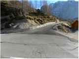 2
2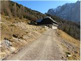 3
3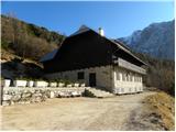 4
4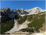 5
5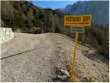 6
6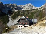 7
7 8
8 9
9 10
10 11
11 12
12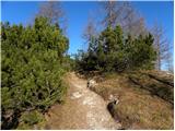 13
13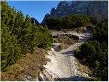 14
14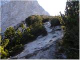 15
15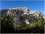 16
16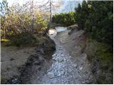 17
17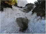 18
18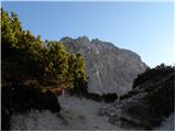 19
19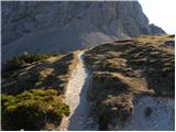 20
20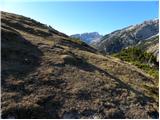 21
21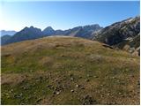 22
22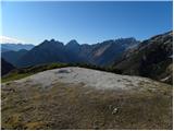 23
23 24
24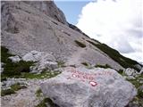 25
25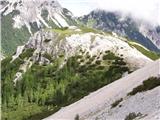 26
26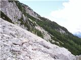 27
27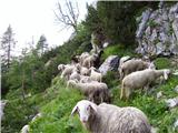 28
28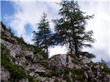 29
29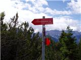 30
30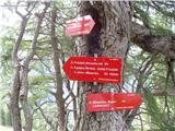 31
31 32
32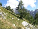 33
33 34
34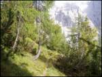 35
35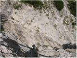 36
36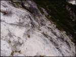 37
37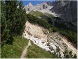 38
38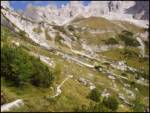 39
39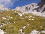 40
40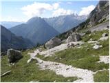 41
41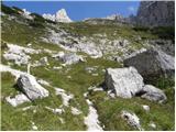 42
42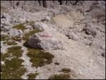 43
43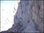 44
44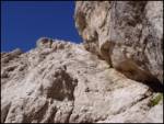 45
45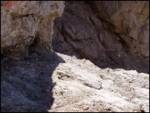 46
46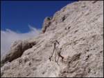 47
47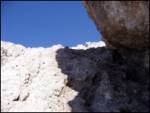 48
48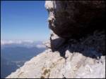 49
49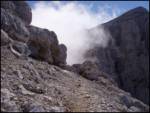 50
50 51
51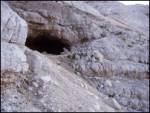 52
52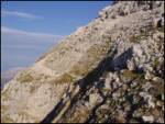 53
53 54
54 55
55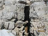 56
56 57
57 58
58 59
59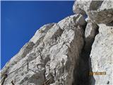 60
60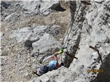 61
61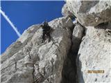 62
62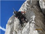 63
63 64
64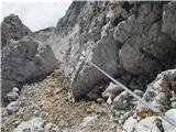 65
65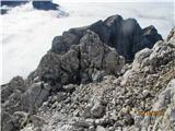 66
66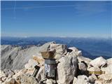 67
67 68
68
Discussion about the trip Vršič - Razor
Show older messages
|
| Gost6. 06. 2007 |
The cavity under the summit reminds me of a small snow cave where we can cool off.
|
|
|
|
| polde28. 08. 2009 |
Hello!
I'm interested in:
- time to ascend Prisojnik from the Vršič - Razor path at the point where we go left on the Slovenska pot, right on the south path to Razor;
- time to ascend Pogačnikov dom - sedlo Planja and
- time to ascend sedlo Planja - Razor.
Thanks for the reply!
|
|
|
|
| jernejscek28. 08. 2009 |
Time from Pogačnik to sedlo Planja is 1 hour on signs, actually less. From there to Razor another hour on signs (Pogačnik-Razor 2 hours), actually less  Good luck, if going from Pogačnik I suggest continuing via Jubilejna to the top of Mlinarica and Prisojnik or directly to Vršič, great tour, I was there on Tuesday in beautiful weather!! Enjoy! Good luck, if going from Pogačnik I suggest continuing via Jubilejna to the top of Mlinarica and Prisojnik or directly to Vršič, great tour, I was there on Tuesday in beautiful weather!! Enjoy!
|
|
|
|
| minka17. 08. 2010 |
I'm wondering if anyone has hiked from Vršič to Razor this year. Is the path well secured, is there still any snow on the path.
Minka
|
|
|
|
| viharnik17. 08. 2010 |
The path is impeccable, snow perhaps only in patches somewhere as a reminder of winter days.
|
|
|
|
| minka18. 08. 2010 |
Viharnik!
Thanks for the reply.
|
|
|
|
| amater19. 09. 2010 |
I'm interested in tomorrow's ascent from Vršič to Pogačnikov dom. Does it fit time-wise in one day? In between also Prisojnik and Razor. Thanks
|
|
|
|
| viharnik19. 09. 2010 |
Some don't even make it to Prisojnik and back in one day, for the mentioned tour there won't be enough hours in the day, but darkness...
|
|
|
|
| dore19. 09. 2010 |
Yes, to there in one day, back the next day. Approximately 6+? hours walking one way. Vršič, Prisank, Zadnje okno, Razor, Pogačnikov dom, I managed in 8 hours, then also manually pump water into the tank for the caretaker (Poljanec).
|
|
|
|
| amater19. 09. 2010 |
yes I thought so, there in one day the next day on to Škrlatica...
|
|
|
|
| pohodnikR5. 04. 2011 |
This summer we would go - small group, from Vrata to Kriške pode and Razor, second day to Vršič (via Prisojnik)... please for the "easiest" or safest variant... especially interested in the path between Planja saddle and Prisojnik... thanks to all for advice and path description... Rajko
|
|
|
|
| lubnikar5. 04. 2011 |
Best to start in Vrata and then over Sovatna to Kriške pode (5h), another 2h to Razor. The saddle between Planja and Razor is a crossing to the anniversary path to Prisojnik, if you're experienced enough. For inexperienced, I recommend from Mlinarica to Prisojnik (another 3h). Don't go before end of July, there will still be enough snow for slipping.
|
|
|
|
| joža x5. 04. 2011 |
I did it alone years ago like this: Day 1 Krnica-Kriška stena-Stenar-Pogačnikov dom Day 2 Razor-Sedlo planja-Mlinarica-Prisojnik-Vršič. For a mountaineer with solid fitness no "problem".
|
|
|
|
| Sano30. 06. 2011 |
Hello, I'm interested in how long that wall is and if it's crumbly (pictures 16, 17, 18), are there many safety features? Thanks and best regards.
|
|
|
|
| Sano2. 07. 2011 |
Does really no one know how to answer my question?
|
|
|
|
| ben2. 07. 2011 |
That wall is no more crumbly than others in our mountains, there are enough safety features, and it's not overly long. Above all, go carefully and there won't be any problems. Good luck!!!
LP B
|
|
|
|
| uhan116. 08. 2011 |
Hi
I'm interested if it's feasible in one day to do Prisojnik (Kopiščarjeva) and continue to Razor (through the last window) and maybe Planja, and back to Vršič along the southern Slovenian path? How much time? I'm very well fit and I've also climbed via della vita on Mangart, so no problems with secured paths. Thanks
|
|
|
|
| funnyboy16. 08. 2011 |
Yes, it's possible. This trail takes prb. 12 hours, but if you're in good shape, you'll manage it (you'll probably need less time). Happy trails
|
|
|
|
| uhan116. 08. 2011 |
Thanks funnboy
|
|
|
|
| bobby9. 07. 2012 |
Hello! If anyone plans on 21.7. going from Vršič to Razor and then extending to Prisojnik and back to Vršič, I recommend myself. Originally we planned only Prisojnik, but from these emails I got energy for Razor too. We are three and I'm asking for a "guide" just because of the route and say safety. We are quite well prepared. I offer transport and if desired also payment (say 30€). We are from MB so the "guide" can also be from these parts.
|
|
|
|
| ljubitelj gora9. 07. 2012 |
I walked the limited trail yesterday back from Razor, because I had a bit before the bridge V.Pišenice, the trail is firm, no winter gear needed, helmet mandatory, full gear is barely necessary, wire ropes are somewhat too loose in places, but it's doable, markings are well visible, the trail is long and runs on the southern side, where it can be quite hot.
|
|
|
|
| misane13. 08. 2012 |
Hello.
How exposed or demanding is the path from Pogačnikov dom to Vršič?
On the first day we will go via Sovatna and Stenar to Pogačnikov dom, where we will overnight.
On the second day we would go from Pogačnikov dom to Vršič.
Possibly also to Planja in between.
Thanks
|
|
|
|
| nominator20. 08. 2012 |
From Mlinarica to the summit, the path is poorly marked.
|
|
|
|
| ibro28. 08. 2013 |
I'm wondering if the trail to Razor is already open, since it was announced that it's closed since July due to a landslide?
|
|
|
|
| ibro1. 09. 2013 |
Jedriliar thanks for the reply, I hope the photos will really be posted,
|
|
|
|
| DD20. 10. 2013 |
Yesterday my colleague and I headed to Razor from Vršič with the intention of seeing the new path to the summit. The path to the new section passed quickly, as we were mostly in the shade and quite unpleasant wind, so we didn't stay long at the top either. The rockfall is still very active though, as when the sun warmed up a bit, it was very lively around the rockfall, so you have to be quite early, and accordingly you need to have crampons and ice axe for safe crossing to the saddle. We descended to Kriške pode and then to Zadnjica.
it was nice
|
|
|
|
| namor217. 06. 2014 |
I'm wondering if the path to Razor is already open.
|
|
|
|
| osa1. 07. 2014 |
I'm wondering if it's possible to get from Vršič to the scree slope without crampons and ice axe.
|
|
|
|
| IgorZlodej1. 07. 2014 |
Definitely, with a helicopter.
|
|
|
|
| IgorZlodej1. 07. 2014 |
We keep trumpeting, and fatal accidents at the end of the week, and nothing, and still silly questions, YES you need to have them and know how to use them and it will be like that at least all July.
|
|
|
|
| BT881. 07. 2014 |
Just here are real movies 
|
|
|
|
| ljubitelj gora1. 07. 2014 |
Better to go from Trenta, here you have quite some ascent, then descent, then ascent again to the saddle and descent again to K.podov. If there is some snowfield that you don't know how to cross, even if there is, turn back, because the mountain always waits.
|
|
|
|
| ms_primoz1. 07. 2014 |
Good thing there are stores around every corner nowadays, so you can buy gear... I don't know how our ancestors hiked in the mountains... oh, they didn't...
The problem is not the path, but the head of the person on the path.
And have a nice and safe step...
I agree with "mountain lover".
|
|
|
|
| JusAvgustin1. 07. 2014 |
yeah, the open-air cinema season is open 
|
|
|
|
| ljubitelj gora1. 07. 2014 |
Not everyone is in the mountains at least 2x/week to know the conditions, @osa asked nicely and the answer could have been friendlier.
|
|
|
|
| viharnik1. 07. 2014 |
The Julians are still OK with snow, but when I look at the snowy Otztal Alps where I'm heading - crampons in between - it will really count. I've already checked some tours for pleasant ones, otherwise MTB option
|
|
|
|
| osa2. 07. 2014 |
Thanks, mountain lover, for the answer. I'll wait another month.
|
|
|
|
| redbull2. 07. 2014 |
The real one answered you, yeah.
|
|
|
|
| cebelca2. 07. 2014 |
The only one who answered her.
|
|
|
|
| lizika2. 07. 2014 |
Cin cin Augustin and the red one was from Red Bull, the real two as if you two discovered something up there, as if only you two know everything, as if there were no mountains or mountaineers before you
|
|
|
|
| Janez Seliškar2. 07. 2014 |
The only one who answered the asked question is Igor.
As long as the tour is going fine, everything is tip-top and oh and all, when it creaks then "hello 112".
Rescuers, of course, can hardly wait to expose themselves and rescue what can be rescued.
|
|
|
|
| pajk19. 08. 2014 |
VRŠIČ-RAZOR how is the snow
|
|
|
|
| Skuta20. 09. 2014 |
There IS snow
|
|
|
|
| Gregorvu11. 10. 2014 |
Hello
Tomorrow we're heading to Razor from Vršič.
Weather looks like it will be.. What's the trail like?? Any snow towards the top??
|
|
|
|
| Matej_K.11. 10. 2014 |
No snow, trail is ok. Helmet mandatory, for the last ascent strongly recommend via ferrata kit.
But I don't know where you read that the weather will be nice?
ARSO for tomorrow: Tomorrow it will be partly clear in the eastern Karavanks and on Pohorje with occasionally increased cloudiness. Elsewhere mostly cloudy, summits mostly in clouds. Locally in the Julian Alps and hills of northern Primorska there will be occasional light rain.
|
|
|
|
| alexandra5. 08. 2015 |
I'm interested in approximately how much the Vršič-Razor-Vršič trail (normal route) amounts to. I reckon about 9h pure walking, is that accurate?
|
|
|
|
| Branee5. 08. 2015 |
According to the signs on the path, it's about 6 hours up and 4.30 hours back.
|
|
|
|
| ŠpRo2919. 06. 2017 |
Maybe some fresh info on conditions on Razor? Maybe also some tip from where is nicest to the top. Thanks
|
|
|
|
| tomazpodbregar28. 07. 2017 |
Hi, I'm wondering if there's any transport if I go to Razor up one path and down another? Sometimes I think there used to be a bus line, but now I'm not sure... Thanks, Regards
|
|
|
|
| B228. 07. 2017 |
@tomazpodbregar, you have ZS...
|
|
|
|
| marusa_k16. 08. 2017 |
We went up on 15.8.2017. Already before 7 a.m. all parking spots at Vršič were taken, so it's good to arrive by car really as early as possible. Hiking took about 5 hours. Vršič is not the best starting point because the path is constantly "up and down" and results in a greater elevation gain than just 990 m.
|
|
|
|
| mirank16. 08. 2017 |
It says that along the path there are over 1300 elevation meters... If coming from Trenta, it's better from the road above the road maintenance building.
|
|
|
|
| m--z15. 08. 2018 |
Can someone tell me if this path to Razor is objectively the least dangerous?
Thanks
|
|
|
|
| postopač15. 08. 2018 |
Hi. I think the path from Vršič and the path from Trenta are equally safe (objectively). Dangerous is only right before the summit the overhang, which is almost vertical. Highly recommend a self-belay kit, good luck.
|
|
|
|
| NYG15. 08. 2018 |
From Trenta past Kriških podov there are fewer secured sections, but considerably more elevation gain
|
|
|
|
| jetamp12. 07. 2019 |
Does anyone perhaps know if there is still any snowfield on the path to Razor?
|
|
|
|
| komarko12. 07. 2020 |
Today I did the route from Mlinarica to Razor. On the way to Razor there are two snowfields. Both can be bypassed below them.
Good luck.
|
|
|
|
| Lenore3. 10. 2021 20:43:56 |
Yesterday went from Vršič (at 6am) to Razor...via Tičarjev dom and junction for Poštarski dom...
The trail drags a bit at first.. especially where you have to walk 300m downhill on a narrow path.. (because you know you'll have to walk it all uphill again )
The entire forest edge trail is very up and down non-stop. From Vršič to the saddle took me 4h. From saddle to Razor summit less than an hour.
On the ladder I used SVK, as one part is a bit overhanging and I felt much safer with via ferrata gear.
Some pegs along the way are loose, but the cable is still usable and safe.
Because of this slog the trail is marked as very difficult... there is some climbing along the way, cables.. but nothing special.. need to be careful, that's it.
|
|
|
|
| bbugari14. 10. 2021 11:14:53 |
So, the walls above Mlinarica are passable, even though the trail is officially closed?
|
|
|
|
| sh5. 10. 2021 22:02:09 |
In early August it was without problems with some attention. Otherwise we were descending this trail. The biggest trouble was finding the markers.
|
|
|
|
| Bernarda.bu19. 06. 2022 16:18:06 |
Does anyone have any info on current snow patches? Is the path passable yet?
|
|
|
|
| darinka418. 06. 2022 20:30:17 |
Was there today. It's passable. Some snow patches higher up on the path.
|
|
|
|
| Kman28. 07. 2022 13:59:52 |
If I understand correctly, have they fixed the safety gear?
|
|
|
|
| bongo28. 07. 2022 15:57:21 |
Probably not, because the path officially remains closed. Given all the "traffic" there, it's probably not a big deal, people even walk on Hanzova to Prisank, for example.
|
|
|
|
| Brave6610. 08. 2022 21:22:56 |
Any news about the path to Razor?
Is it safe for a walk or not?
Thanks.
|
|
|
|
| Janez Seliškar11. 08. 2022 08:28:08 |
The path between sedlo Mlinarica and sedlo Planja is CLOSED.
|
|
|
|
| Brave6611. 08. 2022 13:39:43 |
Thank you and good luck on the path.
best regards
|
|
|
|
| modrook1212. 08. 2022 15:36:46 |
If I understand correctly, is this path closed at Planja saddle?
|
|
|
|
| Matej_K.12. 08. 2022 15:59:03 |
The path is closed between the junction to Zadnje okno and Planja saddle. That is, the path lasting about 1 hour is closed due to worn-out safety gear and mostly invisible markers.
|
|
|
|
| Kawasaki22. 06. 2023 09:14:46 |
What are the options from Prisojnik to Razor and from it to kriški podi?
How much walking is that for one day approx? Or how much from Prisojnik to Razor and by how many nmv do you descend on the path? Thanks.
|
|
|
|
| Enka29. 07. 2023 18:10:43 |
The path is open, safety gear impeccable, markings mostly good too. Nice wild path.
|
|
|
|
| modrook1230. 07. 2024 15:30:55 |
hello! I'm interested if this path from Vršič is normally passable to Razor.
best regards, Franci
|
|
|
|
| AM*1. 08. 2024 22:23:39 |
Hi. Has anyone gone up this path to Razor recently? 
|
|
|
|
| Kat8324. 08. 2024 21:12:37 |
Hi, today we went on this trail to Razor. The trail is normally passable, without snow patches. I advise having enough fluids with you, because on such a hot day as today, it runs out quickly
Best, Katja
|
|
|
|
| zupantomaz9728. 08. 2024 23:20:10 |
Hi, I set out on this trail on 22.8. As Kat83 already said, the trail is without snow patches. I can add that the trail is also very nicely secured (all safety features are renovated) and marked. Given that the trail is not the most crowded, I encountered a lot of animals, and two snakes crossed my path, so perhaps a bit of caution. The trail offers really nice views, but note that on the return along the same path, you need to climb 400m in elevation, which takes quite some energy on this relatively long trail. But it's nice because with an early start, the surrounding mountains provide quite a bit of shade in the morning.
|
|
|
To post a comment you must log in:
If you do not yet have a username, you must first
register.