Vršič - Veliki Ozebnik (via Zavetišče pod Špičkom)
Starting point: Vršič (1611 m)
| Latitude/Longitude: | 46,43360°N 13,74350°E |
| |
Route name: via Zavetišče pod Špičkom
Walking time: 5 h 20 min
Difficulty: difficult pathless terrain
Elevation gain: 869 m
Elevation difference along the route: 1250 m
Map: TNP 1:50.000
Recommended equipment (summer): helmet, self belay set
Recommended equipment (winter): helmet, self belay set, ice axe, crampons
Views: 7.928
 | 2 people like this post |
Access to starting point:
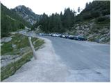
From Kranjska Gora, drive towards Bovec or vice versa, but only to the Vršič pass, where we park.
Route description:
From the parking lot at Vršič pass, head towards Trenta, where we quickly reach a small intersection. To the left, a road closed to public traffic branches off towards the nearby Tičarjev dom and continues to Poštarski dom. We go right, where next to a wooden hut selling various souvenirs, we notice the start of the marked trail leading towards Jalovec and Zavetišče pod Špičkom.
After just a few steps, the trail takes us to the foot of the scree below Mala Mojstrovka. We keep slightly to the left, where the path through a belt of dwarf pines leads us to the foot of the cliffs, along which we descend slightly. The trail remains quite scenic at first and, with a few short ascents and descents, brings us to a shorter, steeper section where fixed protection helps at two difficult spots, which is especially useful when the path is wet or slippery. After this section, the trail gradually begins to traverse downward, and we descend for quite some time, giving the impression that the path will take us into the valley rather than towards the Jalovec area. During the traverse, we occasionally get nice views of the mountains above the Trenta valley. When the path enters the forest, we reach a marked junction near the hunting hut in Rutarska Trenta, which is set slightly off the marked trail.
Continue straight towards Zavetišče pod Špičkom (left to Zadnja Trenta, right to Jalovec), where a few more junctions follow, but we follow the marked trail towards Zavetišče pod Špičkom. The trail now begins to ascend more seriously for the first time, mainly traversing to the left. When we leave the forest or it thins out, we arrive below the cliffs, ascending on a rockier path, while the surroundings remain fairly grassy or covered with dwarf pines and shrubs. The views become increasingly beautiful; our gaze quickly turns to the interesting ridge of Špiček, below which Zavetišče pod Špičkom is located. Looking back, we see Prisojnik, which is already quite distant, especially considering we started hiking near it. Later, the trail turns slightly left or southwest and joins the path from Zadnja Trenta.
Continue straight or slightly right, following the signs to the shelter. The trail gradually enters the world of scree slopes. Higher up, from the increasingly scenic path, a trail to Jalovec branches right, bypassing the shelter. We, passing numerous signposts with interesting inscriptions, reach Zavetišče pod Špičkom in a few minutes of further walking.
From the shelter, we return a bit and then head onto the path towards Jalovec, where the trail quickly leads to the climbing section.
The trail ascends along an initially well-protected rocky ridge, then steeply up the wall of the lesser-known Veliki Ozebnik (2480 m). The steepness gradually eases, and the trail turns slightly right, crossing steep and slippery slopes below Veliki Ozebnik. This section is poorly protected and very exposed to falling rocks (helmet mandatory!). The trail then crosses a shorter exposed gully and leads us into softer grassy terrain.
Just a few steps after the gully, we leave the marked trail and continue the ascent left through pathless terrain. We ascend along the right side of the gully in very steep terrain, where there is a high risk of triggering rockfall (we must be very careful here as a marked trail runs below!). After 20 minutes of easy scrambling not exceeding grade 1, we reach the summit of Veliki Ozebnik.
Orientation in the final section is difficult, and there is also a high risk of falling rocks.
Vršič - Rutarska Trenta 2:15, Rutarska Trenta - junction below Špičkom 0:40, junction below Špičkom - Zavetišče pod Špičkom 0:50, Zavetišče pod Špičkom - junction off marked trail 1:15, junction off marked trail - Veliki Ozebnik 0:20.

Photos:
 1
1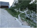 2
2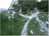 3
3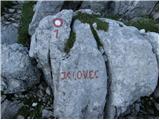 4
4 5
5 6
6 7
7 8
8 9
9 10
10 11
11 12
12 13
13 14
14 15
15 16
16 17
17 18
18 19
19 20
20 21
21 22
22 23
23 24
24 25
25 26
26 27
27 28
28 29
29 30
30 31
31 32
32 33
33 34
34 35
35 36
36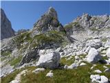 37
37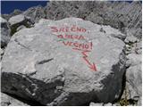 38
38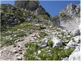 39
39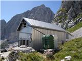 40
40 41
41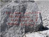 42
42 43
43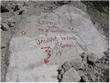 44
44 45
45 46
46 47
47 48
48 49
49 50
50 51
51 52
52 53
53
Discussion about the trip Vršič - Veliki Ozebnik (via Zavetišče pod Špičkom)
To post a comment you must log in:
If you do not yet have a username, you must first
register.