Vrzdenec - Koreno (via Samotorica)
Starting point: Vrzdenec (380 m)
| Latitude/Longitude: | 46,02220°N 14,26650°E |
| |
Route name: via Samotorica
Walking time: 1 h 45 min
Difficulty: easy marked way
Elevation gain: 349 m
Elevation difference along the route: 400 m
Map: Škofjeloško in Cerkljansko hribovje 1:50.000
Recommended equipment (summer):
Recommended equipment (winter):
Views: 8.422
 | 2 people like this post |
Access to starting point:
First, we drive to Horjul (to here from Dobrova or Vrhnika), then we continue driving towards Vrzdenec and Gorenja vas. In the first sharp left turn after the village of Vrzdenec, we will notice a narrow asphalt road which branches off to the right from the main road. We take this road, which after a shorter steep ascent brings us to the church of St. Kancian above Vrzdenec. We park on one of the parking lots near the church.
Route description:
A little further from the church, at the end of the road we will notice hiking signposts which direct us onto a cart track in the direction of Kožljek (we do not continue right in the direction of Koreno). The cart track, which starts ascending along the stream, brings us already after a minute of walking to an unmarked junction.
We continue right on the second cart track (the first to the right is quite overgrown, the left one disappears), which immediately after crossing the stream turns right and then ascends along its right bank. After a short ascent the cart track turns sharply left and begins gradually to distance itself from the stream. Further ahead the blazes become more frequent, and the path soon brings us to a marked junction, where we continue right in the direction of Samotorica (left at Hlipč). We continue the ascent on the cart track which higher brings us out of the forest onto panoramic grassy slopes. We continue the ascent on the increasingly wider cart track, which past the hunting observatory brings us to the church of St. Michael on Samotorica.
At the church we step onto the road which we follow to the right; it quickly brings us to a marked crossroads. We continue straight in the direction of Koreno (left Kožljek, right Horjul) on the road which gently ascends along the edge of the forest. After a few minutes of further walking along the road we notice blazes which direct us right onto a footpath. The marked path, which further proceeds along a cart track, immediately after the cross turns slightly left and begins gently to descend. The cart track path soon emerges from the forest onto grassy slopes, across which with a few shorter ascents and descents we reach the village of Koreno, where we step onto an asphalt road. We then follow the well-marked road to the farm tourism pr'Lenart, where the blazes direct us left onto a narrow road along which we ascend to the church of St. Mohor and Fortunat. From the church we continue on a poorly visible path which past a large cross brings us to a vantage point where a panorama board stands and below it a logbook box.

Photos:
 1
1 2
2 3
3 4
4 5
5 6
6 7
7 8
8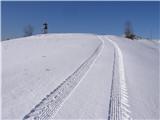 9
9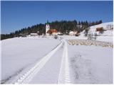 10
10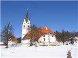 11
11 12
12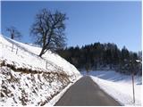 13
13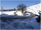 14
14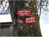 15
15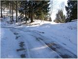 16
16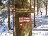 17
17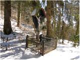 18
18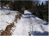 19
19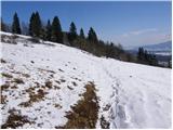 20
20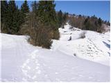 21
21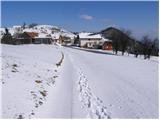 22
22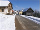 23
23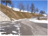 24
24 25
25 26
26 27
27 28
28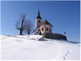 29
29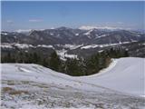 30
30 31
31
Discussion about the trip Vrzdenec - Koreno (via Samotorica)
|
| francimedved25. 02. 2009 |
A short time ago I was up there. It's an excellent trip to escape the Ljubljana fog in winter. Regards Franci
|
|
|
|
| podplat7. 03. 2009 |
I'm interested in the description of the path from Vrzdenec to the right towards Koreno, as it's not described anywhere, but there is a direction sign, and also where the path joins one of the listed paths. Thanks, regards Borut
|
|
|
|
| mabe20. 06. 2011 |
The path is very poorly marked in some sections. At least 3 times or even more I had to turn back and check the path again.
|
|
|
|
| tista17. 01. 2021 |
The path is well marked (Jan 2021), markers are clear and frequent. At the top access is only possible to the church, as there is a fence everywhere due to the pasture. The marked path now does not go past the hunting observation post but markers lead right directly to the road. Otherwise the path is also suitable for children, the start is steep (not too much) then the path is varied and not strenuous.
|
|
|
To post a comment you must log in:
If you do not yet have a username, you must first
register.