Bajdiše / Waidisch - Ferlacher Horn / Grlovec
Starting point: Bajdiše / Waidisch (547 m)
| Latitude/Longitude: | 46,49450°N 14,34830°E |
| |
Walking time: 3 h 35 min
Difficulty: easy marked way
Elevation gain: 1293 m
Elevation difference along the route: 1293 m
Map: Karavanke - osrednji del 1:50.000
Recommended equipment (summer):
Recommended equipment (winter): ice axe, crampons
Views: 5.624
 | 1 person like this post |
Access to starting point:
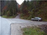
Via the border crossing Ljubelj we drive to Borovlje / Ferlach, where we turn right in the direction of the village Sele / Zell-Pharre. We follow the road, which ahead mostly ascends, to the village Bajdiše / Waidisch. Immediately behind the village we notice signs for Grlovec / Ferlacher Horn by the road. We park on a smaller parking lot by the road approximately 100m further.
Route description:
From the parking lot, we return to the signposts, where we head towards Grlovec / Ferlacher Horn. Further across the bridge we cross a stream and the path brings us to a large meadow. On the other side of the meadow we notice the blazes, which lead us into the forest. The path immediately steeply ascends and ascends above a torrent stream, which we hear right below us. The path then turns slightly to the left and brings us to a forest road. We follow the road only briefly to the spot where the blazes direct us right onto a footpath. After ten minutes the path brings us again to a forest road. We continue right upwards and the path brings us to a smaller hamlet, after which the marked path turns left onto a cart track. The cart track, which ascends diagonally along the fence, soon turns right and brings us to the hunting observatory on a smaller clearing. Only a few steps further the path crosses a forest road and ascends a quite overgrown meadow. Further we cross the forest road a few more times, then the signs direct us left along the forest road, which we follow for about 100m to the spot where a footpath branches off right upwards, which then crosses the forest road two more times. When we notice a cross by the road, the road crossings end.
Here the path again steeply ascends and through the forest brings us to a junction, where we continue left. A shorter diagonal ascent follows, then the path turns right and ascends the vegetated ridge. The path further crosses a forest clearcut and then brings us to the summit area of the mountain. After a few minutes we step out of the forest and before us we see a large cross, which stands on the top. Only a few minutes of walking on a scenic grassy slope follow.
Description and pictures refer to the condition in the year 2007 (October).

Photos:
 1
1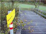 2
2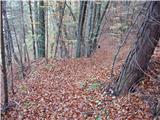 3
3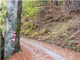 4
4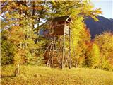 5
5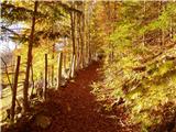 6
6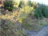 7
7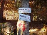 8
8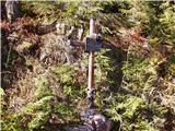 9
9 10
10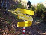 11
11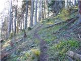 12
12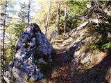 13
13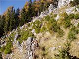 14
14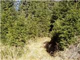 15
15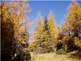 16
16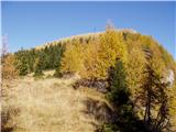 17
17 18
18
Discussion about the trip Bajdiše / Waidisch - Ferlacher Horn / Grlovec
To post a comment you must log in:
If you do not yet have a username, you must first
register.