Waldrast - Großer Speikkogel (Koralpe)
Starting point: Waldrast (1500 m)
| Latitude/Longitude: | 46,81920°N 14,93190°E |
| |
Walking time: 2 h
Difficulty: easy marked way
Elevation gain: 640 m
Elevation difference along the route: 640 m
Map: WK 237 Saualpe-Lavanttal-Koralpe 1:50.000
Recommended equipment (summer):
Recommended equipment (winter):
Views: 18.554
 | 3 people like this post |
Access to starting point:
A) Over one of the border crossings with Austria (Korensko sedlo, Karawanks Tunnel, mountain pass Ljubelj, mountain pass Jezerski vrh, mountain pass Pavličev vrh) we drive to Austria, and then we continue driving on the so-called southern motorway towards Graz. On the mentioned motorway we drive to the town of Wolfsberg, where we leave the motorway, and when we get to a roundabout with an old or regional road we continue driving "straight" in the direction of the Koralpe ski resort. Ahead we drive through settlements St. Stefan, Maildorf and Rieding, and we follow the ascending road to a large parking lot at the Koralpe ski center.
B) Over the border crossing Holmec or Vič we drive to Austria, and then we continue driving towards the town of Wolfsberg, where signs for Koralpe point us to the right. Ahead we drive through settlements St. Stefan, Maildorf and Rieding, and we follow the ascending road to a large parking lot at the Koralpe ski center.
Route description:
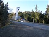
At the end of the parking lot signs for Koralpenhaus point us on a footpath which ascends along the left edge of the ski slope (while the ski resort is operating the passage is forbidden). A moderately steep path after a few minutes of ascent brings us to an unmarked junction, where we continue on the left gentle track. The path, which then for some time runs along the ski slope, higher brings us to an asphalt road. Here we continue the ascent to the right on the ascending road which with increasingly beautiful views quickly brings us to the mountain hut.
From Koralpenhaus we continue on the road which after two sharp turns soon brings us to two radar stations on the top. The path bypasses the radar stations on the right side, and then the road ends. Next follows only a few steps of ascent to a cross, which we see on the left side.
Photos:
 1
1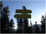 2
2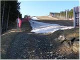 3
3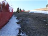 4
4 5
5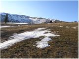 6
6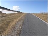 7
7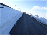 8
8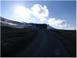 9
9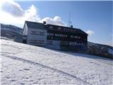 10
10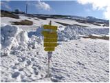 11
11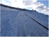 12
12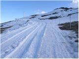 13
13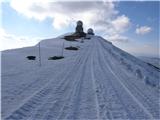 14
14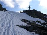 15
15 16
16
Discussion about the trip Waldrast - Großer Speikkogel (Koralpe)
|
| Sam.volk18. 04. 2009 |
Today we visited this beautiful peak. Weather cold, foggy, windy, there's still quite a bit of snow. Nice hike, worth seeing. Lp Franc
|
|
|
|
| S57MB7. 09. 2010 |
Hi, does anyone have an electronic hiking map of the area around this Golica and a map of the Graz surroundings? Thanks.
my address: s57mbboris@gmail.com
|
|
|
|
| S57MB7. 09. 2010 |
Thanks for the links, they will be very useful to me. Thanks
|
|
|
|
| marinka6727. 10. 2013 |
Yesterday on Koralpe no wind, which apparently almost never happens there. Lying in the sun in short sleeves! Really gorgeous day! Since there were more of us, we had a "picnic" at the hut (there), Austrian mountaineers watched us curiously, as they obviously aren't used to snacking on mountain tops. Except for some chocolate and water bottles we didn't notice anyone munching anything.
We felt like "hobos" 
Which actually doesn't matter at all, the day was gorgeous.
|
|
|
To post a comment you must log in:
If you do not yet have a username, you must first
register.