Waldrast - Seespitz (Koralpe) (via Großhöllerhütte)
Starting point: Waldrast (1500 m)
| Latitude/Longitude: | 46,81920°N 14,93190°E |
| |
Route name: via Großhöllerhütte
Walking time: 3 h 30 min
Difficulty: easy marked way, easy unmarked way
Elevation gain: 566 m
Elevation difference along the route: 660 m
Map:
Recommended equipment (summer):
Recommended equipment (winter): ice axe, crampons
Views: 1.716
 | 1 person like this post |
Access to starting point:
A) Over one of the border crossings with Austria (Korensko sedlo, Karawanks Tunnel, mountain pass Ljubelj, mountain pass Jezerski vrh, mountain pass Pavličev vrh) we drive to Austria, and then we continue driving on the so-called southern motorway towards Graz. On the mentioned motorway we drive to the town of Wolfsberg, where we leave the motorway, and when we get to a roundabout with an old or regional road we continue driving "straight" in the direction of the Koralpe ski resort. Further we drive through the settlements St. Stefan, Maildorf and Rieding, and we follow the ascending road to a large parking lot at the ski center Koralpe.
B) Over the border crossing Holmec or Vič we drive to Austria, and then we continue driving towards the town of Wolfsberg, where signs for Koralpe point us to the right. Further we drive through the settlements St. Stefan, Maildorf and Rieding, and we follow the ascending road to a large parking lot at the ski center Koralpe.
Route description:
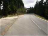
At the beginning of the parking lot, we notice signposts for "Wasserfall and Großhöllerhütte", which point us to the left on the road which is closed with a gate. The road then immediately turns right and with some gentle ascents and descents after approximately half an hour of walking brings us to a crossroad, where we continue in the direction of the mountain hut Großhöllerhütte. We also follow the road in the next crossroads in the same direction, until it changes into a footpath. At the spot where the road ends there is also the next path junction, where we have two options to continue. We choose the right path which leads us by the stream upwards. A little higher we cross the mentioned stream and step on some kind of island, on which we then walk a few minutes. The path ahead over a small bridge again passes on the right side of the stream (left bank) and starts ascending steeper. When the steepness decreases we come to the next junction, where we continue left (right mountain hut Koralpenhaus). After a few additional steps we again over a small bridge cross the stream. Here the path branches off to the left downwards towards the waterfall to which we have only two minutes of walking.
From the waterfall we continue on a path which starts ascending steeper on the more and more panoramic slope. After 20 minutes of ascent from the waterfall the path brings us to the mountain hut Großhöllerhütte.
From the mountain hut we continue on the mountain road in the direction of the mountain hut Grillitschhütte and the peak Großer Speikkogel, which after approximately 10 minutes of additional walking brings us to the next junction, where we continue right in the direction of the peak Großer Speikkogel (straight alpine pass Weinebene and mountain hut Grillitschhütte).
We continue the path on a wide cart track which further crosses a few trickling streams. The gently sloping cart track, which at first even slightly descends, a little higher turns into a gentle footpath which continues through panoramic and gentle meadows. A little further the path to the mountain hut Koralpenhaus also branches off to the right, and we continue straight in the direction of the peak Großer Speikkogel. Further the marked path turns a little to the left and starts moderately ascending over a somewhat steeper slope. A short steeper ascent follows and the path brings us to a small saddle between the peaks Seespitz and Großer Speikkogel.
On the mentioned saddle we reach the marked panoramic path Weinebene - Großer Speikkogel, which we only cross and continue the path on the eastern side of the saddle, where we notice the beginning of an unmarked path which from the saddle turns to the left. We continue on and along a panoramic ridge, on which at first a completely gentle unmarked path runs. After a good 3 minutes of additional walking the path passes on the summit head of the peak Seespitz, on which it starts ascending steeply. We then follow this steep path to the peak, in the middle of which stands a smaller cross, which we reach after a few minutes of additional walking.

Photos:
 1
1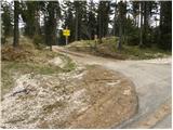 2
2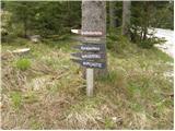 3
3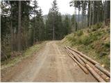 4
4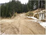 5
5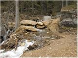 6
6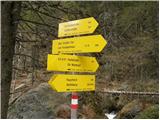 7
7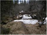 8
8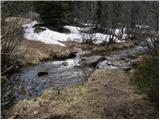 9
9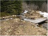 10
10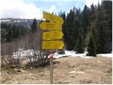 11
11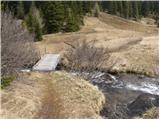 12
12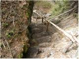 13
13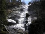 14
14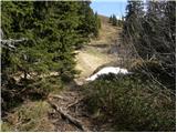 15
15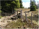 16
16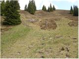 17
17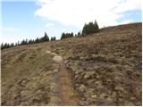 18
18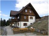 19
19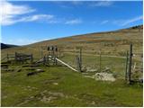 20
20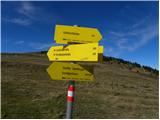 21
21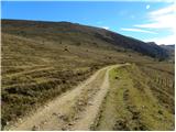 22
22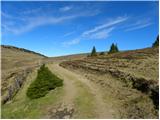 23
23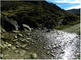 24
24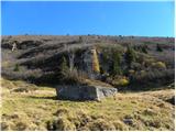 25
25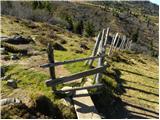 26
26 27
27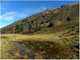 28
28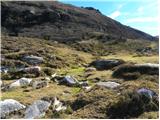 29
29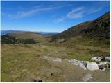 30
30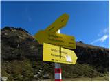 31
31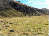 32
32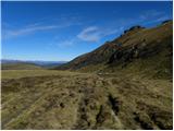 33
33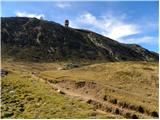 34
34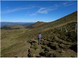 35
35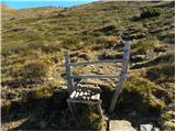 36
36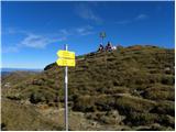 37
37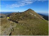 38
38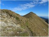 39
39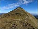 40
40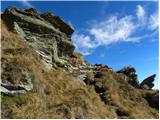 41
41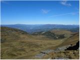 42
42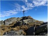 43
43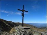 44
44
Discussion about the trip Waldrast - Seespitz (Koralpe) (via Großhöllerhütte)
To post a comment you must log in:
If you do not yet have a username, you must first
register.