Weissensee - Eckwand (via Almspitz)
Starting point: Weissensee (940 m)
| Latitude/Longitude: | 46,69890°N 13,41480°E |
| |
Route name: via Almspitz
Walking time: 4 h 45 min
Difficulty: partly demanding marked way
Elevation gain: 1281 m
Elevation difference along the route: 1290 m
Map:
Recommended equipment (summer):
Recommended equipment (winter): ice axe, crampons
Views: 4.096
 | 1 person like this post |
Access to starting point:
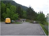
A little before Spittal from the direction of Beljak/Villach (on the old road), the road towards the village of Ziebel branches off to the left. In the mentioned village, we continue driving towards the lake Weissensee, which is approximately 15 km from Ziebel. We park on a large well-maintained parking lot near the lake.
Route description:
From the large parking lot, we descend a few meters to the main road, where on the left side we notice signposts. We head on a wide path which leads along the lake following the signs »Techendorf«. The path first leads us over a smaller bridge and brings us to a camp on the eastern side of the lake Weissensee. Here we turn right onto an asphalt road which runs along the camp and brings us to a crossroads where we turn left and after a few meters of walking we come to signposts. We go left following the signs »Techendorfer Alm steil«. After a few meters we come again to signposts and go right on a steep path towards the mountain pasture Techendorfer Alm. The left path leads along a gentler route, which mostly follows the road.
The path ascends quite steeply through the forest and brings us to a clearing where we cross a cart track and begin to ascend along the edge of the forest. Here the first views already open up towards the nearby peaks in the Latschur group. The path ascends again through the forest and then crosses the mountain road several times. At all crossroads, which are very well marked, we continue in the direction of Techendorfer Alm steil (steep path). Finally, when the path towards the saddle Stosia branches off to the left, we continue along the road, which after approximately 15 minutes of walking brings us to the mountain pasture Techendorfer Alm, where there also stands a smaller mountain hut.
From the mountain pasture we continue north following the signs Stosia, Latschur. The path first crosses a sparse forest and then ascends along grassy slopes towards the saddle Stosia. This part of the path is marked with white-blue blazes.
On the saddle we turn right and continue along the grassy ridge. When we come to a junction we continue straight along the ridge, while to the right branches off the direct path to Eckwand. When we come again to a junction we take the right path, which continues along the ridge and leads to Almspitz (2180 m). The left path leads to Latschur. The path then continues to ascend along the grassy ridge and soon brings us to the summit of Almspitz from which there is a nice view of the surrounding peaks.
From the summit we then descend a few meters towards the west to the saddle between the peaks Almspitz and Latschur. On the saddle we turn right, where we cross the somewhat steeper northern slopes of Almspitz. When we come back onto the ridge, soon from the right side a direct and somewhat shorter path from the saddle Stosia joins. There follows a shorter ascent along the grassy ridge towards the summit.

Photos:
 1
1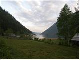 2
2 3
3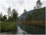 4
4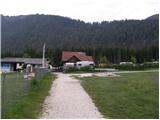 5
5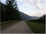 6
6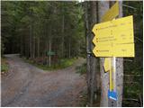 7
7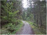 8
8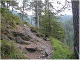 9
9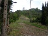 10
10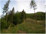 11
11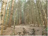 12
12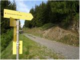 13
13 14
14 15
15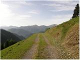 16
16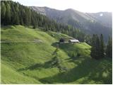 17
17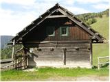 18
18 19
19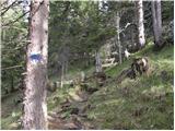 20
20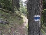 21
21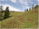 22
22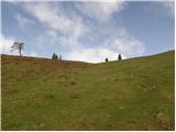 23
23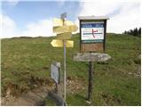 24
24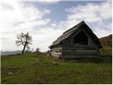 25
25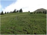 26
26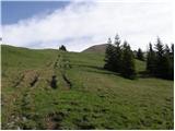 27
27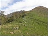 28
28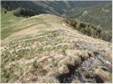 29
29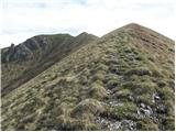 30
30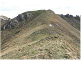 31
31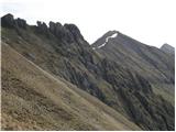 32
32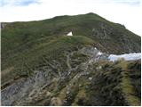 33
33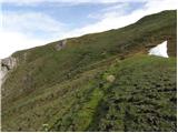 34
34 35
35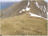 36
36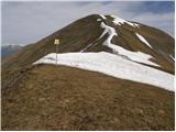 37
37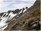 38
38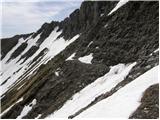 39
39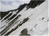 40
40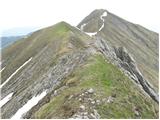 41
41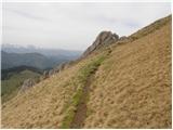 42
42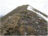 43
43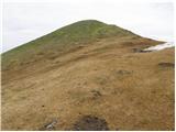 44
44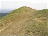 45
45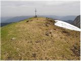 46
46
Discussion about the trip Weissensee - Eckwand (via Almspitz)
|
| VanSims26. 07. 2010 |
Access to Eckwand from the starting point Weissensee has many alternative approaches. The main routes are the ones described on this portal (maybe a few more), but they have quite a few variants and alternatives.
Already to Techendorfer Alm we have an alternative described above: steep variant and variant along the forest road. The steep variant is quite steep and quite strenuous for people with less fitness. But technically completely undemanding. You can exit already about halfway and continue on the forest road (if someone runs out of steam  ). After the second such crossing with the road it's no longer so steep, so you can combine road in the lower part and steep variant in the upper, if we're not exactly at peak fitness ). After the second such crossing with the road it's no longer so steep, so you can combine road in the lower part and steep variant in the upper, if we're not exactly at peak fitness
At Techendorfer Alm there are two loose dogs (apparently the hut keeper's). Whoever is bothered by that has an alternative turnoff to Stosio already 10 min before Techendorfer Alm (and saves 10 min.)
Then from the Stosio saddle there is also a direct path to Eckwand for those who would have trouble crossing above Almspitz.
That crossing is actually a bit more demanding (for experienced hikers especially ferrata climbers of course a piece of cake  ). I had dry conditions but in conditions like in the upper picture it might be somewhat dangerous in my opinion. ). I had dry conditions but in conditions like in the upper picture it might be somewhat dangerous in my opinion.
I descended via Karalm (reverse path as described in the route description via this pasture). Here too, when descending along the forest road to Weissensee, there is a forest alternative. The alternative is well marked all the way almost to the end when we're already right at the stream. There I didn't see markings ahead so I bushwhacked along the right path to the stream. Crossing the stream is nothing special (except maybe after rain) then don't go straight into the bushes that lead to the road (like I did ) but go a bit more along the stream up a few dozen meters and you'll climb to the road almost without trouble (noticed of course only when I was on the road  ) )
This alternative is technically perhaps a bit more demanding (somewhere between easy and moderately difficult), very steep and not recommended in wet (at least downhill).
|
|
|
To post a comment you must log in:
If you do not yet have a username, you must first
register.