Winklertal - Monte Vancomun / Hochspitz (via Winkler Jocb)
Starting point: Winklertal (1550 m)
Route name: via Winkler Jocb
Walking time: 4 h 45 min
Difficulty: partly demanding marked way
Elevation gain: 1030 m
Elevation difference along the route: 1130 m
Map:
Recommended equipment (summer):
Recommended equipment (winter): ice axe, crampons
Views: 2.695
 | 1 person like this post |
Access to starting point:
Via the border crossing Korensko sedlo we descend into Austria, where at the first major intersection we continue left towards the village Podklošter/Arnoldstein. In the mentioned village we arrive at a roundabout, where we continue right in the direction of "Hermagor". Further we drive on a wide road that leads us through the Gailtal valley. At the settlement Mauthen we continue left in the direction of the mountain pass Plöckenpass, then after a few hundred meters right in the direction of the Lesachtal valley. Further we drive on a narrower and quite winding road which we follow to the village Untertilliach. Just a little after the mentioned village (at the second bus stop) a left downward-branching road that is at first still asphalted separates. The road then crosses a bridge, after which a wide macadam road joins us from the left side. We continue straight for approximately 50 m, then we come to the next unmarked intersection, where we continue right on the lower "main" road which a few meters ahead brings us to the marked intersection. This time we continue left in the direction of "Hochspitz and Oberalm" on a worsening road which higher brings us to an unmarked intersection in front of which is a smaller parking lot.
Route description:
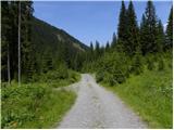
From the parking lot we continue on the road to the hut Gartlhütte at 1600 m altitude. From the hut we then continue on the mountain road which leads us through the valley towards the south and brings us near the stream Winkler Bach. For some time we ascend along the stream, then the road turns right and ascends for a long time in zig-zags upwards. The road mostly ascends on grassy slopes, only occasionally bringing us into sparse forest. On the grassy slopes in summer livestock also grazes. We follow such a road all the way to the alpine pasture Oberalm at 2160 m altitude.
From the alpine pasture where the mountain road ends we continue on the footpath which first crosses grassy slopes below the mountain Reiterkarspitz, then turns left and begins to ascend towards the saddle Winkler Jocb. The ascent to the saddle runs over grassy terrain, and along the path we will also notice some remains from the First World War.
On the saddle we continue left following the signs “Mitterkarbiwak”. The path then turns slightly right and crosses grassy slopes below the summit Cima Manzon 2328 m. Here the path runs on the southern slopes and soon brings us near the saddle Val Mezzana / Mosser Sharte 2226 m. On the saddle there is also an unmarked junction. We continue on the marked path which leads across grassy slopes on the south side of the peak Gamskofel / Cima Mezzana 2420 m, while unmarked paths lead left on the north side.
The path continues to cross grassy slopes below the summit Gamskofel. On this section the path is relatively level and only rarely rises slightly. Here we can usually see many marmots, and from the path there is a nice view towards the Dolomites and our goal Hochspitz, which we already see ahead. Such a path leads all the way to the saddle Hochspitzsenke / Val Carnia 2314 m. On the saddle we continue left following the signs “Mitterkarbiwak” and begin to descend gently along the old military mule track below the slopes of the peak Hochspitz. The path then brings us to a junction, where we continue right following the signs “Hochspitz”.
From the junction the path then ascends somewhat more steeply and brings us to the ridge where we continue right. The path further runs along the ridge, which is slightly exposed in a few places. In the final section the path turns left to the eastern side of the mountain and follows only a short ascent to the summit.

Along the route: Gartlhütte (1600m),
Oberalm (2160m), Winkler Jocb (2248m), Mosser Sharte (2226m), Hochspitzsenke (2314m)
Photos:
 1
1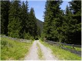 2
2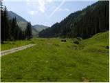 3
3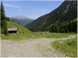 4
4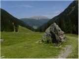 5
5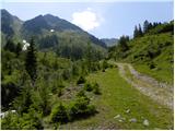 6
6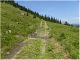 7
7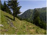 8
8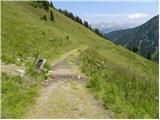 9
9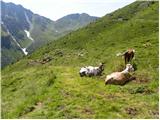 10
10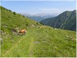 11
11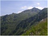 12
12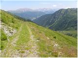 13
13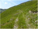 14
14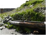 15
15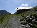 16
16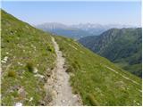 17
17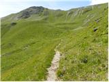 18
18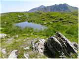 19
19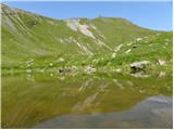 20
20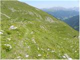 21
21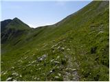 22
22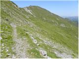 23
23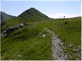 24
24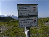 25
25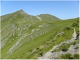 26
26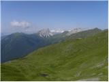 27
27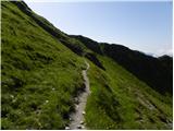 28
28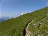 29
29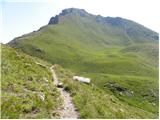 30
30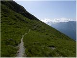 31
31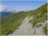 32
32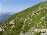 33
33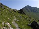 34
34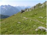 35
35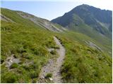 36
36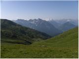 37
37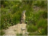 38
38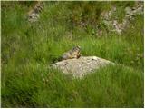 39
39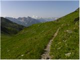 40
40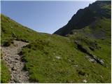 41
41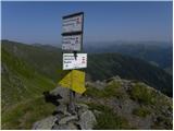 42
42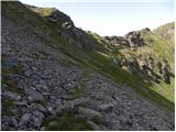 43
43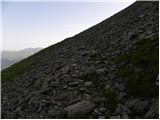 44
44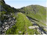 45
45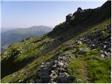 46
46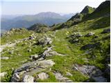 47
47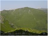 48
48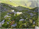 49
49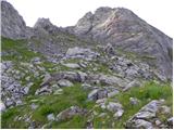 50
50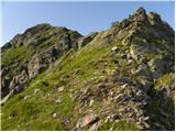 51
51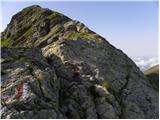 52
52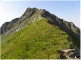 53
53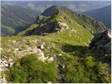 54
54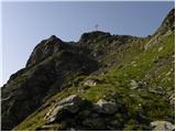 55
55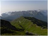 56
56 57
57
Discussion about the trip Winklertal - Monte Vancomun / Hochspitz (via Winkler Jocb)
To post a comment you must log in:
If you do not yet have a username, you must first
register.