Žabnice / Camporosso in Valcanale - Kamniti lovec / Cima del Cacciatore
Starting point: Žabnice / Camporosso in Valcanale (858 m)
Starting point Lat/Lon: 46.5044°N 13.5404°E 
Time of walking: 3 h 30 min
Difficulty: difficult marked way
Difficulty of skiing: no data
Altitude difference: 1213 m
Altitude difference (by path): 1220 m
Map: Julijske Alpe - zahodni del 1:50.000
Access to starting point:
Over the border crossing Rateče or border crossing Predel we drive to Trbiž / Tarvisio, and then we continue driving in the direction of Videm / Udine and settlement Žabnice / Camporosso in Valcanale. When Trbiž ends, only a little after store Eurospar (store is located on the right side of the road), still before the main roundabout, we turn left on street Via Lussari. Few 100 meters we drive on the mentioned street, and then we get to a smaller crossroad, from the crossroad we continue straight and after the crossroad, we park on a parking lot on the right side of the road. We park on the lower part of the parking lot, on the upper part the parking is prohibited with a traffic sign.
Path description:
From the starting point, we continue on for public traffic closed asphalt road which leads us past few more houses. Above the hamlet, the path leads past the information board, and then the asphalt ends. We continue on a macadam road which leads us through ditch Višarski graben, through which runs the stream Rio Lussari. Higher, the road changes into a wide cart track, and next to it Stations of the Cross show up.
Further, we are for some time ascending on a cart track, from which only occasionally a view opens up a little in the direction of Carnic Alps, where we clearly see Ojstrnik. Higher from the cart track we turn to the right on a marked footpath in the direction of Kamniti lovec / Cima del Cacciatore and Svete Višarje / Monte Lussari (straight on a cart track Višarska planina / Malga di Lussari). Next follows an ascent through the forest, at XIII. Station of the Cross we get very close to a ski slope and transport road.
At the mentioned station we leave the footpath which leads to Svete Višarje and to a saddle Višarsko sedlo we continue on a transport road. After few minutes of a moderate ascent on a transport road we reach bigger chapel on a saddle Višarsko sedlo, from where we continue left on a footpath in the direction of Kamniti lovec (straight Zajzera, right Svete Višarje).
From the saddle, we ascend a little and then the path for some time continues without large changes in altitude, or is only slightly ascending. Further, the path starts moderately ascending, and higher is ascending diagonally on slopes of Beraški križ, peak which we see left from the path. After a long crossing to the right, follows shorter a little steeper part, and then the path brings us in the cirque V Klobuku, where the path for some time flattens and turns again more to the right. When the path again starts ascending it turns left and then leads on the scree, on which we walk all the way to the entrance into a more demanding part.
At the beginning of a secured part arrow on rock points us right, where with the help of steel cables we start steeply ascending. After a shorter steep ascent, a well-secured path turns right and it ascends diagonally to crumbly gravel gully, to which we descend on still secured path. Next follows an ascent through the gully, where we have to be very careful, not to trigger stones, because below us runs mountain path and every stone can be dangerous for numerous mountaineers below us, and we also have to pay attention to falling stones, which is triggered by mountaineers above us. During the ascent through the gully, which technically isn't that difficult, on some spots we also get help from a steel cable. On top of the gully, we reach the ridge, where we continue right, after that on a steep path in a minute of additional walking, we reach the panoramic peak.
Žabnice - Višarsko sedlo 2:15, Višarsko sedlo - Kamniti lovec 1:15.
Description and pictures refer to a condition in the year 2017 (July).
On the way: Višarsko sedlo / Sella Lussari (1715m)
Pictures:
 1
1 2
2 3
3 4
4 5
5 6
6 7
7 8
8 9
9 10
10 11
11 12
12 13
13 14
14 15
15 16
16 17
17 18
18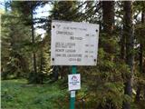 19
19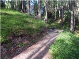 20
20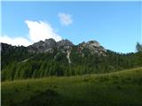 21
21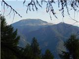 22
22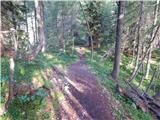 23
23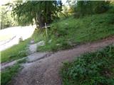 24
24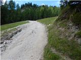 25
25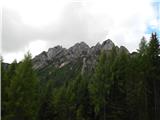 26
26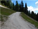 27
27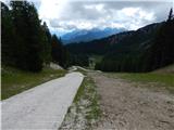 28
28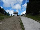 29
29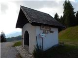 30
30 31
31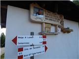 32
32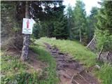 33
33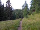 34
34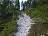 35
35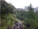 36
36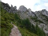 37
37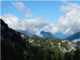 38
38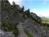 39
39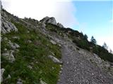 40
40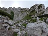 41
41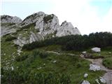 42
42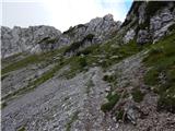 43
43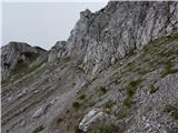 44
44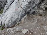 45
45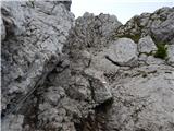 46
46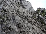 47
47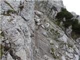 48
48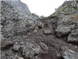 49
49 50
50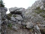 51
51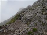 52
52 53
53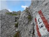 54
54 55
55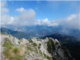 56
56