Starting point: Zadlog (702 m)
| Latitude/Longitude: | 45,93920°N 14,00260°E |
| |
Walking time: 1 h 15 min
Difficulty: easy marked way
Elevation gain: 426 m
Elevation difference along the route: 426 m
Map: Nanos 1:50.000
Recommended equipment (summer):
Recommended equipment (winter): ice axe, crampons
Views: 18.110
 | 2 people like this post |
Access to starting point:
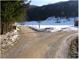
From Logatec we drive towards Idrija or vice versa, but only to the settlement of Godovič, from where we continue driving towards Črni vrh and Col. At the church in the center of Črni vrh we continue right in the direction of the village Zadlog. We then follow this road straight at the crossroads, and it soon brings us to the Zadloška kotlina basin. After a good 4 km of driving from the crossroads in Črni vrh, we will notice by the road the first signpost for Špičasti vrh, which directs us to the left. A well-marked road then brings us to the spot where the footpath begins.
We can also reach Črni vrh from the Vipava Valley via Col.
Route description:
Mountain signs for Špičasti vrh direct us onto a cart track, which initially ascends gently across a large meadow. On the other side of the meadow, the marked path splits into two parts. We can continue slightly left on the cart track or somewhat to the right on a very steep footpath. Both paths run through the forest and join higher up into one relatively steep path. The path then passes again onto a cart track, which brings us in a moderate ascent to a forest road, which we follow to the right.
After a few minutes of walking on the road, we leave it and continue slightly left towards Špičasti vrh. We continue the ascent on a cart track, which soon splits into two parts. We continue slightly right on the marked cart track, which gradually turns into a footpath. The path then turns left and continues along a wide forested ridge. We follow the mentioned path, which a little below the summit steeply ascends for a short time, all the way to the lookout tower on Špičasti vrh.

Photos:
 1
1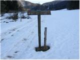 2
2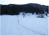 3
3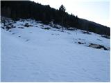 4
4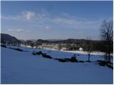 5
5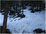 6
6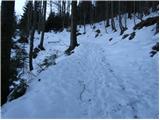 7
7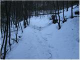 8
8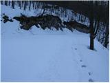 9
9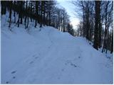 10
10 11
11 12
12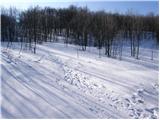 13
13 14
14 15
15 16
16
Discussion about the trip Zadlog - Špičasti vrh
|
| ulmusglabra6. 03. 2012 |
today I was first up: wind like crazy, on summit it would blow me away soon... and in Zadlog it's like Siberia
otherwise nice trip by bike to Zadlog and then on foot up 
LP
|
|
|
|
| TheStig1. 04. 2012 |
Been there several times and recommend it to everyone! In my opinion the best view from a hill in Slovenia! I really like the terrain variety as you ascend quite steeply all the way. With slow walking and breaks you're up in 45 min.
LP
|
|
|
|
| VanSims15. 04. 2013 |
Yesterday up there. The path is (except for some muddy patches in the lower part) still under snow, but the snow is hard and you can walk nicely on it. Poles recommended especially for the descent.
Weather was nice. View too.
|
|
|
|
| di9. 04. 2025 17:56:54 |
Hills conquered:
Zmetovec, Špičasti vrh, Žgavčev vrh
|
|
|
To post a comment you must log in:
If you do not yet have a username, you must first
register.