Zadnja Trenta (Flori) - Jalovec (via Jalovška škrbina)
Starting point: Zadnja Trenta (Flori) (900 m)
| Latitude/Longitude: | 46,40430°N 13,70980°E |
| |
Route name: via Jalovška škrbina
Walking time: 5 h 40 min
Difficulty: very difficult marked way
Elevation gain: 1745 m
Elevation difference along the route: 1760 m
Map: TNP 1:50.000
Recommended equipment (summer): helmet
Recommended equipment (winter): helmet, ice axe, crampons
Views: 32.511
 | 9 people like this post |
Access to starting point:
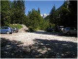
From Kranjska Gora we drive over the Vršič pass towards Bovec or the other way around, but only to the 49th hairpin bend of the Vršič road (near the village of Trenta). Here we turn onto a side road in the direction of the source of the Soča River. The road after a short ascent quickly brings us to the parking lot in front of the hut at the source of the Soča, but we continue left across the bridge and follow the road further to the parking lot at the end of the road (at the parking lot we notice mountain signs for Bavški Grintavec, the waterfalls of Suhi potok and Jalovec).
Route description:
From the parking lot we head right on the footpath towards Jalovec and the shelter under Špiček (the left path leads to Bavški Grintavec). The path from which we have a beautiful view of the already mentioned Bavški Grintavec at the beginning, quickly enters a dense forest, where it begins to climb steeply. The steep path, which almost all the time runs through the forest, brings us after about an hour and a half of walking to a junction, where we continue on the right path towards Jalovec and Mali kot (left to the Shelter under Špiček, Jalovec via the Shelter and Škrbina pod Gradom). The path, which continues through the forest, higher up brings us to the next junction, where the path from Vršič joins from the right. We continue straight upwards towards Jalovec (left Shelter under Špiček, right Vršič) along the path that climbs relatively steeply, first still through the forest, higher up on increasingly scenic slopes below Goličica, Lopa and the Šite.
On this section we mostly climb the southeastern slopes, which higher up become increasingly rocky; when we reach around 1950 meters above sea level, an unmarked trail branches off to the right towards the Šite, but we continue on the marked path, which turns slightly to the left and a little higher climbs to the marked junction below Jalovška škrbina.
Here we go left towards Jalovec (straight Jalovška Škrbina and Tamar valley) and cross the slopes to the entrance into the Goličica wall.
Before entering the climbing section we put on our helmet, and the sign informs us that we will continue the ascent on a very demanding path.
The first part of the ascent through the Goličica wall we do in a slight traverse to the left, then the path turns right and begins to climb up the wall. The path further becomes more and more exposed, with protections only at the most difficult spots, otherwise we have to do most of the ascent without protection (this part of the path is especially very dangerous for slipping on the descent).
Higher up the steepness eases and we reach the scree slopes south of Goličica, along and over which we then climb transversely to the left.
The increasingly scenic path then leads us through Vratca into Ozebnik to the place from where a beautiful view opens into Jalovec's ozebnik and towards the Tamar valley; the path through the ozebnik has been closed for several decades.
We continue on the less steep path, which takes us over the Jalovško sedelce to the junction at Jezerca, which we reach in a slight descent.
Here a path joins from the left that leads past the Shelter under Špiček and which is somewhat better protected than this one through the Goličica wall, but still very demanding; we continue slightly right towards Jalovec.
The path ahead begins to climb steeply again and with the help of only a few protections we climb on a sometimes quite exposed path to the main ridge of Jalovec, where the steepness of the path eases a bit, but it is still very exposed in many places and often drops off steeply on both sides.
Also on the main ridge, which is sometimes quite narrow, there are mostly no protections, and we follow the exceptionally scenic path to the next junction, where the path from Kotovo sedlo joins.
We continue straight and in a few minutes reach the 2645 meter high summit, which many also call the king of the mountains.
Starting point - Planina Trenta 1:30, Planina Trenta - Rutarska Trenta 0:30, Rutarska Trenta - junction below Goličica 1:30, junction below Goličica - Jezerca 1:20, Jezerca - junction on the Jalovec ridge 0:45, junction on the Jalovec ridge - Jalovec 0:05.

Along the route: Planina Trenta (1398m), Rutarska Trenta (1546m), Razpotje pod Goličico (2070m), Vratca v Ozebnik (2327m), Nad kuloarjem (2371m), Jalovško sedelce (2394m), Jezerca (2390m), Razpotje na grebenu Jalovca (2613m)
Photos:
 1
1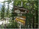 2
2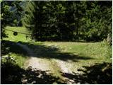 3
3 4
4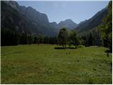 5
5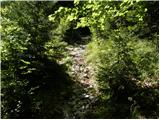 6
6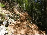 7
7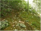 8
8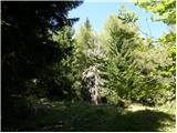 9
9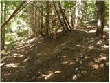 10
10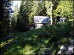 11
11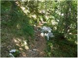 12
12 13
13 14
14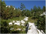 15
15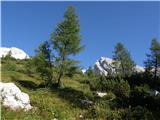 16
16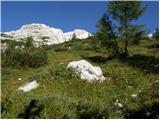 17
17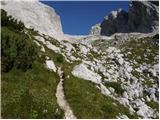 18
18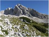 19
19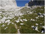 20
20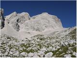 21
21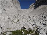 22
22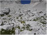 23
23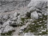 24
24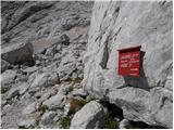 25
25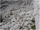 26
26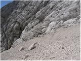 27
27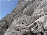 28
28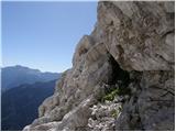 29
29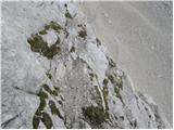 30
30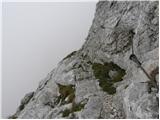 31
31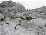 32
32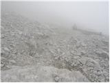 33
33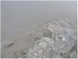 34
34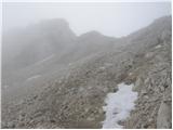 35
35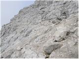 36
36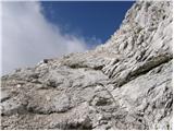 37
37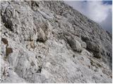 38
38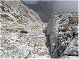 39
39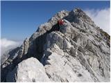 40
40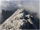 41
41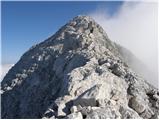 42
42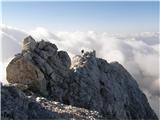 43
43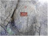 44
44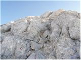 45
45 46
46
Discussion about the trip Zadnja Trenta (Flori) - Jalovec (via Jalovška škrbina)
|
| matic424. 07. 2010 |
Before the hunting hut, we turn left. After a few steps there is a junction (faded inscription on the rock) where we go right (left to the shelter under Špička). After a few minutes of walking, the path from Vršič joins from the right. From the top, we can descend past the shelter under Špička and make a nice circular tour. Very picturesque path.
|
|
|
|
| Žiga Šubic22. 07. 2011 |
Great trail, especially from Špička onwards it's quite adrenaline-pumping  Particularly right below the summit. Maybe the time in the description is a bit exaggerated. I made it up in 3 hours, 1.5 hours to the Jalovec-Špička junction and 1.5 hours to the top. Particularly right below the summit. Maybe the time in the description is a bit exaggerated. I made it up in 3 hours, 1.5 hours to the Jalovec-Špička junction and 1.5 hours to the top.
|
|
|
|
| irska14. 08. 2011 |
hm, interesting, how few comments for this trail, why is that?!  ... hope someone can manage to answer me: is it comparable to Frischauf's on Grintovec? ... hope someone can manage to answer me: is it comparable to Frischauf's on Grintovec?
|
|
|
|
| Majdag31. 08. 2014 |
...Yesterday we were returning along the path over Jalovško škrbino. Crazy, I couldn't even take a single photo. You spend all the time just looking at your feet, where to step and where to grab
|
|
|
|
| ivana1236. 09. 2020 |
The path is not suitable for inexperienced hikers & climbers! Very poorly secured!!
To Jalovec (up) we went past the shelter under Špičko from Zadnja Trenta. We knew there was another path connecting Trenta and Jalovec. This is exactly that one - via Jalovška škrbina. Since we didn't want to play the monotonous game - go back the same way - we chose the path via Jalovška škrbina for the descent. I myself have no problem with height or climbing. But this really surprised me. Especially the protection. A couple of bolts here and there. Below you a 200m wall, path strewn with small stones. Jalovski greben is nothing compared to this! Never again
I believe that going down such a path is much harder than up. Especially mentally. Be careful!
|
|
|
|
| Slash137. 09. 2020 |
We went up this path on Saturday. I agree that this is not a path for the inexperienced and that it can be very unpleasant in the downhill direction. For up it was just "fine", enough bolts that you have to "pull" everything. Definitely more demanding than the Jalovec ridge itself.
|
|
|
|
| di6. 09. 2021 20:03:52 |
On the return, there are no visible signs (signposts) for the direction Trenta (or something similarly appropriate, like Flori).
|
|
|
|
| felix8. 09. 2021 07:15:46 |
Walked this path years ago, yes it's quite demanding, and the path past Špička to Jalovec could also be better secured at some spots, given that Jalovec is on the SPP.
|
|
|
|
| ovi19. 06. 2023 15:29:41 |
Very strenuous one-day hike - no problem for hikers with dogs up to the shelter under Špička - further on it's mission impossible for a quadruped (arrange supervision - Hut keeper?) - need to start walking in the dark so that you'll be back at the starting point by evening (normal mountaineering fitness) - for all others...
Speaking from experience. 14 hours plus.
|
|
|
|
| dprapr19. 06. 2023 17:49:14 |
With "normal mountaineering fitness" 10 hours would be enough.
|
|
|
|
| ovi20. 06. 2023 15:41:10 |
...the mentioned portal is also followed by foreigners - What was it with that "foreigner" who fell from Mojstrovka?
No, of course it was improper equipment - have you ever thought that comments - like yours - very often lead to accidents (google translator) - GRS rescues (many end in fatalities sadly);
Why? Because you'll go up "full throttle", without short stops observing the surroundings, nature... which are not included in the indicated "average time"
You go ahead - probably you also rush to Triglav in such time - kudos - no need to sleep in huts, bivouacs;
You know, sometimes things that take a bit longer provide greater pleasure...oops- different topic.
and safe steps, 10-tka!
|
|
|
|
| dprapr20. 06. 2023 20:17:23 |
Accidents are caused precisely by those who are not physically fit enough for such a tour and need 14 hours for it. They usually get into trouble on the descent. Such a one-day tour is not suitable for them.
|
|
|
|
| mirank20. 06. 2023 20:26:38 |
What can you do, in the time of increasingly motorically limited children, it will be necessary to stretch the official time limits for all tours For us abnormal old men, the described frames are anyway too loose For us abnormal old men, the described frames are anyway too loose
|
|
|
|
| turbo20. 06. 2023 20:30:20 |
Drago is completely right. Fourteen hours is literally a tour from 5am to 7pm, so only one or two hours reserve of daylight. If you can't do such and similar tours in about ten hours, it's better to split it into two parts with overnight at Zavetišče pod Špičko. Start at 5am, say with dawn, and finish the tour around 3pm. That way you have plenty of day left if something unexpected happens, say a thunderstorm, or if you have a bad day and go a bit slower and walk one or two hours longer than planned. With excellent fitness after ten hours of demanding high mountains you're tired, after twelve even more. With not the best fitness and familiarity after ten you're already properly knackered, what after fourteen I don't even want to think, God forbid something complicates during the trip and you'd have to go faster. Drago is also completely right about descent, descents are often unlucky, legs don't carry as they should, attention and concentration have already greatly slackened, no two ways about it... And surely during a ten-hour tour you also enjoy the views, flowers, chamois and ibex, you also sit by the path and on the summit, you're not deprived of anything if you proceed properly
|
|
|
|
| felix21. 06. 2023 13:48:18 |
I agree with turbot. When I was young, I easily did the tour in one day. Lately I no longer dared and slept at Špička.
|
|
|
|
| di8. 08. 2024 11:45:20 |
On the signposts the direction is written: Mali kot 2h.
This cannot be found on maps (paper or digital).
Google says it's the same as Jalovška škrbina. (I myself determined beforehand that it's somewhere there where the path splits either towards the wall of Jalovec or to the officially undescribed Šitam.)
|
|
|
|
| di8. 08. 2024 11:46:13 |
Very "awkwardly" marked: Where it splits, it's not clear where to continue.
There are quite a few examples, mentioning just one: at the hunting hut the marking is to the right, but the more appropriate direction goes left upwards. This part of the path is not drawn on printed maps. Where does it lead?! (Especially when going in the opposite direction, or downhill, or from Vršič. You descend to the lowland, where a sign finally sends you up, back to that point, hehe.)
By the way: when PZS representatives repeatedly say even through the media "look at the map": a couple of printed hiking maps vs. digital navigation - each draws e.g. unmarked paths in this area differently (under Šitam, under Travnik ...).
|
|
|
|
| erikaleon9. 09. 2025 14:59:35 |
On Saturday started from Trenta, the path is quite demanding especially crossing Goličica, which requires caution, safety gear is not applicable. I misjudged the amount of drink as I took only 1.5 liters total.
|
|
|
To post a comment you must log in:
If you do not yet have a username, you must first
register.