Zadnja Trenta (Flori) - Veliki Ozebnik (via Jalovška škrbina)
Starting point: Zadnja Trenta (Flori) (900 m)
| Latitude/Longitude: | 46,40430°N 13,70980°E |
| |
Route name: via Jalovška škrbina
Walking time: 5 h 20 min
Difficulty: difficult pathless terrain
Elevation gain: 1580 m
Elevation difference along the route: 1600 m
Map: TNP 1:50.000
Recommended equipment (summer): helmet, self belay set
Recommended equipment (winter): helmet, self belay set, ice axe, crampons
Views: 5.583
 | 2 people like this post |
Access to starting point:
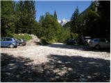
From Kranjska Gora, drive over Vršič Pass towards Bovec or vice versa, but only to the 49th hairpin bend of the Vršič road (near the village of Trenta). Here, turn onto the side road towards the source of the Soča River. The road quickly brings us, after a short ascent, to the parking lot in front of the hut at the source of the Soča, but we continue left over the bridge and follow the road further to the parking lot at the end of the road (at the parking lot we notice mountain signs for Bavški Grintavec, the waterfalls of Suhega potoka and Jalovec).
Route description:
From the parking lot, head right onto the hiking trail towards Jalovec and the shelter below Špička (the left trail leads to Bavški Grintavec). The trail, from which we get a nice view of the aforementioned Bavški Grintavec at the beginning, quickly enters dense forest, where it begins to ascend steeply. The steep trail, which runs almost entirely through the forest, brings us after about an hour and a half of walking to a junction, where we continue on the right trail towards Jalovec and Mali kot (left Shelter below Špička, Jalovec via Shelter and Škrbina pod Gradom). The trail, which continues through the forest, brings us higher to the next junction, where the trail from Vršič joins from the right. We continue straight uphill towards Jalovec (left Shelter below Špička, right Vršič) on a trail that ascends relatively steeply, first still through the forest, higher up on increasingly scenic slopes below Goličica, Lopa and Šite.
On this section we mostly ascend the southeast slopes, which become increasingly rocky higher up; when we reach about 1950 meters above sea level, an unmarked path branches off to the right towards Šite, but we continue on the marked trail, which turns slightly left and ascends a bit higher to the marked junction below Jalovška škrbina.
Here we go left towards Jalovec (straight Jalovška Škrbina and Tamar valley) and cross the slopes to the entrance to the Goličica wall.
Before entering the climbing section, put on your helmet; the sign informs us that we will continue the ascent on a very demanding trail.
The first part of the ascent on the Goličica wall is done in a slight traverse ascent to the left, then the trail turns right and begins to ascend the wall upwards. The trail becomes increasingly exposed further on, and safety gear is only present on the most difficult sections; otherwise, we have to do most of the ascent without protection (this part of the trail is especially dangerous for slipping on the descent).
Higher up, the steepness eases and we reach the scree slopes south of Goličica, along and on which we then ascend traverse to the left.
The increasingly scenic trail then brings us through Vratca v Ozebnik to a point from which we get a nice view into Jalovčev ozebnik and towards the Tamar valley; the trail through the ozebnik has been closed for several decades.
We continue on a less steep trail that brings us over Jalovsko sedlo to the junction at Jezerca, which we reach with a slight descent.
Continue left towards the Shelter below Špička (right Jalovec) on a trail that continues with a slight ascent on partly grassy slopes. After a few minutes of easy walking, the trail brings us to a point where we leave the marked trail leading towards the Shelter below Špička (we leave the marked trail just a few meters before the fixed cable and gully, which is exposed to falling rocks).
Continue right and continue the ascent through pathless terrain on the southern slopes of Veliki Ozebnik. Further, we ascend on the right side of the gully through very steep terrain, where there is a high risk of rockfall. After 20 minutes of easier climbing, which does not exceed UIAA grade I, we reach the summit of Veliki Ozebnik.
Orientation in the last section is difficult, and there is also a high risk of falling rocks.
Starting point - Planina Trenta 1:30, Planina Trenta - Rutarska Trenta 0:30, Rutarska Trenta - junction below Goličica 1:30, junction below Goličica - Jezerca 1:20, Jezerca - junction off marked trail 0:10, junction off marked trail - Veliki Ozebnik 0:20.

Along the route: Planina Trenta (1398m), Rutarska Trenta (1546m), Razpotje pod Goličico (2070m), Vratca v Ozebnik (2327m), Nad kuloarjem (2371m), Jalovško sedelce (2394m), Jezerca (2390m), Odcep z markirane poti (2380m)
Photos:
 1
1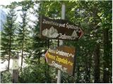 2
2 3
3 4
4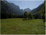 5
5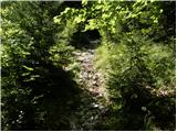 6
6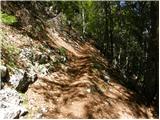 7
7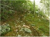 8
8 9
9 10
10 11
11 12
12 13
13 14
14 15
15 16
16 17
17 18
18 19
19 20
20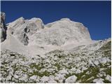 21
21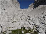 22
22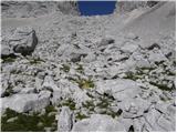 23
23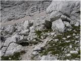 24
24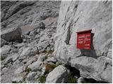 25
25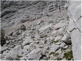 26
26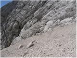 27
27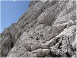 28
28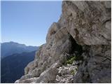 29
29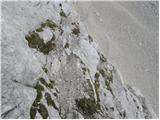 30
30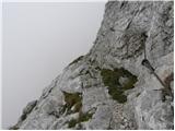 31
31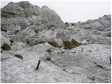 32
32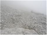 33
33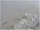 34
34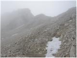 35
35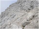 36
36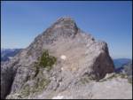 37
37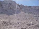 38
38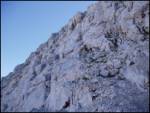 39
39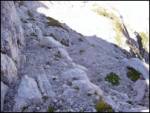 40
40 41
41
Discussion about the trip Zadnja Trenta (Flori) - Veliki Ozebnik (via Jalovška škrbina)
To post a comment you must log in:
If you do not yet have a username, you must first
register.