Zadnji travnik - Govca (Olševa)
Starting point: Zadnji travnik (1382 m)
| Latitude/Longitude: | 46,46010°N 14,69070°E |
| |
Walking time: 1 h 45 min
Difficulty: easy marked way
Elevation gain: 547 m
Elevation difference along the route: 560 m
Map: Kamniške in Savinjske Alpe 1:50.000
Recommended equipment (summer):
Recommended equipment (winter): ice axe, crampons
Views: 68.690
 | 1 person like this post |
Access to starting point:
A) We drive to Črna na Koroškem (to here from Ravne na Koroškem or from Šoštanj through the mountain pass Spodnje Sleme), and then we continue driving towards Koprivna. Further on, we ascend along the river Meža, ignoring all left and right turn-offs up to the sharp left turn. At the mentioned turn, we turn right in the direction of Olševa (still on the asphalt road Sveti Jakob) onto a macadam road, which gradually starts to ascend steeply. Further on, we ascend along the river Meža for some time, then a somewhat worse macadam road turns sharply left. A little higher follows a sharp right turn, after which the road ascends transversely to the right. When we are already quite high, a somewhat narrower road branches off to the right towards the nearby Govševa planina, but we continue straight ahead and follow the macadam road to a clearing, where we see the mountain signposts for Olševa and Planinski dom Kumer. We park in a suitable spot by the mountain signposts.
B) We drive to Luče (to here from Mozirje or from Kamnik over the mountain pass Volovljek (Kranjski Rak)), and then we continue driving towards Logarska dolina. In the village Solčava, we leave the main road towards Logarska dolina and continue driving to the right in the direction of Podolševa, the mountain pass Spodnje Sleme, and Črna na Koroškem. Further on, the road loses its asphalt surface, and after a few kilometres at the junction in Podolševa, we turn right towards Črna na Koroškem. The road, which further on mainly ascends transversely, brings us after some time to the mountain pass Spodnje Sleme. From the pass, the road starts descending, and we follow it in the direction of Črna na Koroškem. When, after a few kilometres, we descend into the valley, at the junction we turn left and then ascend along the river Meža. A little higher, a road branches off to the right towards Kumer, but we drive along the main road for approximately another 1 km, or to the sharp left turn. At the beginning of the turn, we notice signs for Olševa, which direct us to the right onto a macadam road. Further on, we ascend along the river Meža for some time, then a somewhat worse macadam road turns sharply left. A little higher follows a sharp right turn, after which the road ascends transversely to the right. When we are already quite high, a somewhat narrower road branches off to the right towards the nearby Govševa planina, but we continue straight ahead and follow the macadam road to a clearing, where we see the mountain signposts for Olševa and Planinski dom Kumer. We park in a suitable spot by the mountain signposts.
Route description:
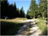
From the unregulated parking lot we continue left in the direction of Olševa on the path, which continues on a cart track and which goes into the forest after just a few metres. We walk on the cart track for about 3 minutes, then the blazes direct us slightly left onto a beaten footpath marked with arrows. A little higher, blazes reappear, and the path returns to the cart track. We continue the ascent on a gradually steeper cart track, which higher flattens somewhat and turns right. From the point where the cart track turns right, we follow it for only another 10 or so metres, then the blazes direct us left onto a steeper footpath again, which quickly brings us to the hunting bivouac Foršnerca.
From the hunting bivouac we continue straight ahead and then, after a few metres, left uphill. Further on, the path starts to ascend more steeply through a partly larch forest, which thins out higher up. After a few minutes' ascent, the path flattens and brings us to a small cirque. There follows a few minutes of moderate ascent, then the path becomes somewhat steeper again, leading us over increasingly panoramic shady slopes of Olševa. Higher up, the path turns left and ascends diagonally to a small gully, up which we climb over scree onto the ridge of Olševa.
We reach the ridge at a marked junction, where we continue right in the direction of Govca, the highest peak of the aforementioned ridge (left: the saddle Spodnje Sleme and Raduha). The path ahead continues along the left, mostly southern side of the ridge, crossing some steeper slopes and, at two points, exposed ones too (especially in wet conditions and snow, risk of slipping). Further on, the slope flattens somewhat, and the path ascends a little more steeply. With fine views towards the mountains above Logarska dolina, we soon reach a sort of side ridge, up which we climb in a few minutes to the main ridge of Olševa. Here the path turns left and, after another 10 or so steps, brings us to Govca.

Along the route: Lovski bivak Foršnerca (1550m)
Photos:
 1
1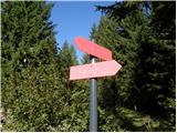 2
2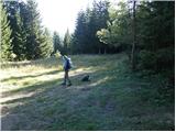 3
3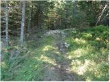 4
4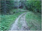 5
5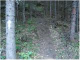 6
6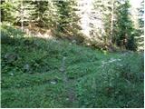 7
7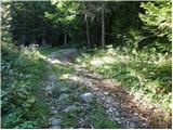 8
8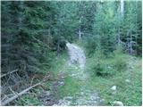 9
9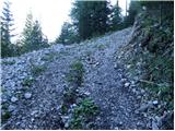 10
10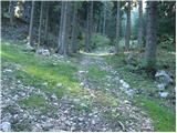 11
11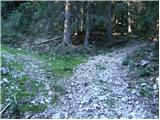 12
12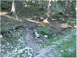 13
13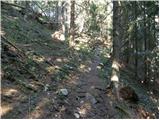 14
14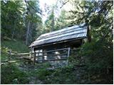 15
15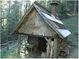 16
16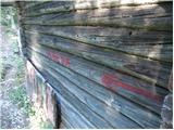 17
17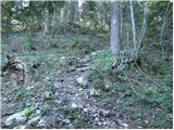 18
18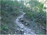 19
19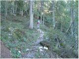 20
20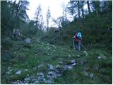 21
21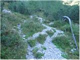 22
22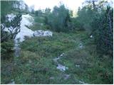 23
23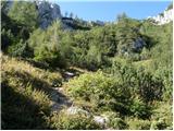 24
24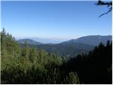 25
25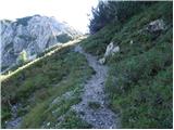 26
26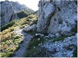 27
27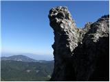 28
28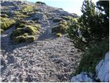 29
29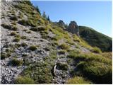 30
30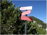 31
31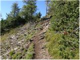 32
32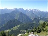 33
33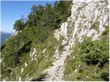 34
34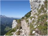 35
35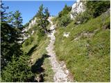 36
36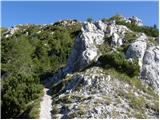 37
37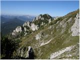 38
38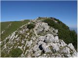 39
39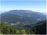 40
40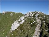 41
41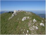 42
42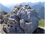 43
43 44
44
Discussion about the trip Zadnji travnik - Govca (Olševa)
|
| franjo6615. 05. 2014 |
What are the conditions like?
|
|
|
|
| Janezs15. 05. 2014 |
On this path there was still a lot of "old" snow a week ago, when the path "moves to the south side", it was bare. From the starting point to the hunters' bivouac there is a lot of fallen trees across the path. Of course, quite a bit of new snow has also fallen, which won't last long. Best regards.
|
|
|
|
| balon31. 05. 2014 |
Is the path suitable for 5 and 7 year olds?
Thanks for the answer.
Balončki
|
|
|
|
| franca31. 05. 2014 |
Hey, Balonček. You're asking about the path type, if suitable for a 5-year-old. Depends on the individual, same as for 20-year-olds, 30-year-olds, ..., and many 80-year-olds aren't to be written off either. You know your children best. Never hesitate to turn back or change the goal if it's a bit too strenuous or too long.
|
|
|
|
| balon1. 06. 2014 |
Hey, thanks franca and yes I know my kids best, turning back or changing goal is not defeat, but the start of a new victory.
|
|
|
|
| borutpovse1. 06. 2014 |
Probably those used to it wouldn't have problems. My 6-year-old can hardly wait to see how steep it is, the visit to Skuta didn't cause him any problems either. Good luck, cheers.
|
|
|
|
| balon2. 06. 2014 |
Thanks and safe steps in our mountains.
Balončki
|
|
|
|
| Marko8313. 07. 2014 |
Based on the description, I have no idea where to get to the starting point, although I drove nearby yesterday because I went to Raduha. From which side do you go here? South or north?
|
|
|
|
| Domch13. 07. 2014 |
You drive further along the road towards Luže to the end of Koprivna, then at the intersection where there are signs for Olševa and the Meža spring left, then stick to the main road to the top and reach Zadnji travnik, then just follow the markers to the ridge and to Govca, it's the least frequented path to Olševa, but it's now officially closed due to fallen trees on the path, but you can get through with a little climbing between the branches if scratches don't bother you, pictures from the path are under Current conditions - Olševa.
|
|
|
|
| Marko8315. 07. 2014 |
Maybe somewhere at these coordinates?
46.443351, 14.675164
Enter it in Google Maps.
I usually go from the direction of Črne gor.
Thanks
|
|
|
|
| VesnaJager22. 11. 2014 |
Hi, does anyone know what the current snow conditions on Govca are? Thanks.
|
|
|
|
| balon9. 06. 2016 |
Is the road to the starting point suitable for a minivan?
Thx,
|
|
|
|
| xxxyx9. 06. 2016 |
The road is quite suitable so no panic, it's really not some highway, the worst is the first climb from the Pečnik farm but nothing serious.
|
|
|
|
| mathei11. 06. 2018 |
To refresh the comments on the above described trip a bit. The trail description matches more or less, only I'd add that the trail isn't exactly easy as you're ascending all the time. Our 4.5-year-old managed it without much effort though, but he has quite a few hikes under his belt and is used to it. Access to the starting point is quite clearly marked, but the road is forested and potholed in places.
You need to bring a stamp pad though, as otherwise you can't get the stamp in the booklet.
|
|
|
|
| NinaH29. 12. 2018 |
The road to Spodnji travnik is currently impassable due to trees on the road and rocks on the roadway, so the car must be left either at the junction where the road turns right (by the Olševa sign, right is a farm) or choose another route.
|
|
|
|
| barbarahribovka31. 03. 2019 |
Today the road to Olševa a little further from the end of the nettle section was not passable by passenger car
|
|
|
|
| glorija29. 06. 2019 |
Hello.. can someone tell me how accessible the road to Dom Kumer is by car, so I can start from Zadnji travnik, there are fallen trees...?
|
|
|
|
| balon20. 07. 2022 14:02:38 |
Hello,
I'm wondering if the trail is suitable for a dog (40 kg).
Thank you for your answer.
|
|
|
|
| balon11. 09. 2023 10:30:17 |
Thanks for the reply, milesdavis.
|
|
|
|
| balon20. 09. 2023 14:19:18 |
How is access from Solčava direction after floods? Road passable for passenger car?
Thanks for the answers.
|
|
|
To post a comment you must log in:
If you do not yet have a username, you must first
register.