Zadnji travnik - Obel kamen (Olševa)
Starting point: Zadnji travnik (1382 m)
| Latitude/Longitude: | 46,46010°N 14,69070°E |
| |
Walking time: 2 h 15 min
Difficulty: easy marked way
Elevation gain: 529 m
Elevation difference along the route: 590 m
Map: Kamniške in Savinjske Alpe 1:50.000
Recommended equipment (summer):
Recommended equipment (winter): ice axe, crampons
Views: 2.950
 | 1 person like this post |
Access to starting point:
A) We drive to Črna na Koroškem (to here from Ravne na Koroškem or from Šoštanj through the mountain pass Spodnje Sleme), and then we continue driving towards Koprivna. Further on, we ascend along the river Meža, and up to the sharp left turn we "ignore" all left and right turn-offs. At the mentioned turn, we turn right in the direction of Olševa (still on the asphalt road Sveti Jakob) onto a macadam road, which gradually starts to ascend steeply. Further on, we ascend along the river Meža for some time, after that the somewhat worse macadam road turns sharply left. A little higher follows a sharp right turn, after that the road ascends diagonally towards the right. When we are already quite high, a somewhat narrower road branches off to the right towards the nearby Govševa planina, and we continue straight and follow the macadam road to a clearing, where we see the mountain signposts for Olševa and Planinski dom Kumer. We park at an appropriate place by the mountain signposts.
B) We drive to Luče (to here from Mozirje or from Kamnik over the mountain pass Volovljek (Kranjski Rak)), and then we continue driving towards Logarska dolina. In the village Solčava, we leave the main road towards Logarska dolina and continue driving right in the direction of Podolševa, mountain pass Spodnje Sleme and Črna na Koroškem. Further on, the road loses the asphalt surface, and after a few kilometres at the junction in Podolševa we turn right towards Črna na Koroškem. The road, which further on mostly ascends diagonally, brings us after some time to the mountain pass Spodnje Sleme. From the pass, the road starts descending, and we follow it in the direction of Črna na Koroškem. When after a few kilometres we descend into the valley, at the junction we turn left and then ascend along the river Meža. A little higher, a road branches off to the right towards Kumer, and we drive on the main road for approximately 1 km, or to the sharp left turn. At the beginning of the turn, we notice signs for Olševa, which direct us right onto the macadam road. Further on, we ascend along the river Meža for some time, after that the somewhat worse macadam road turns sharply left. A little higher follows a sharp right turn, after that the road ascends diagonally towards the right. When we are already quite high, a somewhat narrower road branches off to the right towards the nearby Govševa planina, and we continue straight and follow the macadam road to a clearing, where we see the mountain signposts for Olševa and Planinski dom Kumer. We park at an appropriate place by the mountain signposts.
Route description:
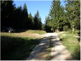
From the unregulated parking lot we continue left in the direction of Olševa on the path which continues on a cart track and which after a few metres goes into the forest. We walk for about 3 minutes on the cart track, then the blazes direct us slightly left onto a beaten footpath marked with arrows. A little higher the blazes reappear, and the path returns to the cart track. We continue the ascent on a gradually steeper cart track, which higher flattens somewhat and turns right. From the point where the cart track turns right, we follow it for only some 10 metres, then the blazes direct us left onto a steeper footpath again, which quickly brings us to the hunting bivouac Foršnerca.
From the hunting bivouac we continue straight and then after a few metres left uphill. Further on, the path starts ascending more steeply through a partly larch forest, which thins out higher up. After a few minutes of ascent, the path flattens and brings us to a smaller cirque. There follows a few minutes of moderate ascent, then the path becomes somewhat steeper again, leading us over increasingly panoramic shady slopes of Olševa. Higher up, the path turns left and ascends diagonally to a smaller gully, through which we climb over scree to the ridge of Olševa.
We reach the ridge at a marked junction, where we continue right in the direction of Govca, the highest peak of the aforementioned ridge (left saddle Spodnje Sleme and Raduha). The path ahead continues along the left, mostly southern side of the ridge, crossing some steeper slopes and at two places also exposed ones (especially in wet conditions and snow there is a risk of slipping). Further on, the slope flattens somewhat, and the path ascends more steeply. With fine views towards the mountains above Logarska dolina we quickly reach a kind of side ridge, along which we climb in a few minutes to the main ridge of Olševa. Here the path turns left and after some 10 steps of further walking brings us to Govca.
From Govca we start descending along the panoramic ridge, then the path turns left downhill from the ridge and quickly brings us to a marked junction. We continue right in the direction towards Obel kamen (straight downhill Potočka zijalka and Podolševa), where first we cross the slopes towards the left, then we start ascending steeply. The last part of the ascent before reaching the ridge is technically more demanding and unprotected. Above the short demanding section we reach a panoramic ridge, along and beside which we continue all the way to Obel kamen, which we recognise by the border stone No. XXII 1.
From the summit we can continue to the cross about 10 minutes away, where there is also the stamping box.
Zadnji travnik - Govca 1:45, Govca - Obel kamen 0:30.

Photos:
 1
1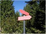 2
2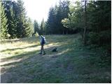 3
3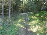 4
4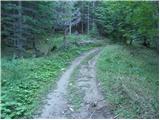 5
5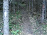 6
6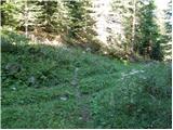 7
7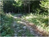 8
8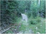 9
9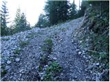 10
10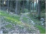 11
11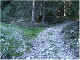 12
12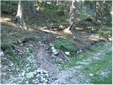 13
13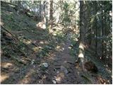 14
14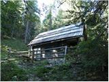 15
15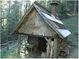 16
16 17
17 18
18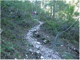 19
19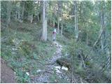 20
20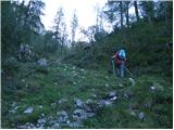 21
21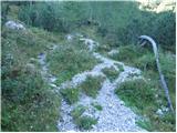 22
22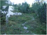 23
23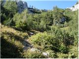 24
24 25
25 26
26 27
27 28
28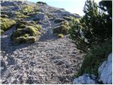 29
29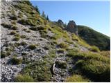 30
30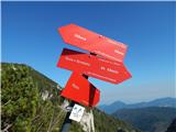 31
31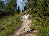 32
32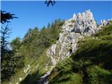 33
33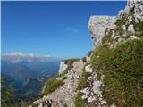 34
34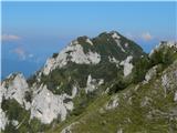 35
35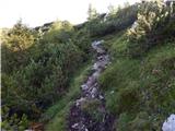 36
36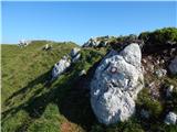 37
37 38
38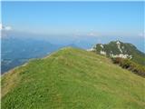 39
39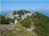 40
40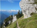 41
41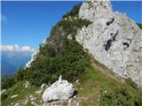 42
42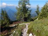 43
43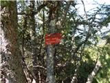 44
44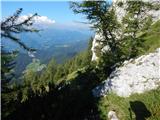 45
45 46
46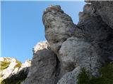 47
47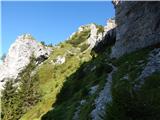 48
48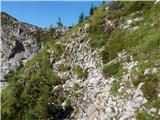 49
49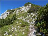 50
50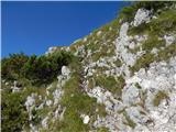 51
51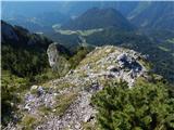 52
52 53
53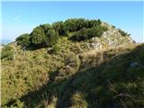 54
54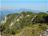 55
55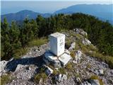 56
56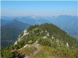 57
57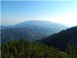 58
58 59
59
Discussion about the trip Zadnji travnik - Obel kamen (Olševa)
|
| branco13. 07. 2024 21:00:43 |
Wonderful path, wonderful Olševa
|
|
|
To post a comment you must log in:
If you do not yet have a username, you must first
register.