Zadnjica - Kanjavec (via Prehodavci)
Starting point: Zadnjica (642 m)
| Latitude/Longitude: | 46,38240°N 13,76040°E |
| |
Route name: via Prehodavci
Walking time: 6 h 15 min
Difficulty: easy marked way
Elevation gain: 1927 m
Elevation difference along the route: 1990 m
Map: Triglav 1 : 25.000
Recommended equipment (summer):
Recommended equipment (winter): ice axe, crampons
Views: 68.867
 | 2 people like this post |
Access to starting point:
From Kranjska Gora, drive over Vršič Pass towards Bovec or vice versa, but only to the 50th hairpin bend of the Vršič or Russian Road (near the village of Trenta). Here we turn onto the side road, along which after a few hundred metres we park at the parking area by the road.
Route description:
From the parking area, continue along the road, which takes us past a few houses (mostly holiday cottages) in about 15 minutes to the point where the road forks into two parts (there used to be a parking area at the junction, but parking is now prohibited).
Continue along the lower right road (the upper road leads to the cable car to Pogačnikov dom) in the direction of Dolič, Luknja and Prehodavci. First follow the gentle road that leads across scenic meadows, higher up through the forest, almost to its end, or more precisely to the marked junction where a marked footpath branches off to the right towards Prehodavci (about 1 hour to here).
From the junction in the area called Utro, continue right (straight to Luknja, Triglav and Dolič), first crossing partly overgrown scree slopes and a few torrents. After a few minutes of traversing with some short ascents and descents, we reach the start of Zadnjiški dol. Here the path begins to ascend moderately along the right side of the valley. Higher up, the path turns a bit more to the right, briefly taking us into the forest, then returning to a rockier terrain. The path continues to a spring, next to which there is a small bench where we can rest. Continuing, the path ascends moderately to steeply for a while and gradually leads onto the scree slopes below Zadnjiški Ozeznik. With a view of the nearby walls of surrounding peaks, we then ascend to the saddle Čez Dol, where the path levels out and forks into two parts.
At this junction, continue left towards Zasavska koča na Prehodavcih (straight to Trenta) and ascend along the path that continues over a fairly steep and partly exposed slope. Follow this somewhat narrower path to the nearby junction where we join the mule track from Trenta.
(If the short somewhat exposed section seems too dangerous, we can reach this junction via a slightly longer path. In this case, at the previous junction continue straight towards Trenta and then a bit further left towards Prehodavci).
At this junction, continue straight and ascend along the wide mule track that crosses steep and precipitous slopes. During the ascent over the precipitous slope, we will notice a small "chapel" (statue of Mary with Jesus) on the left side.
Continuing, the slope along which the path runs becomes less steep and more scenic. Higher up, the well-preserved mule track leads over an even less steep slope of Zelena griva, above which the slope becomes steeper again. A few short steep sections follow, then the path and the slope level out. A little above an indistinct ridge, we reach a marked junction, where we continue left (right to Lepo or Veliko špičje - Stanko Kos path, straight to Koča pri Triglavskih jezerih) towards the nearby Zasavska koča na Prehodavcih. The path continues along a wide and scenic ridge, which takes us past the winter bivouac in a few minutes to Zasavska koča na Prehodavcih.
From Zasavska koča, return to the nearby winter bivouac, from there head southeast onto the path towards Hribarice, Kanjavec, Koča na Doliču and Triglav and begin descending towards Rjavo jezero, which we reach in about ten minutes of descent.
At Rjavo jezero (also known as Rjava mlaka), the path forks again, and we choose the path towards Hribarice (the right path descends along the Dolina Triglavskih jezer).
The path continues over scree slopes below Poprovec and ascends laterally to the right, higher up joining the path that passes by Zeleno jezero, or the path from Koča pri Triglavskih jezerih.
A short steep section follows, then we ascend laterally to the right to a junction, where the path from the Vrata pass joins us, or the path along the Zelnarice ridge or Za Kopico valley.
Continue straight towards Hribarice, a few minutes higher at the edge of the Hribarice plateau the path levels out, and the Hribarice saddle is a bit further ahead.
At the point where the path levels out, we also reach a somewhat less noticeable junction, where we leave the path towards Koča na Doliču and Triglav and continue slightly left towards Kanjavec.
The path leads into a small and relatively steep valley between the two peaks of Kanjavec. The increasingly scenic path continuing along this valley levels out higher up and takes us to the saddle between the western and eastern peak of Kanjavec.
Here continue right (left to the western peak along an unmarked path) and in a few minutes ascend to the scenic and precipitous summit.
Start - Na placu 0:15, Na placu - Utro 1:00, Utro - Čez Dol 1:45, Čez Dol - Plate 1:10, Plate - Zasavska koča 0:05, Zasavska koča - Rjavo jezero 0:10, Rjavo jezero - Hribarice 0:50, Hribarice - Kanjavec 1:00.

Photos:
 1
1 2
2 3
3 4
4 5
5 6
6 7
7 8
8 9
9 10
10 11
11 12
12 13
13 14
14 15
15 16
16 17
17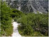 18
18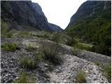 19
19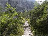 20
20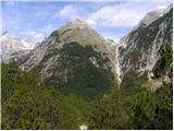 21
21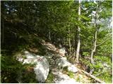 22
22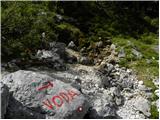 23
23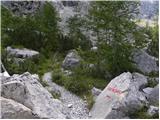 24
24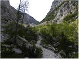 25
25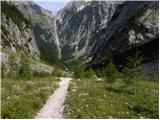 26
26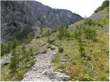 27
27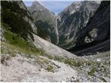 28
28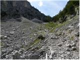 29
29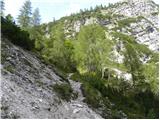 30
30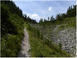 31
31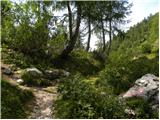 32
32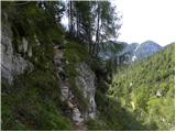 33
33 34
34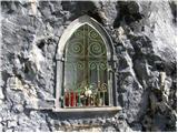 35
35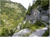 36
36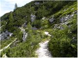 37
37 38
38 39
39 40
40 41
41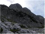 42
42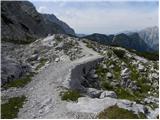 43
43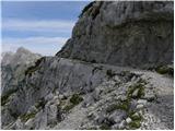 44
44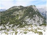 45
45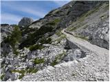 46
46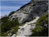 47
47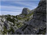 48
48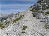 49
49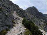 50
50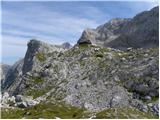 51
51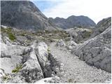 52
52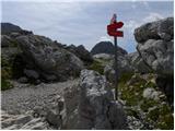 53
53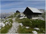 54
54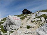 55
55 56
56 57
57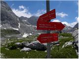 58
58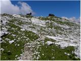 59
59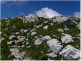 60
60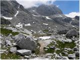 61
61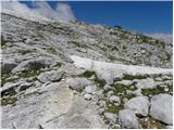 62
62 63
63 64
64 65
65 66
66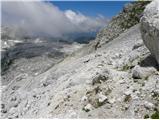 67
67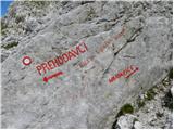 68
68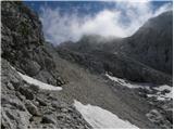 69
69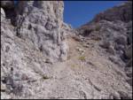 70
70 71
71 72
72 73
73 74
74 75
75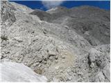 76
76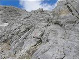 77
77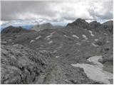 78
78 79
79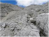 80
80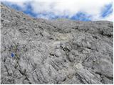 81
81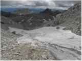 82
82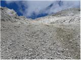 83
83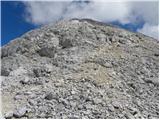 84
84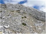 85
85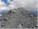 86
86 87
87
Discussion about the trip Zadnjica - Kanjavec (via Prehodavci)
|
| Gost6. 11. 2006 |
Wonderful trip, especially to Prehodavci. Further on it drags a bit, but it's quite okay especially when from the top you look at the little brother of Triglav and Škrlatica.
|
|
|
|
| grahlck27. 06. 2009 |
Is there any snow on this trail?
|
|
|
|
| triglavski28. 06. 2009 |
Check under forum - conditions, Julian Alps - title Kanjavec.
|
|
|
|
| Bizy1. 08. 2009 |
Here on the small map the path is incorrect, it shows through Trebški dol - this is not correct according to the described path and pictures.
The same remark applies to Zasavska koča at Prehodavci from Zadnjica.
|
|
|
|
| gorski_moz11. 11. 2009 |
Can someone please explain to me.
I registered and everything, and put it under the mountain description, and uploaded photos to the description, I have tons (Kanjavec), now I'm wondering how others can access these photos to view them, e.g. like you have, I don't know where to go without registering.
Please tell me
lp
|
|
|
|
| Kriška11. 11. 2009 |
For starters, it would help if you wrote your question (questions?) in Slovenian, so that we all understand what you're actually interested in?
|
|
|
|
| geppo11. 11. 2009 |
There are two or three really good pics somewhere there, they could even be for Facebook!!
Best regards
|
|
|
|
| FRSA18. 08. 2011 |
Does anyone perhaps know how long it takes to hike from Kanjavec to Prehodavci via Hribarice pass (from the Dolič direction)?
Thanks and best regards
|
|
|
|
| mukica18. 08. 2011 |
Approximately 1 to 2 hours. From the top of Kanjavec to the hut, depending on how fast your step is
|
|
|
|
| IgorZlodej19. 08. 2011 |
1 hour, skipping Hribarice and keeping to the right.
|
|
|
|
| metod19. 09. 2011 |
More than the summit itself, the view of Kanjavec walls from (Vodnikov) Vršac thrilled me, so I'm already looking forward to a new outing. Just let the weather hold for a few more days.
|
|
|
|
| MrvdMr-8225. 01. 2012 |
Hi, I'm interested in the conditions for Kanjavec, how is the path, has anyone been to the summit recently?
|
|
|
|
| sla25. 01. 2012 |
You have the link on the Turni klub Gora forum.
|
|
|
|
| osa1. 07. 2015 |
I plan the route from Zadnjica over Prehodavci to Kanjavec, descent to Dolič and back to Zadnjica via the mule track. Wondering if the trail is completely snow-free as I have no winter gear.
|
|
|
|
| lakkon30. 07. 2017 |
Hello mountain lovers!
tomorrow the circular Zadnjica - hut Prehodavci - Kanjavec - hut Dolič - Zadnjica ''falls''
is it perhaps highly advisable to also arrive at the parking lot in Zadnjica as early as possible on Monday? in case of full parking, can you park closer without problems or is it not even allowed?
oh, is there currently any peculiarity on the mentioned path that might make the tour more difficult and is not noted in the description?
thanks for the help.
|
|
|
|
| redbull30. 07. 2017 |
No snow anymore, so winter gear is not needed
|
|
|
|
| turbo30. 07. 2017 |
Park at Na Logu next to the TNP center and go to Prehodavce via Trebiški Dol, descend through Zadnjica back to the village.
|
|
|
|
| Grenaleva10. 09. 2019 |
Has anyone done a loop via Dolič up and Prehodavce down? Are the markers good? Thanks
|
|
|
|
| bo_zl10. 09. 2019 |
Grenaleva: last year I walked the path from Zadnjica to Dolič, from there to Kanjavec and to Zasavska koča na Prehodavcih and from there to Zadnjica. All super marked and signposted. No way to miss it.
|
|
|
|
| bo_zl10. 09. 2019 |
Correction, I read my comment under the Kanjavec trip via Dolič and Prehodavce, and yes now I remember from Kanjavec to the place where on Hribarice the path joins the one from Dolič to Prehodavce it was poorly marked and quite some orientation issues, maybe they've repainted the marks this year. How quickly one forgets.
|
|
|
|
| Grenaleva11. 09. 2019 |
Thank you very much for the reply. How long did the loop take?
|
|
|
|
| bo_zl12. 09. 2019 |
Unfortunately I don't have it noted. Only that I wrote it was a long path.... I think you have to count about 12 hours including breaks.
|
|
|
|
| Grenaleva18. 09. 2019 |
On Saturday I did the tour and it's well marked, except from the junction to the hut at Triglav Lakes to Prehodavci the marks get lost among rocks. If nice weather Prehodavci are visible anyway, if fog better descend to the lower path. Definitely better up via Dolič. If good fitness with all stops it's faster too. Otherwise excellent circular tour
|
|
|
|
| Jernej96828. 04. 2021 13:56:13 |
On Saturday, my colleague and I did the described route. Shortly after the junction where we leave the mulatjera at Dolič, we encountered an avalanche deposit and fallen trees on the overgrown scree, which significantly hinder access to the start of Zadnjiški Dol. These obstacles must be expected also in this summer season. From there on, we walked only on snow. Zadnjiški Dol is covered with numerous avalanche deposits, which makes the ascent through the valley a bit more difficult. On the slope of Zeleni grivi we plunged a bit more to the right (aimed above the usual mulatjera, which levels out here and then again directs right into the steep slope). Thus we reached the ridge quite a bit more to the right than the mulatjera does. Due to the influx of ski tourers, we bivouacked the night outside under the shelter of our largest winter bivouac. The next morning in pleasant company of ski tourers over Hribarice to Kanjavec and back to Zadnjica along the same path. Demanding but unforgettable tour.
|
|
|
|
| Hribolazec8112. 08. 2025 11:30:35 |
Does anyone know about sleeping in the winter bivouac, the hut unfortunately has only one night free for sleeping, the hut at Tr. lakes has not even one night free, I would hike there Kanjavec, Tičarice, Zelnarice, Špičje, Triglav Lakes, so I had 4 days planned 
|
|
|
|
| sh12. 08. 2025 14:16:32 |
The bivouac is managed by the hut in summer and you can't just sleep there.
|
|
|
To post a comment you must log in:
If you do not yet have a username, you must first
register.