Zadnjica - Kanjavec (West peak) (via Prehodavci)
Starting point: Zadnjica (642 m)
| Latitude/Longitude: | 46,38240°N 13,76040°E |
| |
Route name: via Prehodavci
Walking time: 6 h 15 min
Difficulty: easy marked way, easy unmarked way
Elevation gain: 1927 m
Elevation difference along the route: 1990 m
Map: Triglav 1:25.000
Recommended equipment (summer):
Recommended equipment (winter): ice axe, crampons
Views: 10.714
 | 2 people like this post |
Access to starting point:
From Kranjska Gora, drive over Vršič Pass towards Bovec or vice versa, but only to the 50th hairpin turn of the Vršič or Russian road (near the village of Trenta). Here, turn onto the side road, along which after a few hundred meters we park at the parking lot by the road.
Route description:
From the parking lot, continue along the road, which takes us past a few houses (mostly holiday homes) in about 15 minutes to the point where the road splits into two parts (there used to be a parking lot at the junction, but parking is now prohibited).
Continue along the lower right road (the upper road leads to the cable car to Pogačnikov dom) towards Dolič, Luknja and Prehodavci. First follow the gentle road leading across scenic meadows, higher through the forest, almost to its end, or more precisely to the marked junction where a marked hiking trail branches right towards Prehodavci (about 1 hour to here).
From the junction in the area called Utro, continue right (straight to Luknja, Triglav and Dolič), first crossing partly overgrown scree and a few torrents. After a few minutes of traversing with some short ascents and descents, reach the start of Zadnjiški dol. Here the path begins to ascend moderately on the right side of the valley. Higher, the path turns further right, briefly taking us into the forest, then back to rockier terrain. The path leads to a spring with a small bench for resting. Continuing, the path ascends moderately to steeply, gradually transitioning to scree under Zadnjiški Ozebník. With views of nearby walls of surrounding peaks, ascend to the saddle Čez Dol, where the path levels and splits.
At this junction, continue left towards Zasavska koča na Prehodavcih (straight to Trenta) and ascend a path over a fairly steep and partly exposed slope. Follow this narrower path to the nearby junction joining the mule track from Trenta.
(If the short exposed part seems too dangerous, reach this junction via a slightly longer path: at the previous junction go straight to Trenta then slightly left to Prehodavci).
At the junction continue straight, ascending the wide mule track crossing steep precipitous slopes. During the ascent, notice a small "chapel" (statue of Mary with Jesus) on the left.
Further, the slope becomes less steep and more scenic. Higher, the well-preserved mule track leads over the slightly less steep slope of Zeleni grivi, above which it steepens again. Follow some short steep sections, then the path and slope level. Slightly above an indistinct break, reach a marked junction: left (right to Lepo or Veliko špičje - Stanko Kos path, straight to Koča pri Triglavskih jezerih) to nearby Zasavska koča na Prehodavcih. The path follows a wide scenic ridge past the winter bivouac in minutes to Zasavska koča na Prehodavcih.
From Zasavska koča return to the nearby winter bivouac, then head southeast on the path to Hribarice, Kanjavec, Koča na Doliču and Triglav, descending to Rjavo jezero in about 10 minutes.
At Rjavo jezero (also Rjava mlaka), the path splits again; choose towards Hribarice (right path descends Dolina Triglavskih jezer).
The path goes over scree under Poprovca, ascending transversely right, higher joining the path past Zeleno jezero or from Koča pri Triglavskih jezerih.
A short steep part follows, then transverse ascent right to junction where path from Vrata pass or Zelnarice ridge or Za Kopico valley joins.
Continue straight to Hribarice; a few minutes higher at the Hribarice plateau edge, the path levels, Hribarice saddle further on.
Where the path levels, reach a less obvious junction: leave path to Koča na Doliču and Triglav, continue slightly left to Kanjavec.
The path enters a small relatively steep valley between Kanjavec peaks. The scenic path levels higher, reaching the saddle between west and east Kanjavec peaks.
At the saddle leave marked path to main east peak, go left for short ascent to west Kanjavec peak.
Starting point - Na placu 0:15, Na placu - Utro 1:00, Utro - Čez Dol 1:45, Čez Dol - Plate 1:10, Plate - Zasavska koča 0:05, Zasavska koča - Rjavo jezero 0:10, Rjavo jezero - Hribarice 0:50, Hribarice - zahodni vrh Kanjavca 1:00.

Photos:
 1
1 2
2 3
3 4
4 5
5 6
6 7
7 8
8 9
9 10
10 11
11 12
12 13
13 14
14 15
15 16
16 17
17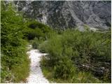 18
18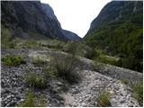 19
19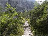 20
20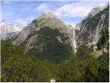 21
21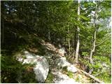 22
22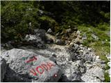 23
23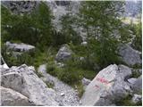 24
24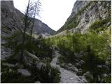 25
25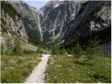 26
26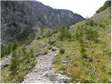 27
27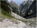 28
28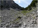 29
29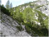 30
30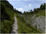 31
31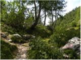 32
32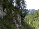 33
33 34
34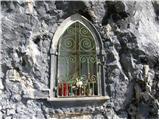 35
35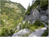 36
36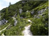 37
37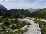 38
38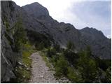 39
39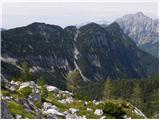 40
40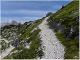 41
41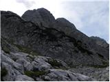 42
42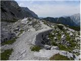 43
43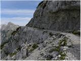 44
44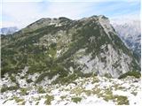 45
45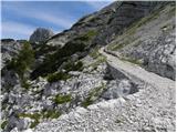 46
46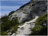 47
47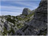 48
48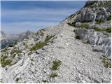 49
49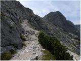 50
50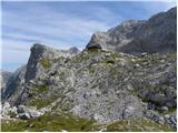 51
51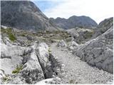 52
52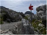 53
53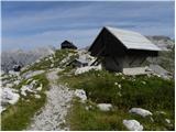 54
54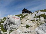 55
55 56
56 57
57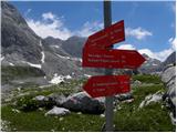 58
58 59
59 60
60 61
61 62
62 63
63 64
64 65
65 66
66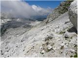 67
67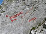 68
68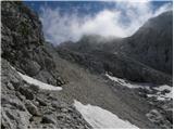 69
69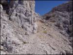 70
70 71
71 72
72 73
73 74
74 75
75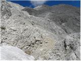 76
76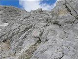 77
77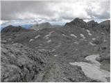 78
78 79
79 80
80 81
81 82
82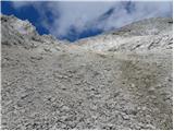 83
83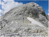 84
84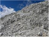 85
85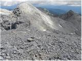 86
86 87
87 88
88 89
89
Discussion about the trip Zadnjica - Kanjavec (West peak) (via Prehodavci)
To post a comment you must log in:
If you do not yet have a username, you must first
register.