Zadnjica - Mišelj vrh (via Dolič)
Starting point: Zadnjica (642 m)
| Latitude/Longitude: | 46,38240°N 13,76040°E |
| |
Route name: via Dolič
Walking time: 7 h 15 min
Difficulty: difficult pathless terrain
Elevation gain: 1708 m
Elevation difference along the route: 1825 m
Map: Triglav 1 : 25.000
Recommended equipment (summer): helmet
Recommended equipment (winter): helmet, ice axe, crampons
Views: 27.452
 | 4 people like this post |
Access to starting point:
From Kranjska Gora, drive over Vršič Pass towards Bovec or vice versa, but only to the 50th hairpin turn of the Vršiška or Russian road (near the village of Trenta). Here, turn onto the side road, along which we park after a few hundred meters at the parking lot by the road.
Route description:
From the paid parking lot in the Zadnjica valley, continue along the marked path, initially along the road in the direction of Pogačnikov dom na Kriških podih, Razor, Stenar, Križ, Bovški Gamsovec, Luknja, Triglav, Koča na Doliču and Kanjavec. The path first leads past a few houses or weekend cottages and after about 15 minutes of walking brings us to a marked junction, where there used to be a free parking lot, but parking is now prohibited here.
Continue along the slightly right lower road in the direction of Zasavska koča na Prehodavcih, Koča na Doliču, Luknja and other nearby destinations (left Pogačnikov dom na Kriških podih and other destinations above Kriških podih and the lower station of the cargo cable car to Kriških podih), where the gentle road continues across scenic meadows, higher through the forest. Just before the end of the forest road at the Planja junction or before the headwall of the valley in the area called Utro, a marked path branches off to the right towards Prehodavci.
Continue straight along the road, which soon turns into a footpath or old military mule track, along which we mostly ascend moderately on gradually steeper slopes. Still in the forest, a climbing path branches off to the right via Komar, but we continue along the mule track, which ascends in numerous serpentine turns, and due to the steep slopes above, parts of the path are exposed to falling rocks.
The fairly scenic path brings us at about 1500 meters above sea level to the next junction, where the path to Koča na Doliču branches off to the right, and straight ahead the path continues towards Luknja, Pogačnikov dom na Kriških podih and Triglav via Plemenice.
Continue right towards Koča na Doliču and continue ascending along the mule track (there is also a mule track towards Luknja).
In the continuation, we mostly ascend moderately along the mule track, which leads across steep and occasionally exposed precipitous slopes. Since the path is wide and well laid out, it is not technically demanding, but exposed to falling rocks and due to occasional deep vistas mostly unsuitable for people prone to vertigo. The path occasionally makes a few serpentine turns, but mostly ascends traversely to the right, gradually approaching the mighty wall of Kanjavec.
Higher up, the climbing path from Zadnjica via Komar joins from the right, a little further the Mira Marko Debelakova path (path via Kanjavec ledges) branches off to the right. The increasingly scenic path higher up makes a few more serpentine turns, from it a path towards Triglav branches off to the left.
Continue straight, then quickly arrive at Koča na Doliču.
From the hut, head to the path in the direction of Vodnikov dom na Velem polju, Hribarice and Dom Planika pod Triglavom and in about ten minutes of easy ascent arrive at the Dolič saddle, where there is a marked junction.
Head slightly right following the signs for Triglav Lakes (left Dom Planika pod Triglavom, straight Vodnikov dom na Velem polju) onto the path that begins gently, then more steeply ascending towards Hribarice. Follow the marked path towards Hribarice to the point where it brings us below the walls of Mišeljski konec. The marked path to Hribarice turns right here, but we head left onto an unmarked but initially well-trodden path. Further on, the increasingly faint trail soon turns right and begins to ascend quite steeply over scree towards a small saddle between Mišeljska glava (2273 m) on the left and Mišeljski konec (2464 m) on the right.
From the saddle, descend about ten meters to the other side and then turn left, crossing the slope below Mišeljska glava in a slight descent. Followed by a short somewhat more difficult ascent over a steep and slightly crumbly slope. Then continue holding the right (southern) side of the ridge, which in short ascents and descents brings us to the grassy summit of Na Nizkem (2295 m).
From the summit of Na Nizkem, descend slightly and then a steep ascent follows along a slightly exposed ridge towards the summit of Mišelj vrh.
Starting point - Na placu 0:15, Na placu - Utro 1:00, Utro - fork for Komar 0:15, fork for Komar - Pod Skokom 1:10, Pod Skokom - Pod steno 1:25, Pod steno - Koča na Doliču 1:00, Koča na Doliču - Dolič 0:10, Dolič - ridge of Mišeljski konec 0:40, ridge of Mišeljski konec - Na Nizkem 1:00, Na Nizkem - Mišelj vrh 0:20.

Along the route: Na placu (714m), Utro (984m), Odcep za Komar (1058m), Pod Skokom (1494m), Pod steno (1899m),
Koča na Doliču (2151m), Dolič (2166m), Greben Mišeljskega konca (2334m),
Na Nizkem (2275m)
Photos:
 1
1 2
2 3
3 4
4 5
5 6
6 7
7 8
8 9
9 10
10 11
11 12
12 13
13 14
14 15
15 16
16 17
17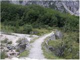 18
18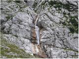 19
19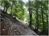 20
20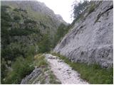 21
21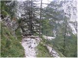 22
22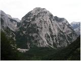 23
23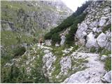 24
24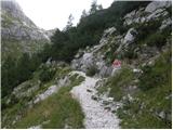 25
25 26
26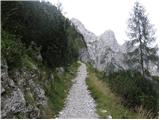 27
27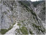 28
28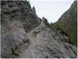 29
29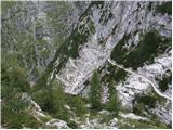 30
30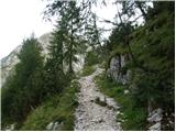 31
31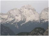 32
32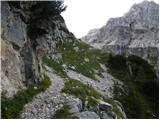 33
33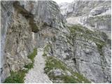 34
34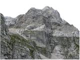 35
35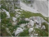 36
36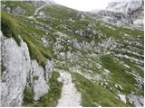 37
37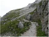 38
38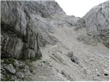 39
39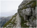 40
40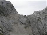 41
41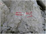 42
42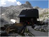 43
43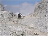 44
44 45
45 46
46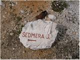 47
47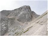 48
48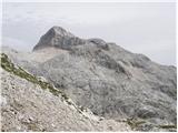 49
49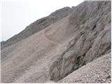 50
50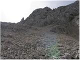 51
51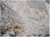 52
52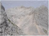 53
53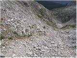 54
54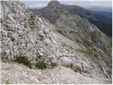 55
55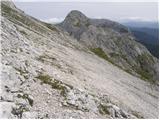 56
56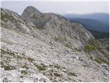 57
57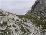 58
58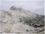 59
59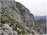 60
60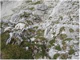 61
61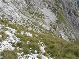 62
62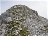 63
63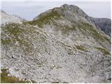 64
64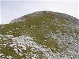 65
65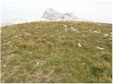 66
66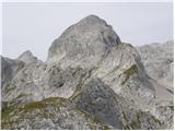 67
67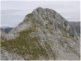 68
68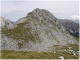 69
69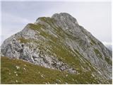 70
70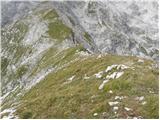 71
71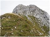 72
72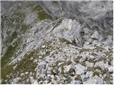 73
73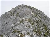 74
74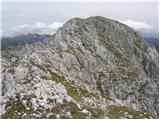 75
75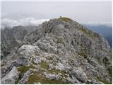 76
76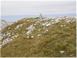 77
77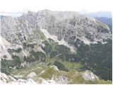 78
78
Discussion about the trip Zadnjica - Mišelj vrh (via Dolič)
|
| di30. 08. 2016 |
Summit (unfortunately) has no stamp.
|
|
|
|
| Pi_is_exactly_330. 08. 2016 |
The summit has a stamp, because Mišelj vrh is part of Bohinjske planinske poti (its pathless or climbing section). The stamp should be attached to one smaller stone within a few meters radius around the summit. 
|
|
|
|
| simon7931. 08. 2016 |
There is a stamp, but not at the same place as the box. It is attached to one stone, around or next to it a cairn is built - probably so that the stamp can be found more easily, but some might not look for the stamp there precisely because of the built cairn ... 
|
|
|
To post a comment you must log in:
If you do not yet have a username, you must first
register.