Zadnjica - Pihavec (via Luknja)
Starting point: Zadnjica (642 m)
| Latitude/Longitude: | 46,38240°N 13,76040°E |
| |
Route name: via Luknja
Walking time: 5 h 15 min
Difficulty: difficult pathless terrain
Elevation gain: 1777 m
Elevation difference along the route: 1780 m
Map: TNP 1:50.000
Recommended equipment (summer): helmet
Recommended equipment (winter): helmet, ice axe, crampons
Views: 9.878
 | 2 people like this post |
Access to starting point:
From Kranjska Gora, drive over Vršič Pass towards Bovec or vice versa, but only to the 50th hairpin turn of the Vršič or Russian road (near the village of Trenta). Here, turn onto the side road, along which after a few hundred metres park at the parking lot by the road.
Route description:
From the paid parking lot in the Zadnjica valley, continue on the marked path, initially along the road in the direction of Pogačnikov dom on Kriške pode, Razor, Stenar, Križ, Bovški Gamsovec, Luknja, Triglav, Koča na Doliču and Kanjavec. The path first leads past a few houses or weekend cottages and after about 15 minutes of walking brings us to a marked junction where there used to be a free parking lot, but parking is now prohibited here.
Continue along the slightly lower right road in the direction of Zasavska koča on Prehodavci, Koča na Doliču, Luknja and other nearby destinations (left to Pogačnikov dom on Kriške pode and other destinations above Kriške pode and the lower station of the cargo cableway to Kriške pode), where the still gentle road leads across scenic meadows, higher through the forest. Just before the end of the forest road at the Planja junction or before the valley head in the area called Utro, a marked path branches right towards Prehodavci.
Continue straight along the road, which soon turns into a footpath or old military mule track, along which we mostly ascend moderately on gradually steeper slopes. Still in the forest, a climbing path branches right via Komar, we continue along the mule track, which ascends in numerous hairpins, and due to steep slopes above, the path is partially exposed to falling rocks.
The fairly scenic path brings us at about 1500 m elevation to the next junction, where the path to Koča na Doliču branches right, we continue straight towards Luknja, Pogačnikov dom on Kriške pode and Triglav via Plemenice.
Continuing ascent along the mule track leads us above Koriti, we follow the path, still partially exposed to falling rocks, to the marked junction at Luknja, where we join the path from Vrata valley and a nice view opens to the other side.
At Luknja turn left following signs for Bovški Gamsovec (right path via Plemenice to Triglav, straight down to Vrata) and ascend grassy slopes below the walls of Pihavec and Bovški Gamsovec, where there are usually many alpine ibex and marmots.
The path then goes slightly right and crosses a smooth rocky slope secured by a fixed cable. After the cable, the path turns slightly left and continues on grassy slopes. Ahead slightly left we spot a small scree, the marked path turns right (90°) towards Bovški Gamsovec (northeast) just before the scree. At this bend leave the marked path and head to the scree. A few metres after the bend there is a cairn on the left of the marked path with pitons beside it. Immediately after crossing the scree, turn right onto grassy slope, ascending almost parallel to the marked path. Grassy slopes turn to rocks, continue in the same direction. Soon notice another scree on the left turning slightly left upward. At its end turn left and ascend to narrow gully. Before entering, a memorial plaque on left for Tinet Mihelič. From plaque continue up the steep gully requiring scrambling. When gully narrows climb left to grassy slope and ascend left crossing slopes westward. Cross narrow scree and ascend steeper grassy slope (still westward). When slope gentles turn right ascending north. Grassy slope turns to rocks, short ascent to col Čez Kamen (2331m). At col turn left joining marked path from Kriške pode after few metres. From col path runs south side of Pihavec westward, then slightly right with short easy ascent to summit.
Descent possible along secured marked path past Pogačnikov dom on Kriške pode to Zadnjica (secured path closed since 2014 due to active rockfall, then descend ascent route).
Starting point - Na placu 0:15, Na placu - Utro 1:00, Utro - branch for Komar 0:15, branch for Komar - Pod Skokom 1:10, Pod Skokom - Luknja 0:45, Luknja - Pihavec 2:00.

Along the route: Na placu (714m), Čez Kamen (2331m), Utro (984m), Odcep za Komar (1058m), Pod Skokom (1494m),
Luknja (1766m), Spominska plošča Tinetu Miheliču (2161m), Čez Kamen (2331m)
Photos:
 1
1 2
2 3
3 4
4 5
5 6
6 7
7 8
8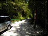 9
9 10
10 11
11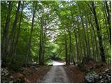 12
12 13
13 14
14 15
15 16
16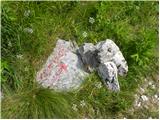 17
17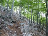 18
18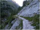 19
19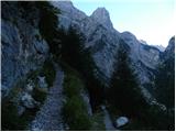 20
20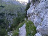 21
21 22
22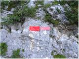 23
23 24
24 25
25 26
26 27
27 28
28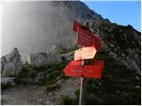 29
29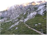 30
30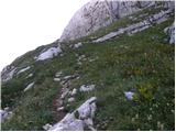 31
31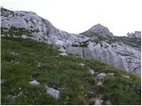 32
32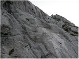 33
33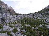 34
34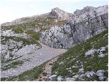 35
35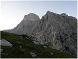 36
36 37
37 38
38 39
39 40
40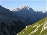 41
41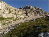 42
42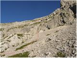 43
43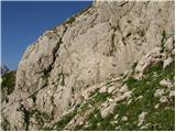 44
44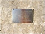 45
45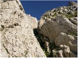 46
46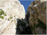 47
47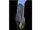 48
48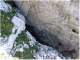 49
49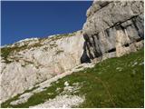 50
50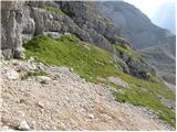 51
51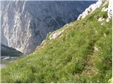 52
52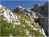 53
53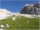 54
54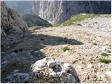 55
55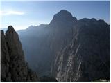 56
56 57
57 58
58 59
59 60
60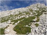 61
61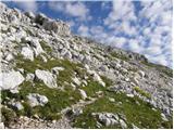 62
62 63
63
Discussion about the trip Zadnjica - Pihavec (via Luknja)
|
| darinka48. 01. 2018 |
I looked at the pictures and where the path to Pihavec goes from Sedlo Luknja. Last year I went past there to Gamsovec, but I didn't see the branch-off. Nor was I paying attention to it otherwise I would have looked. Did anyone go to Pihavec from this side last year? From Pogačnik there was a sign that it's closed.
|
|
|
|
| turbo8. 01. 2018 |
The path is orientationally not difficult, usually there's a cairn at the bend. That gully uphill doesn't pose problems, you pull up and exit left onto steep grass, then zigzag to the junction with the marked path. Such capital chamois like there, a few meters from you, almost you step on them, I haven't seen yet) Since the path towards Kriški is closed due to landslide, there's no other way but back the same. In that gully you get a bit stuck  , then straddle and slowly down , then straddle and slowly down 
The nicest is to go over Planina Zajavor (overgrown, but the mule track in the forest is still nicely walkable) and from there up steep grass towards Luknja - with a bit of luck you find a streamlet crawling over rocks at the foot of Mali Pihavec. (Justi was grazing at Zajavor , with Vinko we found the streamlet when we were there years ago and also remains of the pasture)
|
|
|
|
| darinka48. 01. 2018 |
I've already seen some hikers who went along that path. Then they returned via the mule track to Zadnjica. They didn't intend to go further. At least that's what they said. I would approximately know where to go.  If there's no fog and rain like last year, there won't be problems. Thanks for the description. If there's no fog and rain like last year, there won't be problems. Thanks for the description.
|
|
|
|
| turbo8. 01. 2018 |
First time you're in Zadnjica, Justi and Vinko will tell you much more about this trail It really is a wonderful hike
|
|
|
|
| B29. 01. 2018 |
Where is the junction in Zadnjica towards Planina Zajavor?
|
|
|
|
| djimuzl10. 01. 2018 |
According to the map, about 200 meters before the junction of the described path and the path to Prehodavci.
|
|
|
|
| turbo10. 01. 2018 |
Yes, a little before the junction to Prehodavci, at an unobvious right bend in the road, the start of the mule track is hidden to the left in the forest, which is clearly visible (sometimes a cairn by the road). To the place where the alpine pasture was, the path is nicely walkable, on the pasture everything is overgrown. From there to the junction with the marked path, you go continuously to the right upwards through locally insolently steep meadows. Best straight up to the junction with the "path" Luknja - Kriški podi, which you sense more than see in the meadows, and then along it right to Luknja or left to Kriški or a bit below.
|
|
|
|
| darinka431. 07. 2018 |
We were there on Saturday 30.7. Darko, Nada and me. All three first-timers. I transferred the path to my phone. But that off-trail is really off-trail. Except for that cairn a bit further from the Luknja pool there's really nothing. The last scree before the slab is very unpleasant to walk on. We didn't give up and found the slab and climbed into the chimney. Quite demanding. At the top beautiful. Nobody. We descended to the other side to Kriške pode. Just scree and rocks. Quite dangerous. We waited for the first one to go, then the second, because the rocks were just set to tumble. The snowfield that remained below doesn't pose any problem. Very very demanding tour.
|
|
|
|
| ločanka1. 08. 2018 |
darinka, we turned left a bit before the chimney, at least that's how I remember. It's been many years since then. It was said that it's easier that way
|
|
|
|
| darinka41. 08. 2018 |
We followed the description. But when you're first-timer you don't know where. We turned left into the grass even before the slab. There was steepness and blackberries. I've never seen so many in those grasses. Then from there we crossed right to the scree below the slab. We didn't want to go left above the slab again but straight up the gully. Then we found the path to the top.
|
|
|
|
| Jernej96826. 04. 2021 23:23:24 |
Nicely documented path
Hope it gets done soon. Just yesterday I admired Pihavec from close range (Zadnjiški Dol).
|
|
|
|
| darinka427. 04. 2021 07:21:16 |
It's worth hiking. We didn't see even one ibex back then. But it sticks in memory as a pathless hike, as I recall I was reading the description from my phone in that tall grass, because we veered too far left before finding Mihelič's plaque and then reached it without trouble. Further on it really wasn't hard anymore.
|
|
|
|
| turbo27. 04. 2021 07:38:12 |
Ibex often rest on rocky ledges in the ridge of Vrh nad Kamnom. Once I remember one that was in such a spot that I got scared...
|
|
|
To post a comment you must log in:
If you do not yet have a username, you must first
register.