Zadnjica - Vrh Hribaric (via Dolič)
Starting point: Zadnjica (642 m)
| Latitude/Longitude: | 46,38240°N 13,76040°E |
| |
Route name: via Dolič
Walking time: 6 h 25 min
Difficulty: easy pathless terrain
Elevation gain: 1746 m
Elevation difference along the route: 1790 m
Map: Triglav 1:25.000
Recommended equipment (summer): helmet
Recommended equipment (winter): helmet, ice axe, crampons
Views: 6.670
 | 1 person like this post |
Access to starting point:
From Kranjska Gora, drive over Vršič Pass towards Bovec or vice versa, but only to the 50th hairpin turn of the Vršič road (near the village of Trenta). Here turn onto the side road, following it in a gentle ascent to the parking lot in Zadnjica valley.
The road to the parking lot at the barrier is now closed to public traffic, so park at the parking lot at the entrance to Zadnjica valley. This extends the route by over 15 minutes.
Route description:
From the paid parking lot in Zadnjica valley continue on the marked trail, initially the road towards Pogačnikov dom na Kriških podih, Razor, Stenar, Križ, Bovški Gamsovec, Luknja, Triglav, Koča na Doliču and Kanjavec. The path initially leads past a few houses or cottages and after about 15 minutes of walking reaches a marked junction where there used to be a free parking lot but parking is now prohibited.
Continue on the slightly right lower road towards Zasavska koča na Prehodavcih, Koča na Doliču, Luknja and other nearby objectives (left Pogačnikov dom na Kriških podih and other goals above Kriške pode and lower station of the cargo cable car to Kriške pode), where the gentle road leads across scenic meadows, higher through forest. Just before the end of the forest road at Planja junction or before the valley head in the area called Utro, a marked path to Prehodavci branches right.
Continue straight on the road which soon becomes a footpath or old military mule track along which we mostly ascend moderately on gradually steeper slopes. Still in the forest a climbing path via Komar branches right, we continue on the mule track which ascends in numerous hairpins and due to steep slopes above is partly exposed to falling rocks.
The fairly scenic path reaches at about 1500 m the next junction where the path to Koča na Doliču branches right, straight continues to Luknja, Pogačnikov dom na Kriških podih and Triglav via Plemenice.
Continue right towards Koča na Doliču ascending further on the mule track (also to Luknja via mule track).
Further mostly moderate ascent on the mule track leading across steep and occasionally exposed sheer slopes. The path is wide and well built so not technically demanding but exposed to falling rocks and due to occasional deep drops mostly unsuitable for vertiginous. The path occasionally zigzags but mostly ascends diagonally right approaching the mighty Kanjavec wall.
Higher the climbing path from Zadnjica via Komar joins from right, a bit further right branches Mira Marko Debelak path (via Kanjavčeve police). The increasingly scenic path higher makes some more hairpins from which left branches path to Triglav.
Continue straight then quickly reach Koča na Doliču.
From the hut take path towards Vodnikov dom na Velem polju, Hribaric and Dom Planika pod Triglavom and in about ten minutes easy ascent reach Dolič saddle with marked junction.
Head slightly right following signs for Triglav Lakes (left Dom Planika pod Triglavom, straight Vodnikov dom na Velem polju) on path initially gentle then steeper towards Hribarice.
Ascend through vast screes between Mišeljski konec left and Kanjavec right. After about 30 minutes ascent the path levels, right notice branch to Kanjavec. Continue straight and ascent on gentle path soon reaching Hribarice pass.
Follow marked path to Triglav Lakes just few minutes then left notice cairn directing left to pathless terrain between Hribarice and Dolina za Debelim vrhom. After easy scramble ascend to saddle between Vrh Hribaric left and Vršaki right. From indistinct saddle continue slightly left, goal now ridge between Mišeljska dolina and Dolina za Debelim vrhom. Without major difficulty ascend to ridge then right onto less trodden path along right (west) side of ridge. Soon see forepeak of Vrh Hribaric ahead. Cairns direct slightly right bypassing forepeak (otherwise short ascent to it). After bypassing only final ascent on pathless ridge to summit.
Starting point - Na placu 0:15, Na placu - Utro 1:00, Utro - junction for Komar 0:15, junction for Komar - Pod Skokom 1:10, Pod Skokom - Pod steno 1:25, Pod steno - Koča na Doliču 1:00, Koča na Doliču - Dolič 0:10, Dolič - Hribarice saddle 0:40, Hribarice saddle - Vrh Hribaric 0:30.

Along the route: Na placu (714m), Utro (984m), Odcep za Komar (1058m), Pod Skokom (1494m), Pod steno (1899m),
Koča na Doliču (2151m), Dolič (2166m), Sedlo Hribarice (2365m)
Photos:
 1
1 2
2 3
3 4
4 5
5 6
6 7
7 8
8 9
9 10
10 11
11 12
12 13
13 14
14 15
15 16
16 17
17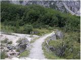 18
18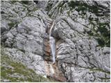 19
19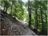 20
20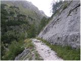 21
21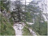 22
22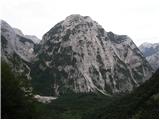 23
23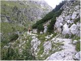 24
24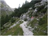 25
25 26
26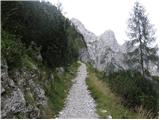 27
27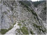 28
28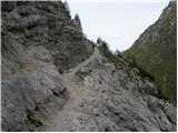 29
29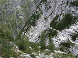 30
30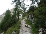 31
31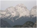 32
32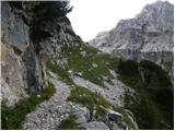 33
33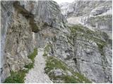 34
34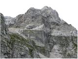 35
35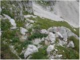 36
36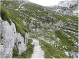 37
37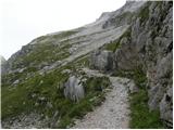 38
38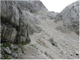 39
39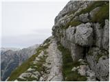 40
40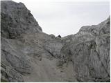 41
41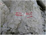 42
42 43
43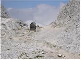 44
44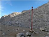 45
45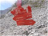 46
46 47
47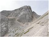 48
48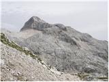 49
49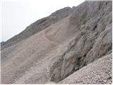 50
50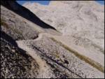 51
51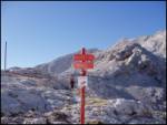 52
52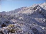 53
53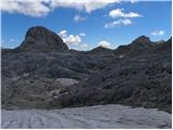 54
54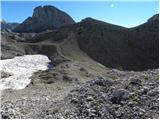 55
55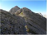 56
56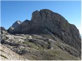 57
57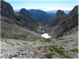 58
58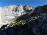 59
59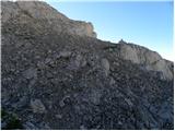 60
60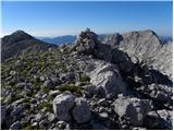 61
61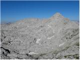 62
62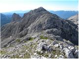 63
63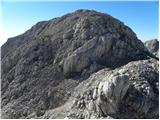 64
64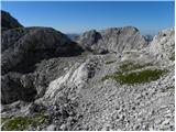 65
65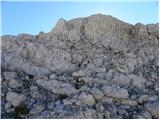 66
66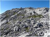 67
67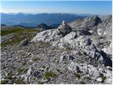 68
68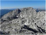 69
69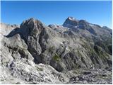 70
70
Discussion about the trip Zadnjica - Vrh Hribaric (via Dolič)
To post a comment you must log in:
If you do not yet have a username, you must first
register.