Žagana peč - Cojzova koča na Kokrskem sedlu (hunting path)
Starting point: Žagana peč (812 m)
| Latitude/Longitude: | 46,33807°N 14,57072°E |
| |
Route name: hunting path
Walking time: 4 h
Difficulty: partly demanding unmarked way, difficult marked way
Elevation gain: 981 m
Elevation difference along the route: 1200 m
Map: Kamniške in Savinjske Alpe 1:50.000
Recommended equipment (summer): helmet
Recommended equipment (winter): helmet, ice axe, crampons
Views: 14.670
 | 2 people like this post |
Access to starting point:
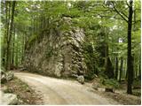
We drive to Kamnik and follow the road ahead towards the valley of Kamniška Bistrica. From the house in Kamniška Bistrica we continue driving on the forest road, which brings us higher to a crossroads, where we continue straight (right Jermanca, starting point for Kamniško sedlo). The road then brings us to Žagana peč (large boulder by the road), and we drive another 30 m further, where on the left side we notice a smaller parking lot on which we park.
Driving from the Koča in Kamniška Bistrica to Žagana peč is now forbidden (traffic sign), which extends the path by approximately 45 minutes.
Route description:
At the parking lot we notice the beginning of the hunting path, which leads us into the forest. The path soon starts to ascend steeply and after approximately 15 minutes brings us to a distinct forested ridge, where the path temporarily flattens. The path quickly withdraws from the ridge to the left, where in the ascent it crosses some steep and especially in wet slippery-dangerous slopes. A short descent follows, then the path turns slightly to the right, where it starts to ascend very steeply (danger of slipping and falling rocks). An ascent follows along and beside a wide forested gully, from which the path higher withdraws to the left. Only a good 15 minutes of ascent through the forest follow, and the path brings us to the hunting cottage, which is located at the edge of a panoramic slope.
From the hunting cottage we continue on a well-visible little path, which returns to the forest and first crosses slopes to the left, then turns somewhat to the right and gradually starts to ascend more steeply. Higher up, the path along which we notice more and more "unofficial" markings (red dots and lines) brings us to a small valley and gradually starts to get lost among tall grasses. Although the path slowly disappears, we can still follow it for some time.
A little further we reach a small junction, where we continue on the left less-trodden little path (right upwards Zob and one of the approach options to Kalška gora). The path ahead ascends gently (except for a few short steep ascents) along the lower edge of rocky cliffs. Further, the barely noticeable little path then brings us to the abandoned pasture Ovčarije, at the end of which it completely disappears. Further we follow the frequent red dots and lines, which soon turn us quite to the right and higher again to the left. We follow the mentioned red lines all the way to the place where we step onto the marked path Krvavec - Kokrsko sedlo (if we consistently followed the red lines, we will reach the marked path right at some sort of verse written on the rock above the path).
When we step onto the marked path, we follow it to the right (left Krvavec), which first in a gentle, then in a moderate ascent crosses the gradually steeper slopes of Kalški greben. Higher the path brings us to a short steep section, over which a steel cable helps us. The path then flattens and brings us in a few minutes of further walking to a small saddle between Kalški greben on the left and Kalška gora on the right.
On the saddle there is a marked junction, and we continue straight down towards Cojzova koča (left Kalški greben, right Kalška gora). The path first descends over a steep slope, then turns into a wall, over which we descend with the aid of safety gear, partly over rugged rocky terrain about 100 m lower. Below the wall the path turns to the right, crosses a few more short steep sections, then brings us to a scree slope, over which we descend transversely close to Kokrsko sedlo. A short steep descent follows, where a bolt helps us, then only a few minutes of pleasant walking remain to Cojzova koča na Kokrskem sedlu.
We descend along the usual path.

The trip can be extended to the following destinations: Kamniška koča na Kamniškem sedlu,
Kalška gora,
Bivak pod Grintovcem,
Kalški greben,
Turska gora,
Štruca,
Dolgi hrbet,
Kokrska Kočna,
Skuta,
Jezerska Kočna,
Grintovec
Photos:
 1
1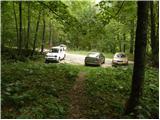 2
2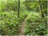 3
3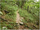 4
4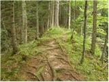 5
5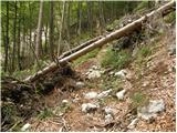 6
6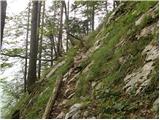 7
7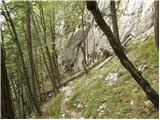 8
8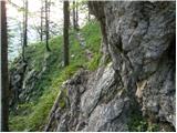 9
9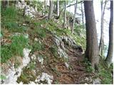 10
10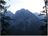 11
11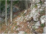 12
12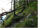 13
13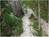 14
14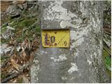 15
15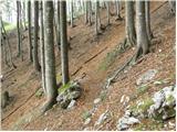 16
16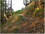 17
17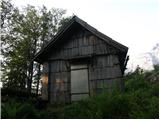 18
18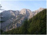 19
19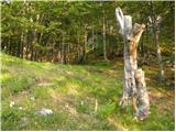 20
20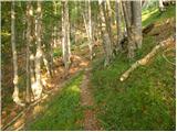 21
21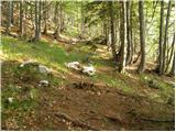 22
22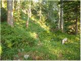 23
23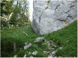 24
24 25
25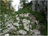 26
26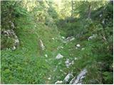 27
27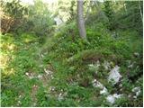 28
28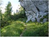 29
29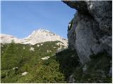 30
30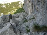 31
31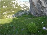 32
32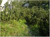 33
33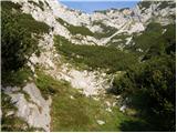 34
34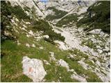 35
35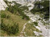 36
36 37
37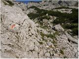 38
38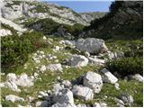 39
39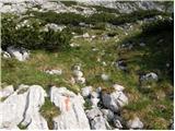 40
40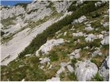 41
41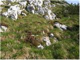 42
42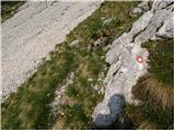 43
43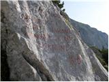 44
44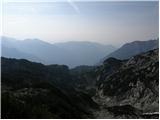 45
45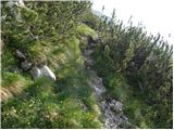 46
46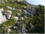 47
47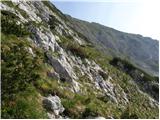 48
48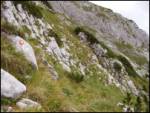 49
49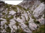 50
50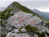 51
51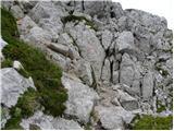 52
52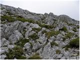 53
53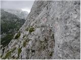 54
54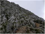 55
55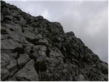 56
56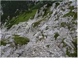 57
57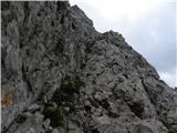 58
58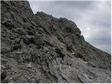 59
59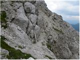 60
60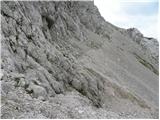 61
61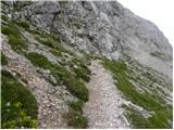 62
62 63
63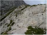 64
64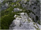 65
65 66
66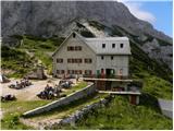 67
67
Discussion about the trip Žagana peč - Cojzova koča na Kokrskem sedlu (hunting path)
|
| ursa.k14. 10. 2014 |
This is one of the most beautiful paths, Kalška gora or the ridge offers fantastic views!
And the whole path is nicely marked with blind markers
|
|
|
|
| palck23. 08. 2024 11:48:27 |
Is the path to the starting point accessible?
|
|
|
|
| garmont23. 08. 2024 18:31:56 |
No issues. The parking lot is also set up.
|
|
|
To post a comment you must log in:
If you do not yet have a username, you must first
register.