Zagorica pri Dobrniču - Sveti Križ (Liška gora)
Starting point: Zagorica pri Dobrniču (250 m)
| Latitude/Longitude: | 45,86950°N 14,96960°E |
| |
Walking time: 40 min
Difficulty: easy unmarked way
Elevation gain: 178 m
Elevation difference along the route: 180 m
Map:
Recommended equipment (summer):
Recommended equipment (winter):
Views: 2.098
 | 1 person like this post |
Access to starting point:
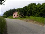
A) We leave the Ljubljana - Novo mesto highway at the Trebnje - west exit, then continue driving in the direction of Žužemberk and Dobrnič. In Dobrnič, the main road towards Žužemberk turns right, and then after the village Preska pri Dobrniču (we bypass the mentioned village on the right side - we do not go into the center of the settlement) it starts ascending. When after a few hundred meters the road flattens and on the right side before the abandoned residential house (the house belongs to the settlement Zagorica pri Dobrniču, even though there is no road sign) we notice a cross, we park in an appropriate place beside the road.
B) First, we drive to Žužemberk, then continue driving towards Trebnje and Dobrnič. After the settlement Dobrava we will reach a junction, where the road towards the village Zagorica pri Dobrniču branches off to the right, and from there we continue a few hundred meters on the main road towards Dobrnič, then we arrive at a smaller hamlet (the hamlet belongs to the settlement Zagorica pri Dobrniču), where behind the last house on the left side we park in an appropriate place beside the road (at the starting point there is a cross).
Route description:
At the cross, we notice a cart track which immediately enters the forest and starts moderately ascending. During the ascent through the forest the path leads us past another cross, behind it we arrive at an unmarked junction of two cart tracks. By the left cart track we notice the blazes (path leads towards the settlement Lisec), we continue on the right one, where blazes are no longer visible. Only a dozen steps higher the cart track splits again, we continue right again (straight to Lisec peak), on a gradually gentler cart track, along which we quickly step onto a macadam road. When we reach the road, we follow it to the right (left we arrive at the settlement Lisec, or also to the eponymous peak), we walk along it to the first branch-off of the cart track to the right (the cart track is at the beginning of a mild left bend). We continue on the gently to moderately steep cart track, along which in a few minutes we arrive at the church of St. Cross, from which a nice view of Lisec opens up.

Photos:
 1
1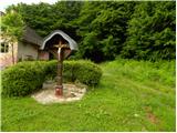 2
2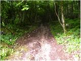 3
3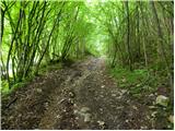 4
4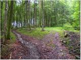 5
5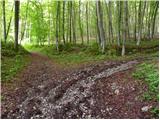 6
6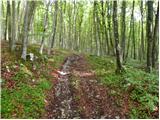 7
7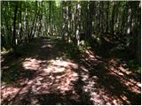 8
8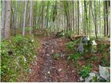 9
9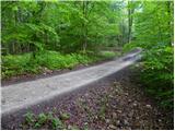 10
10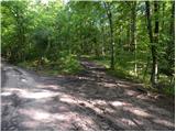 11
11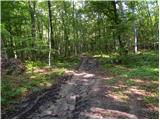 12
12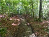 13
13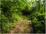 14
14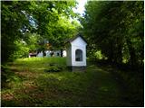 15
15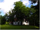 16
16 17
17
Discussion about the trip Zagorica pri Dobrniču - Sveti Križ (Liška gora)
|
| Peter 715. 01. 2022 08:03:24 |
I would like to ask where you can park your car for Liška gora. There is a new house at the cross now and there is no more parking there.
|
|
|
To post a comment you must log in:
If you do not yet have a username, you must first
register.