Zagrad - Hotel Celjska koča
Starting point: Zagrad (240 m)
| Latitude/Longitude: | 46,21170°N 15,26260°E |
| |
Walking time: 1 h 10 min
Difficulty: easy marked way
Elevation gain: 412 m
Elevation difference along the route: 440 m
Map:
Recommended equipment (summer):
Recommended equipment (winter):
Views: 75.662
 | 2 people like this post |
Access to starting point:
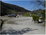
From the highway Ljubljana - Maribor, we go to the exit Celje - center and continue driving in the direction of Laško and Zidani Most. The road ahead leads through the center of Celje, and then brings us to a roundabout with a fountain. Here we continue "straight" (direction Laško and Zidani Most) and follow the road to the next traffic-light intersection, where we continue left, drive over the river Savinja and then at the intersection behind the bridge continue right. Further, we come to the underpass under the railway track and only a few meters ahead to the fire station in Zagrad near which we park on a larger macadam parking lot.
To the starting point we can also come from Dolenjska and Zasavje. In this case, we first drive to Rimske Toplice and then through Laško to the starting point.
Route description:
On the eastern side of the parking lot we notice the blazes, which point us to the path which at first ascends among houses and then crosses an asphalt road. Further we ascend only for a short time through the forest and then join the previously mentioned road. The road, which further gently to moderately ascends, leads us over a panoramic grassy slope from which a nice view opens up. Higher the road ends and we continue on a wide and well-made mountain path which further leads us through an indistinct valley. Higher we step on a macadam road and with the exception of some shortcuts follow it to a marked junction by which a sign is located.
We continue straight on a well-made path (left steep path to Grmada), which higher again joins the macadam road. The road then slightly descends and past Trobiš's beech tree brings us to a smaller crossroad where we continue slightly left on an ascending cart track. The wide cart track, from which soon to the left branches off the path to the mountain hut Pečovniška koča, higher changes into a macadam road which we then follow all the way to the mountain hut Celjska koča.

Photos:
 1
1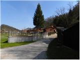 2
2 3
3 4
4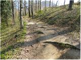 5
5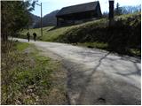 6
6 7
7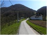 8
8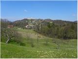 9
9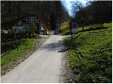 10
10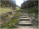 11
11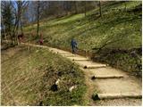 12
12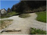 13
13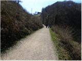 14
14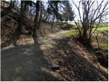 15
15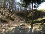 16
16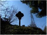 17
17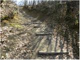 18
18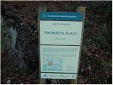 19
19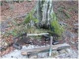 20
20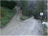 21
21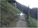 22
22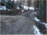 23
23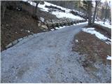 24
24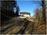 25
25 26
26
Discussion about the trip Zagrad - Hotel Celjska koča
|
| rozka26. 12. 2009 |
On Christmas Eve after abundant dinner a walk across Grmada to the hut fitted well and given the temperatures we were almost in short sleeves, crazy...except a bit of caution because slippery here and there, nothing special
|
|
|
|
| VanSims4. 04. 2011 |
I would like to warn the owners of the bob track that safety is very poorly taken care of. No safety belts, let alone helmets. Children over 8 years old can go on the devices by themselves! Smaller ones just in their lap from where they can easily tip over. The parent can hardly supervise the child and the bob at the same time. People don't respect the 25m safety distance anyway.
I also think the bob track is narrow and someone can easily slip off.
The easiest is to write 'at your own risk'. Sad that the inspection and/or law tolerates this here. When the accident happens, you can legally wash your hands, but the media coverage can hit your pocket hard, if you're just in it for profit. I wouldn't let my children go up there.
How safety is taken care of in Germany in amusement parks, I won't even talk about. And there the park is responsible for the accident if it violates standards.
|
|
|
|
| modrook1224. 06. 2015 |
Is there any view from the Celjska koča?
|
|
|
|
| defence125. 06. 2015 |
Yes to Celje but it's nicer from the neighboring Grmada
|
|
|
|
| modrook1225. 06. 2015 |
Is Grmada accessible with a stroller? Thanks for the information
|
|
|
|
| Patriček21. 02. 2025 20:27:59 |
Be careful, as apparently they are breaking into cars at the parking lot. They broke into ours and since we returned to the parking lot after 10 minutes, we caught them. It was a black Renault Megane estate. Be vigilant.
|
|
|
|
| tomo_kugy21. 02. 2025 23:15:18 |
@Patriček
Bravo, dear colleague, for the notice on this portal. Next time we'll go together to Grmada and then for another strudel at Pečovniška koča.
|
|
|
|
| MitjaCE25. 02. 2025 14:43:11 |
They are breaking into cars a lot at this parking lot. They also broke into ours 14 days ago. I remember that black Megane with the observer sitting in it.
|
|
|
|
| Vitaja27. 02. 2025 12:38:44 |
Apparently two already got it, shortly after the new year. Mine saw them when they took them away. But now again?
|
|
|
To post a comment you must log in:
If you do not yet have a username, you must first
register.