Zagrad - Medvižica (via Ostrič)
Starting point: Zagrad (780 m)
| Latitude/Longitude: | 45,50430°N 14,05990°E |
| |
Route name: via Ostrič
Walking time: 1 h 45 min
Difficulty: easy marked way
Elevation gain: 301 m
Elevation difference along the route: 350 m
Map: Slovenska Istra - Čičarija, Brkini in Kras 1:50.000
Recommended equipment (summer):
Recommended equipment (winter):
Views: 9.844
 | 1 person like this post |
Access to starting point:
From the Ljubljana - Koper highway, take the Kozina exit and follow the road ahead in the direction of Reka. In the village Obrov, turn right in the direction of the village Golac, from which we continue driving towards the hamlet Zagrad. In Zagrad, continue left and follow the road, which becomes a macadam, to the spot where we notice a sign prohibiting further driving (forest road use at your own risk). Park here on a smaller parking lot by the road.
Route description:
Only a few meters before the traffic sign we notice a cart track which turns right from the road and starts gently ascending at first (beginning not marked). Soon we notice the first blaze, which tells us that we are on the right path. Further, we moderately ascend along the cart track, which higher up exits the forest onto grassy slopes surrounded by individual trees (mostly pines). The path here flattens and a little further turns slightly to the right, where we also come to a marked junction.
We continue in the direction of Ostrič, Slavnik and Razsušica (left pond 30 minutes) on the path which starts ascending towards the indistinct saddle between Ostrič on the left and less known Griža on the right. We follow this path to the spot where we will notice a larger sinkhole in front of us. Here the cart track continues straight, but the marked footpath turns left and starts steeply ascending the unvegetated slope of Ostrič. We follow this steeper path for a short time all the way to the summit of Ostrič from which a nice view opens up.
From the top we continue on the marked path, which in a few minutes of moderate descent descends to the other side of the previously mentioned sinkhole. Here we again step onto the cart track and follow it to the left. The marked path then turns right into the forest, where it circles Griža in a semicircle, then turns slightly to the left, where after a few minutes of gentle ascent we arrive at a clearing in the middle of which the marked path to the summit of Medvižica branches off to the right (slightly left Razsušica). The path immediately returns to the forest, where after a few steps of further walking we come to a rocky section. Here the path turns left and steeply ascends over the rocky slope. We then follow this steep path, which is surrounded by numerous cracks, to the scenic summit.
The path between Ostrič and Medvižica is occasionally somewhat poorly marked.

Photos:
 1
1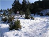 2
2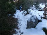 3
3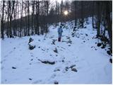 4
4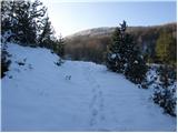 5
5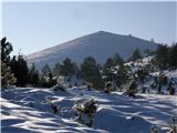 6
6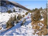 7
7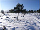 8
8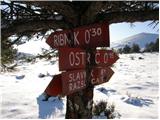 9
9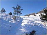 10
10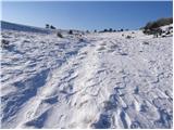 11
11 12
12 13
13 14
14 15
15 16
16 17
17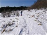 18
18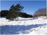 19
19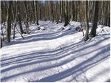 20
20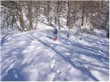 21
21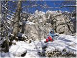 22
22 23
23 24
24
Discussion about the trip Zagrad - Medvižica (via Ostrič)
|
| repa&zelje2. 01. 2020 |
Exceptionally beautiful January outing. Recommend a circular tour via Ostrič past Medvižica, via Razsušica back to Zagrad. Fantastic views: Triglav, Dolomites, Snežnik, Učka, from Medvežica also the Gulf of Trieste... Total with stops (snack) 3 hours.
|
|
|
|
| Fulcrum18. 01. 2026 13:57:49 |
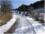
From the parking lot (picture 1) we continue along the gravel road for another 100 meters, to the spot where the sign directs us right onto the well-marked trail towards Ostrič, or Žabnik as the locals call it. The trail is well marked, with new directional signs helping us at several points.
|
|
|
To post a comment you must log in:
If you do not yet have a username, you must first
register.