Zagrad - Velika Plešivica (via Mala Plešivica)
Starting point: Zagrad (757 m)
| Latitude/Longitude: | 45,50584°N 14,05705°E |
| |
Route name: via Mala Plešivica
Walking time: 2 h 15 min
Difficulty: easy unmarked way, easy marked way
Elevation gain: 151 m
Elevation difference along the route: 415 m
Map: Slovenska Istra - Čičarija, Brkini in Kras 1:50.000
Recommended equipment (summer):
Recommended equipment (winter): ice axe, crampons
Views: 6.539
 | 1 person like this post |
Access to starting point:
From the Ljubljana - Koper motorway we take the Kozina exit and continue on the road towards Rijeka. We drive to the village of Obrov, where signs for Golac direct us right onto a narrower road. This is followed by a 4 km drive to the village of Golac, from where we continue following signs for the village of Zagrad, which is just over 1 km away. There are no designated parking spaces in Zagrad, but it is possible to park on a widening at the edge of the village.
It is more advisable to park already in Golac, which extends the walk by approximately 15 minutes.
Route description:
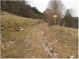
From the marked junction in the village of Zagrad we continue on the right road, along which there are signs for Velika vrata, Slavnik and Mala and Velika Plešivica (left Ostrič). The path initially leads past a few houses, then ascends transversely into the forest, where the poorer road makes some switchbacks; we follow it up to the turning area (there are still some parking possibilities along the road, but the road is quite poor), where the markings lead us left onto a clearing, from there we continue uphill along a cart track. The ascent continues first along the western slopes of the peak Čičer, then higher along the northwestern slopes we reach a marked junction.
We continue right towards Mala and Velika Plešivica (left Razsušica, Medvižica and Ostrič) and initially ascend moderately through dense forest. Later the partly poorly visible path begins to descend more steeply and from the right a somewhat shorter path joins, leading along an unmarked cart track. We follow the path left towards Slavnik (inscription on a rock) and in a few minutes ascend to the pass or saddle between Lipica on the left and Liskovica on the right.
A short descent follows again; when the path levels out we quickly reach a forest road, which we reach exactly at its end or turning area. We continue right, then quickly turn left from the road onto a marked cart track that ascends through a belt of forest. We walk along the cart track for a few dozen meters; when it turns left we go straight onto an initially poorly visible trail along which the markings continue. We ascend through increasingly sparse forest, which gives way to sparse shrubbery and individual smaller pines and junipers. A few more minutes of increasingly scenic walking follow and we reach the scenic summit of Mala Plešivica.
From the summit of Mala Plešivica we continue along the marked path that begins to descend towards the north to northwest; ahead we can see the neighboring Velika Plešivica and to its left Slavnik.
Lower down the path leads past an unusual underground structure whose arched concrete entrance and massive rusty iron grilles strongly resemble an abandoned mine adit or military bunker. In reality it is technical heritage – a supply facility of the local water supply. This picturesque intermediate point simultaneously confirms we are on the right path; a little further we step onto a cart track that brings us in a few minutes to a forest road.
We follow the road left and descend along it to the Velika vrata pass, where we go right and then immediately left.
Just a few steps beyond the point where we left the road we reach a grazing area where horses graze. The markings here direct us across the pasture fence onto a grassy slope, along which we then ascend on a barely traceable trail; a few markings help with orientation, though they are quite sparse on the lower part of the pasture. Higher up the trail becomes clearer and markings are also more frequent. We follow this increasingly scenic path to the spacious and scenic summit of Velika Plešivica.
Zagrad - razpotje Kičer 0:45, razpotje Kičer - Mala Plešivica 0:45, Mala Plešivica - Velika vrata 0:20, Velika vrata - Velika Plešivica 0:25.

Photos:
 1
1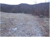 2
2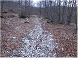 3
3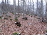 4
4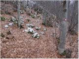 5
5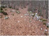 6
6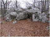 7
7 8
8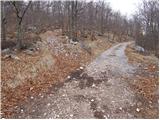 9
9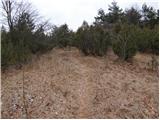 10
10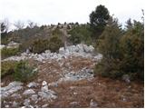 11
11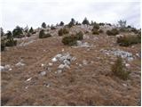 12
12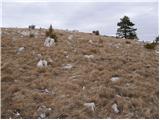 13
13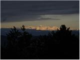 14
14 15
15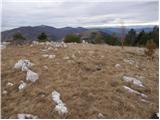 16
16 17
17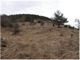 18
18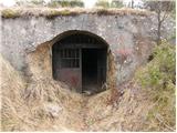 19
19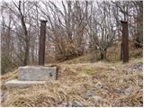 20
20 21
21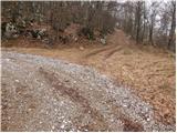 22
22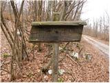 23
23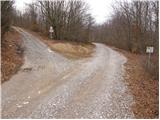 24
24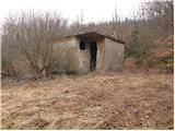 25
25 26
26 27
27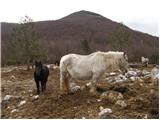 28
28 29
29 30
30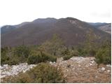 31
31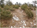 32
32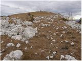 33
33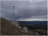 34
34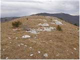 35
35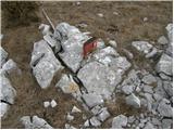 36
36
Discussion about the trip Zagrad - Velika Plešivica (via Mala Plešivica)
|
| klavdipo10. 02. 2009 |
Piles of rusty iron on both peaks indicate that the markers have long forgotten these two peaks! 
|
|
|
|
| squash1238. 09. 2013 |
Today my wife and I did this tour. If you crave solitude, this is the right tour for you. We didn't meet a living soul on the path. The path is quite well marked. The view from both summits is nice. They could add a stamp at the summit. Good luck.
|
|
|
|
| Pljusak21. 10. 2014 |
Ostrič-Razsušica-Medvižica are excellently marked and we praise the people who did it. We'll try to go around this other side too. We never met a living person, and we were there twice.
|
|
|
|
| navdušena14. 01. 2022 12:34:13 |
What's the road to the starting point like? Is it possible to park somewhere in Zagrad?
|
|
|
|
| franca14. 01. 2022 15:11:54 |
there's enough space by the road at Mali pod Zagradom
|
|
|
|
| zvončica15. 08. 2023 23:00:09 |
The trail to Mala and Velika Plešivica is excellently marked, both summits have a box with a logbook and stamp. Directional signs are also placed on both summits.
|
|
|
To post a comment you must log in:
If you do not yet have a username, you must first
register.