Starting point: Zagrad (240 m)
| Latitude/Longitude: | 46,21240°N 15,26200°E |
| |
Walking time: 1 h
Difficulty: easy marked way
Elevation gain: 292 m
Elevation difference along the route: 315 m
Map:
Recommended equipment (summer):
Recommended equipment (winter):
Views: 7.681
 | 2 people like this post |
Access to starting point:
a) From the Maribor - Ljubljana highway, we take the Celje Center exit towards Laško or Zidani Most. First, we go over the first bridge directly below the center of Celje over the river Savinja. A little lower in the settlement Polule, at the traffic-light-controlled intersection, we turn left over a bridge over the Savinja and immediately after the bridge, at the intersection, turn right. Just before the underpass for Zagrad we park on a parking lot on the right.
b) From the direction of Zidani Most or Laško, we turn right at the traffic-light-controlled intersection in Polule and continue to the parking lot as described above.
Route description:
From the parking lot, we continue to the intersection, left for Zagrad/underpass and we follow right or straight on the asphalt road in the direction of Tremerje, direction sign. After a few hundred meters we turn left and under the railway underpass we immediately ascend through Pečovnik along the riverbed of the stream. Up to an altitude of around three hundred meters there is asphalt and further right onto the forest path, inscription on the tree Vipota and soon to one of the highest trees in Slovenia, around 50 meters high Douglas fir.
We continue following the path higher and at two marked turn-offs to the right we reach the summit of Vipota.
Photos:
 1
1 2
2 3
3 4
4 5
5 6
6 7
7 8
8 9
9 10
10 11
11 12
12 13
13 14
14 15
15 16
16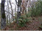 17
17
Discussion about the trip Zagrad - Vipota
|
| bruny11. 11. 2013 |
Personally, I started this trail at Celje railway station. In the trail description, the decision for the starting point Zagrad, because it is the optimal starting point for Celjska koča, Grmada, Tolsti vrh and more, and descriptions already existed and there are more parking spaces. Whoever doesn't like using asphalt and the embankment next to it and wants to go directly up the hill can of course extend by car to the parking lot at photo no.6, a bit higher, a few parking spaces available. But that's a distance of about half a kilometer...Best regards
|
|
|
To post a comment you must log in:
If you do not yet have a username, you must first
register.