Zagreb (Gračani) - Sljeme (Bikčevićeva staza)
Starting point: Zagreb (Gračani) (280 m)
Route name: Bikčevićeva staza
Walking time: 2 h 30 min
Difficulty: easy marked way
Elevation gain: 753 m
Elevation difference along the route: 753 m
Map:
Recommended equipment (summer):
Recommended equipment (winter):
Views: 6.124
 | 3 people like this post |
Access to starting point:
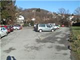
From the highway, take the Zagreb - west exit, then in Novi Zagreb at the roundabout by the Billa shopping center continue driving east to the next roundabout, where we will turn towards Zagreb - center. Continue across the Sava bridge and we are on Marina Držića street. Go straight through the underpass, past the bus stop and under the railway tracks all the way to Kvaternikov trg. Here we turn left west onto Vlaška street. Vlaška street will begin to ascend after a slight right bend, we go straight ahead. Vlaška street turns into Medveščak road and becomes two-lane. Drive to the traffic-light intersection, where we follow the signs for Gračani (there are also signs for Sljeme ski slopes by the road). Now we drive constantly gently uphill through Gračani. After speed bumps we will see the entrance to the parking lot on the left (This parking lot is at the turning loop of the tram line, which ends at the top of Gračani. If we turn too late there will be a short series of obstacles - poles - in the middle of the road ahead). I recommend leaving the vehicle here, because the parking lots in Bliznec are always crowded and it is almost impossible to find a free parking space.
Zagreb is quite orientationally demanding. I advise using a map and navigation.
Route description:
From the parking lot we go north, descending stairs, then choose the narrower road closed to motor vehicles. The mentioned road takes us to the attraction of this trail, where we go through a short tunnel. It is built as the final exit of the Donja Stubica - Zagreb road through Medvednica, which was never completed. After exiting the tunnel, there is one unofficial shortcut, also asphalted downhill, but the proper trail goes straight on. The trail then takes us under the base station of the former Sljeme cable car, which no longer operates, and here we cross from the forest back to asphalt and descend gently to the huge parking lot by Bliznec stream. If it's not weekend, it's possible to find a parking spot here, but on weekends there is such a crowd already in the morning that there are no free spots left. We continue and reach the entrance to Bikčevićeva trail, located on the right and impossible to miss. The trail is steep for a short time at the beginning, then levels out and gently ascends above Bliznec stream. Along the trail, short sections of rocky and rooty base alternate. After some time, the trail at a sharp and exposed bend turns sharply right to the east. After the bend is the first junction, where left downhill a path branches to Bliznec stream, right goes the variant via Strmopeč viewpoint, we go straight. The trail ahead unobtrusively turns north and gradually becomes somewhat steeper. At one point the variant via Strmopeč joins from the right. Somewhere halfway there is the Njivice rest area with shelter, where we can rest. Our trail, which so far had marking number 18, will change to trail number 19 (trail no. 18 continues to Hunjka pass). After Njivice the trail becomes somewhat steeper. Our trail turns into a logging road, where the base becomes more demanding. We reach a belt of mixed forest, where the trail first levels out, but only for a few meters, then steep again. When we reach the grave of the unknown soldier the trail will be level again for some time. Now there are several junctions along the trail. Left some paths go to Runolist mountain hut, right some more branches to Hunjka pass. Further the trail enters spruce forest and ascends very steeply to Pačkovski hut, located on this part of Medvednica. In front of the hut there is also Rauchova lugarnica shelter, which is a bivouac where one can sleep. For many hikers the Pačkovski mountain hut is also the end point of this trail, which ends at the hut. We will go further from the hut and cross the road, then go left west. Now we are on the Medvednica ridge, where the trail is constantly level. After some walking we reach asphalt, where we pass by hotel Snježna kraljica, past a smaller TV tower (here asphalt ends), past Sljemenska kapelica chapel and finally reach the mountain junction above Činovničko livado. From there we continue west on steeper trail, cross the ski slope and after some time are at the top of Sljeme, where the huge TV tower is located. A bit further, by Vidikovac restaurant, an excellent view to the north opens up.

Photos:
 1
1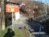 2
2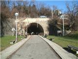 3
3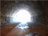 4
4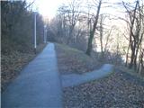 5
5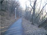 6
6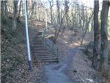 7
7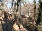 8
8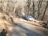 9
9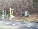 10
10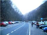 11
11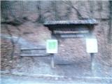 12
12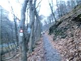 13
13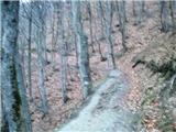 14
14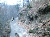 15
15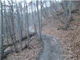 16
16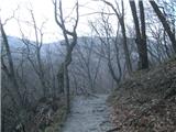 17
17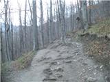 18
18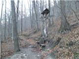 19
19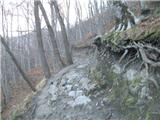 20
20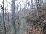 21
21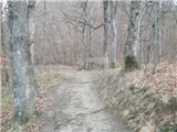 22
22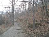 23
23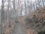 24
24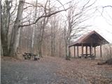 25
25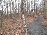 26
26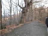 27
27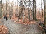 28
28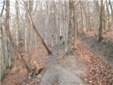 29
29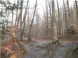 30
30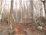 31
31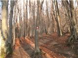 32
32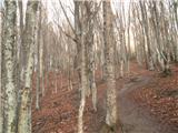 33
33 34
34 35
35 36
36 37
37 38
38 39
39 40
40 41
41 42
42 43
43 44
44 45
45 46
46 47
47 48
48 49
49 50
50 51
51 52
52 53
53 54
54 55
55 56
56 57
57 58
58 59
59 60
60 61
61
Discussion about the trip Zagreb (Gračani) - Sljeme (Bikčevićeva staza)
To post a comment you must log in:
If you do not yet have a username, you must first
register.