Zagreb (Šestine) - Sljeme (path HPD (path 52))
Starting point: Zagreb (Šestine) (291 m)
| Latitude/Longitude: | 45,85430°N 15,95020°E |
| |
Route name: path HPD (path 52)
Walking time: 2 h 15 min
Difficulty: easy marked way
Elevation gain: 742 m
Elevation difference along the route: 742 m
Map:
Recommended equipment (summer):
Recommended equipment (winter):
Views: 8.751
 | 1 person like this post |
Access to starting point:
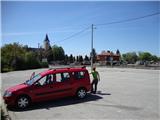
a) From the center of Zagreb, drive through Britanski trg to Pantovčak Street, follow it to the end (roundabout), turn left onto Šestinski vijenac and soon reach the church and cemetery behind it (Šestinski trg), where there is a larger parking lot.
b) Cross the Croatian border at Rigonci, continue through Zaprešić along Aleja Bologne and Ilica. Soon at the beginning of Ilica, turn left onto Vrapčansko, follow it for approx. 2 km, turn right onto Trdico, follow it to Krvarić Street from which continue along Mikulići Street, then to Lukšiće to Šestinska cesta and the church/cemetery behind which there is a parking lot where you can leave the car. Since these are quite narrow and unclear streets, we recommend using a map or navigation.
Route description:
Start at the parking lot, descend the road left (from the square sign), past the ski service and bar. Continue along the main street but only to the stream (bakery corner) and Potočani Street, where we see the first markings and path 52 sign. The asphalt road climbs the street past houses and soon brings us to a sign indicating entry to Medvednica Park. Soon leave the concrete road in a sharp bend (left), it turns into a cart track and later a wide, excellently marked hiking path. The path continues through the forest, followed by a somewhat steeper section which soon flattens and leads to a water spring (dry during visit). The path then splits (follow signs to summit) and crosses steep slopes in places (danger of slipping). Soon spot the tower on top, path turns into wide cart track along the broad summit ridge. Continue straight towards the tower. Cross asphalt road, continue past abandoned upper funicular station; where a few steps on stairs remain to the top.
At the top is a catering outlet (Vidikovac). Summit stamp is built into the wall of the outlet. Due to forest, view limited only to Gorjanci.

Photos:
 1
1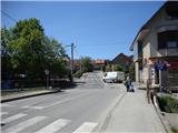 2
2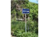 3
3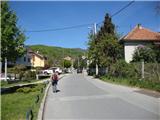 4
4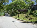 5
5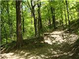 6
6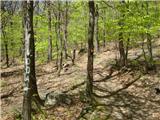 7
7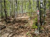 8
8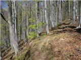 9
9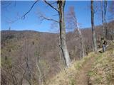 10
10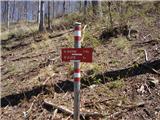 11
11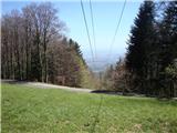 12
12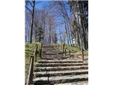 13
13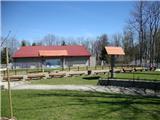 14
14 15
15 16
16
Discussion about the trip Zagreb (Šestine) - Sljeme (path HPD (path 52))
To post a comment you must log in:
If you do not yet have a username, you must first
register.