Zajasovnik - del (Strmce, kapelica) - Jasovnik (Motnik tourist trail)
Starting point: Zajasovnik - del (Strmce, kapelica) (580 m)
| Latitude/Longitude: | 46,20985°N 14,89273°E |
| |
Route name: Motnik tourist trail
Walking time: 45 min
Difficulty: easy marked way
Elevation gain: 184 m
Elevation difference along the route: 184 m
Map:
Recommended equipment (summer):
Recommended equipment (winter): ice axe, crampons
Views: 3.020
 | 3 people like this post |
Access to starting point:
A) From the A1 highway in the Celje direction, choose the Vransko exit. Turn right and follow the signs for Vransko and Kamnik. Drive to the settlement Ločica pri Vranskem. Soon we come to the junction for Kamnik. Turn right. After a few kilometers, we come to Motnik and turn into the center of the settlement. At the junction before the bus stop, notice the red hiking signposts. Turn left up the road and uphill. After a little more than 1 km, we reach the chapel (Zajasovnik - del, Strmec). Here we have a great parking space.
B) From the A1 highway in the Ljubljana direction, choose the Trojane exit. When coming from the exit to the junction, turn left onto the main road. The junction is well marked. A little before the settlement Ločica pri Vranskem, turn left for Kamnik. After a few kilometers, we come to Motnik and turn into the center of the settlement. At the junction before the bus stop, notice the red hiking signposts. Turn left up the road and uphill. After a little more than 1 km, we reach the chapel (Zajasovnik - del, Strmec). Here we have a great parking space.
Route description:
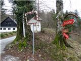
There is a chapel at our starting point and nearby there are signposts for Jasovnik, Ločica and Trojane. We go left in the direction of Jasovnik. After a few dozen meters we go past a house. A little further on a tree we notice the sign for Jasovnik and Ločica. It directs us left uphill across the meadow into the forest. The path is initially wide, the blazes are visible but rare. After a short ascent we come to a fork, where we take the upper, right path. Here there are no blazes. Then the path descends a little, but only for a few meters. We come to a fork, where we go left uphill. Here again there are no blazes, though they would be needed. The path leads uphill, where we finally notice a blaze. Also watch the path, because after a few meters we must go left uphill. There are many cut trees here. There is no blaze, but we notice it a little higher. The path leads through the forest, it is visible, but caution is never superfluous. For a short time we catch our breath when we come to the fork Mali Jasovnik (left) - Jasovnik (right).
To Mali Jasovnik we have less than 5 minutes of ascent. Through the treetops we have a nice view of Motnik.
From the fork to Jasovnik another 10 minutes of ascent on a steeper slope await us. From here the blazes are well visible. The path is full of stones and can be very slippery in rainy weather. A little below the summit it flattens slightly. When we come to the logbook box, we are at the summit.
Warning: be careful when walking, because below the summit due to poor path marking you can quickly go astray.

Along the route: Mali Jasovnik (724m)
Photos:
 1
1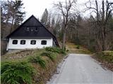 2
2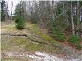 3
3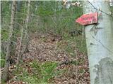 4
4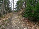 5
5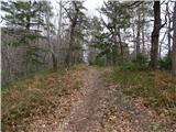 6
6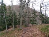 7
7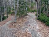 8
8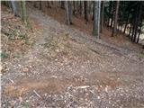 9
9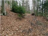 10
10 11
11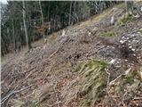 12
12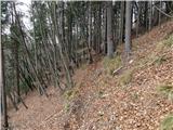 13
13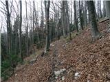 14
14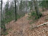 15
15 16
16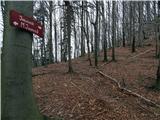 17
17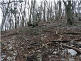 18
18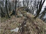 19
19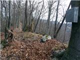 20
20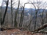 21
21 22
22
Discussion about the trip Zajasovnik - del (Strmce, kapelica) - Jasovnik (Motnik tourist trail)
|
| grega_p22. 01. 2021 |
For access to the starting point from central Slovenia, it's easiest to go down at the Trojane exit, then left on the main road for another km or so and after the bus stop and AC underpass turn left (Kamnik municipality sign). At the long bend then turn left over the bridge and then at the next junction sharply right to the starting point. The road is asphalted and shortens the bend via Ločica by 10min.
Thanks for the path description and idea, but it seems to me that the path is quite easy orientation-wise. It's marked, some markings are faded, otherwise it leads quite easily to the top. The junctions are logical, always upwards.
In picture 10 there is a marking (even though it says they are not visible), picture 12 in reality (at least currently) is not a junction, as it's the only path.
Up top I think you can't get lost, as stated, because the path logically brings you to the ridge.
These remarks are meant only as a correction so as not to deter anyone from this nice trip, as it's not demanding orientation-wise, it's easily accessible and with my very moderate pace achievable in half an hour (the described 45min would be with little Jasovnik).
Best regards, Grega
p.s. today there were two beautiful wood grouse on the path, a beautiful wonder of nature in special slow movement and wild colors.
|
|
|
To post a comment you must log in:
If you do not yet have a username, you must first
register.