Zajzera - Monte Nabois grande
Starting point: Zajzera (897 m)
| Latitude/Longitude: | 46,46841°N 13,49213°E |
| |
Walking time: 4 h 30 min
Difficulty: very difficult marked way
Elevation gain: 1416 m
Elevation difference along the route: 1430 m
Map: Julijske Alpe - zahodni del 1:50.000
Recommended equipment (summer): helmet, self belay set
Recommended equipment (winter): helmet, self belay set, ice axe, crampons
Views: 24.524
 | 3 people like this post |
Access to starting point:
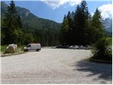
Through the border crossing Predel or Rateče we drive to Trbiž / Tarvisio. Further, we drive on the old road towards Videm / Udine. Already after a few kilometers from Trbiž / Tarvisio, the road into Ovčja vas / Valbruna branches off to the left. In Ovčja vas / Valbruna we turn left and follow the road ahead through the Zajzera valley upwards. After a few kilometers of driving, we come to a crossroads at the bridge above the road (at the second bridge). Here we turn left in the direction of the marks for Svete Višarje / Monte Lussari and then already after a few meters of driving, we turn right onto a large parking lot where we park.
Route description:
At the end of the parking lot, we head onto a cart track which after a few tens of meters joins the road. We continue left over the bridge and follow the road to a crossroads where we head right following the signs »616 Rifugio Pellarini«. For some time we then walk by the river and soon join the mountain road. We continue left on the mountain road on which we then ascend for a long time. All the time while walking on the road we follow the signs for path 616 and hut Rifugio Pellarini.
At approximately half of the ascent on the road, a very demanding path to Mali Nabojs (Piccolo Nabois) branches off to the right. We continue on the road all the way to the end, where there is the lower station of the cargo cableway. We continue slightly right on a cart track which quickly turns into a footpath. The path then turns to the left and starts ascending on a somewhat steeper slope below the cableway. We ascend mostly through the forest towards the east, occasionally a nice view of the surrounding peaks opens up to us. Such a path brings us to a marked junction where we continue right following the signs Rif. Pellarini (20 min), left leads path 617 to Svete Višarje (4 hours).
The path soon brings us out of the forest onto scree from where a very nice view towards Viš opens up to us. Here the path turns to the right and follows the last ascent to hut Pellarini.
From the hut we continue on path 616, which already after a few tens of meters brings us to a junction. We continue right following the signs Sella Nabois (Škrbina Nabojsa), left leads the path towards Žabniška škrbina (Sella Carnizza). The path then leads us across the wide bed of a torrent to the right side of the valley, where we soon come to a new junction. We continue straight following the signs Grande Nabois via normale, right leads the ridge path to Veliki Nabojs.
We continue ascending on the right side of the valley past increasingly sparse dwarf pines and larches. The path then brings us to yet another junction where path Gola Nordest to Viš branches off to the left. We continue ahead through the valley and start ascending on the scree below the sheer walls of Viš towards Škrbina Nabojsa.
A little before the notch we leave the scree and already slightly faded blazes direct us right upwards. The initial ascent is quite steep but does not cause major difficulties, as steps are carved into the rock. Later when the path brings us to somewhat more grassy terrain, the path turns to the left. In the continuation during the ascent we cross the slopes towards the west, then the path turns to the right and starts ascending on an even somewhat steeper slope. Here the ridge path joins us unnoticeably from the right side.
The path continues to lead us up the steep slope. The last ascent towards the summit becomes very demanding, and the path on this section is secured with a steel cable.

Photos:
 1
1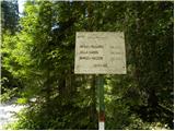 2
2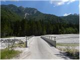 3
3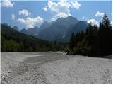 4
4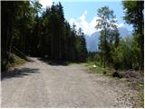 5
5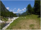 6
6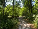 7
7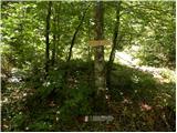 8
8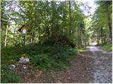 9
9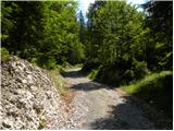 10
10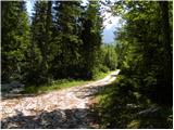 11
11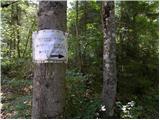 12
12 13
13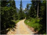 14
14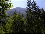 15
15 16
16 17
17 18
18 19
19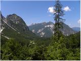 20
20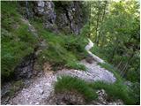 21
21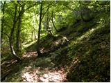 22
22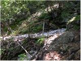 23
23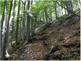 24
24 25
25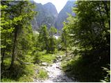 26
26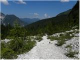 27
27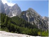 28
28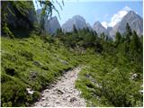 29
29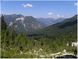 30
30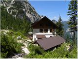 31
31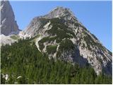 32
32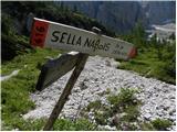 33
33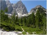 34
34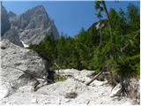 35
35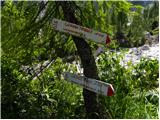 36
36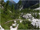 37
37 38
38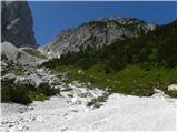 39
39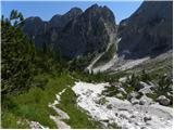 40
40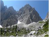 41
41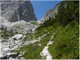 42
42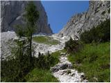 43
43 44
44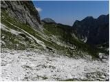 45
45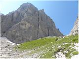 46
46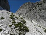 47
47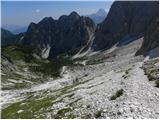 48
48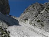 49
49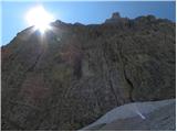 50
50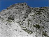 51
51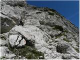 52
52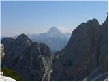 53
53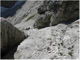 54
54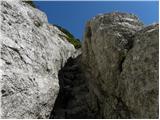 55
55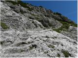 56
56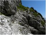 57
57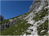 58
58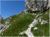 59
59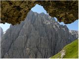 60
60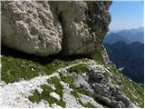 61
61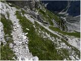 62
62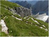 63
63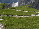 64
64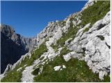 65
65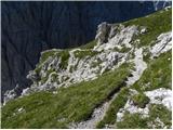 66
66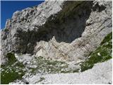 67
67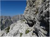 68
68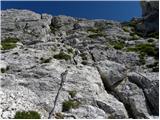 69
69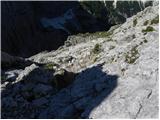 70
70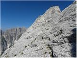 71
71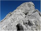 72
72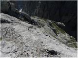 73
73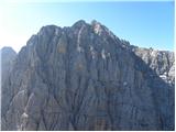 74
74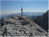 75
75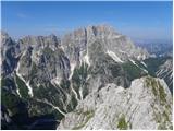 76
76
Discussion about the trip Zajzera - Monte Nabois grande
|
| falcon14. 03. 2011 |
Beautiful summer tour, in the initial part from the parking lot to the freight cableway, otherwise somewhat stretched. From there pure pleasure. To Koča Pellarini (they brew excellent cappuccino), then under the wall of Viš, where I still encountered a herd of chamois, almost to the saddle, then the "steps" and finally more demanding to the summit. otherwise somewhat stretched. From there pure pleasure. To Koča Pellarini (they brew excellent cappuccino), then under the wall of Viš, where I still encountered a herd of chamois, almost to the saddle, then the "steps" and finally more demanding to the summit. On the return, the valley path from the cableway to the parking lot was always superfluous. Beautiful tour, magnificent views, worth the effort. On the return, the valley path from the cableway to the parking lot was always superfluous. Beautiful tour, magnificent views, worth the effort.
|
|
|
|
| Jure S.7. 08. 2012 |
In my opinion it's not worth carrying a complete self-protection kit, as there are only a couple of pegs at the top, otherwise nothing. I regretted having it with me.
|
|
|
|
| gorskarozica13. 08. 2012 |
Nice path, suitable for descent to make the tour more varied. Recommend ascent via the ridge path.
|
|
|
|
| valerija1123. 08. 2013 |
Today in pleasant company we walked this tour. To the hut nicely in the shade, in the hut really good cappuccino.
Further on, the altitude and light breeze took care that the heat didn't cause us major problems.
So another unforgettable trip behind us. I recommend you go to these parts. Best regards
|
|
|
|
| gorski svizec21. 07. 2016 |
I'm curious if there are any special features on the path to the mountain?
|
|
|
|
| malimiha21. 07. 2016 |
No peculiarities. Hiked 14 days ago. Regards
|
|
|
|
| VanSims2. 07. 2017 |
The route could easily be just 'difficult'. That steep section at the beginning is greatly eased by bolted steps. The chains before the summit are exposed but apart from needing to pull a bit harder on them in places, there's no issue.
Koča Pellarini is closed this season because - they can't find a caretaker...
|
|
|
|
| bbugari114. 07. 2022 23:12:15 |
On the initiative of a Ločanka friend, I did a three-day hike around Zajzera for the weekend. Day 1: Ovcja vas-Pl. Ravna (Zita chapel)-Poldasnja spica-Rudni vrh-Grego hut-Krniška glavica-Stuparich bivouac-Mazzeni bivouac. Day 2: Mazzeni bivouac-V. Nabojs-Pellarini hut-Žabniška skrbina-Carnizza bivouac. Day 3: Carnizza bivouac-Prašnik saddle-Kamniti lovec-road-Ovcja vas.
Huts clean and empty, Stuparich bivouac tidy, Mazzeni bivouac hmmmmmmmm, Carnizza bivouac like hotel...
Signposts completely destroyed, paths well marked, new fixed protections OK, but unfortunately unprotected hard scramble up gully to Poldasnja spica and short annoying section down from Stuparich.
Some signposts really odd: old sign at Grego hut (Mazzeni bivouac 3h!?!), old at Pellarini hut (Stuparich bivouac 5h!?!) and new at Prašnik saddle (Kamniti lovec 3.45h!?!?!?).
Below Mazzeni bivouac still marked path to Škrbina prednje špranje, but isn't it closed (not on new Italian maps due to dangerous landslide)?
Zajzera aka Špranja really wonderful, beautiful landscape!!!
Trail from Stuparich to Mazzeni wild and overgrown, yet well marked and followable.
On ascent from Pellarini to Žabniška skrbina section of path rebuilt (and secured) due to landslide.
Junction to path 615 below Lastovicami unmarked!
|
|
|
|
| MPS17. 02. 2023 10:28:48 |
In October I ascended Veliki Nabojs via this path. I would say that in the lower part it is also possible to go via a different and interesting path that goes through the forest. The path is marked with red dots and well followable. It joins the above-described path approx. 100 m before the hut. I also recorded a short video from the hike, which you can view at the link: Veliki Nabojs, 2313 m
I hope it will be helpful to someone in presenting the path itself.
Safe steps, Mirko
|
|
|
To post a comment you must log in:
If you do not yet have a username, you must first
register.