Zajzera - Rifugio Pellarini
Starting point: Zajzera (897 m)
| Latitude/Longitude: | 46,46841°N 13,49213°E |
| |
Walking time: 2 h
Difficulty: easy marked way
Elevation gain: 602 m
Elevation difference along the route: 610 m
Map: Julijske Alpe - zahodni del 1:50.000
Recommended equipment (summer):
Recommended equipment (winter):
Views: 12.993
 | 1 person like this post |
Access to starting point:
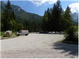
Through the border crossing Predel or Rateče we drive to Trbiž / Tarvisio. Further we drive on the old road towards Videm / Udine. Already after a few kilometers from Trbiž / Tarvisio, the road into Ovčja vas / Valbruna branches off to the left. In Ovčja vas / Valbruna we turn left and follow the road ahead through the valley of Zajzera upwards. After a few kilometers of driving, we come to a junction at the bridge above the road (at the second bridge). Here we turn left in the direction of the signs for Svetih Višarij / Monte Lussari and then already after a few meters of driving we turn right onto a large parking lot where we park.
Route description:
At the end of the parking lot, we head onto the cart track which after a few dozen meters joins the road. We continue left over the bridge and follow the road to a junction where we turn right following the signs »616 Rifugio Pellarini«. For some time we then walk along the river and soon join the mountain road. We continue left on the mountain road up which we then ascend for a long time. All the time while walking on the road we follow the signs for path 616 and hut Rifugio Pellarini.
At approximately half of the ascent on the road a very demanding path to Mali Nabojs (Piccolo Nabois) branches off to the right. We continue on the road all the way to the end, where there is the bottom station of the cargo cableway. We continue slightly right on a cart track which quickly turns into a footpath. The path then turns to the left and starts ascending on a somewhat steeper slope below the cableway. We ascend mostly through the forest towards the east, occasionally a nice view also opens up on the surrounding peaks. Such a path brings us to a marked junction where we continue right following the signs Rif. Pellarini (20 min), left leads path 617 to Svete Višarje (4 hours).
The path further soon brings us out of the forest onto the scree from where a very nice view opens up towards Viš. Here the path turns to the right and follows the last ascent to hut Pellarini.

Photos:
 1
1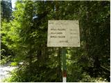 2
2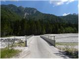 3
3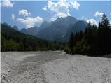 4
4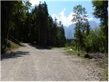 5
5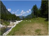 6
6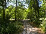 7
7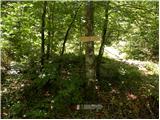 8
8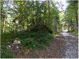 9
9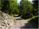 10
10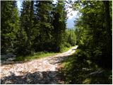 11
11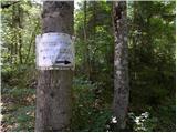 12
12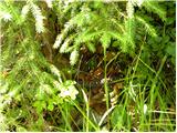 13
13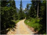 14
14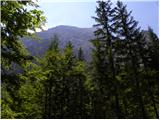 15
15 16
16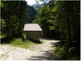 17
17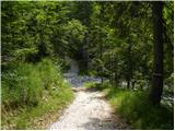 18
18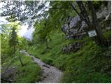 19
19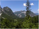 20
20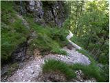 21
21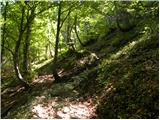 22
22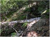 23
23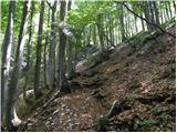 24
24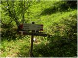 25
25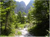 26
26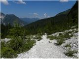 27
27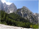 28
28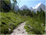 29
29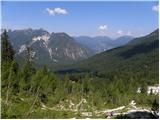 30
30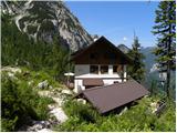 31
31
Discussion about the trip Zajzera - Rifugio Pellarini
|
| slavkoo7. 08. 2013 |
Beautiful summer tour, in the initial part from parking to the goods cable car somewhat elongated. From there on pure pleasure. To Pellarini hut (they make excellent cappuccino), then under the wall of Viš, where I still met a herd of chamois, almost to the saddle, then on the "steps" and at the end more demanding to the summit. On the descent the valley path from cable car to parking was always superfluous to me. Beautiful tour, magnificent views, worth the effort.
Jure S.
7.8.2012 Complete self-belay kit in my opinion not worth carrying, because only at the top a couple of clips, otherwise nothing. I regretted having it with me.
gorskarozica
13.8.2012 Nice path, suitable for descent to make the tour more varied. Recommend ascent via ridge path.
valerija112
3.8.2013 Today in pleasant company we did this tour. To the hut nicely in the shade, in the hut really good cappuccino.
Further altitude and light breeze took care that the heat didn't cause us much trouble.
So another unforgettable trip behind us. I recommend you go to these parts. Nice greetings
|
|
|
|
| slavkoo7. 08. 2013 |
Everything holds true: nice tour, now in hellish heat in the valley real refreshment. Pleasant service by the Slovenian-speaking girl from Milje near Trieste, cappuccino really super.
|
|
|
|
| VanSims1. 07. 2017 |
Rifugio Pellarini is closed for the entire season this year!
|
|
|
|
| TanjaM12. 08. 2017 |
The hut is open from 1 August onwards.
|
|
|
|
| VanSims23. 12. 2017 |
They have finally found a caretaker.
|
|
|
To post a comment you must log in:
If you do not yet have a username, you must first
register.