Zalog - Polhograjska Gora (Sveti Lovrenc) (gentle path)
Starting point: Zalog (448 m)
| Latitude/Longitude: | 46,06640°N 14,27780°E |
| |
Route name: gentle path
Walking time: 1 h 30 min
Difficulty: easy marked way
Elevation gain: 376 m
Elevation difference along the route: 400 m
Map: Ljubljana - okolica 1:50.000
Recommended equipment (summer):
Recommended equipment (winter): crampons
Views: 5.247
 | 1 person like this post |
Access to starting point:
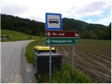
From the highway Ljubljana - Koper, take the Brezovica exit, then continue driving in the direction of Dobrova (to Dobrova we can also come from the direction of Šentvid, namely through Podutik and through the mountain pass Preval) and Polhov Gradec. In Polhov Gradec at the bus stop, we continue right towards Črni Vrh. The road further steeply ascends, then flattens and leads us through the castle yard. A quite gentle road then leads us through the valley of Velika Božna, and we drive there to the hamlet Zalog, where we notice signs for Sveti Jurij and Polhograjska Gora, which point us to the left. At the mentioned crossroad, our path begins, and because there aren't any arranged parking spots here, we have to park a little lower on one of the appropriate places by the road.
Route description:
From the starting point, that is from the crossroad where we notice signs for the church of St. Jurij and Polhograjska Gora, we head onto a side road (by the crossroad there are also signs for the village Praproče), which first leads past a few houses, then starts moderately ascending. At first a nice view also opens towards our goal, then the view is limited more to the west and north, where we nicely see the church of St. Lenart above Črni Vrh. The road, which is on parts quite panoramic, brings us higher into the village Praproče, and we, a few meters before the triangular crossroad by which there are numerous hiking signposts, turn sharply left onto a cart track that starts still before the first house in the village (the path beginning is not marked, and also further on the blazes are very rare or almost nonexistent).
The cart track first runs across a meadow, then passes into the forest through which it slightly ascends and occasionally descends. Higher the cart track becomes steeper and passes to the northern side of Praproški grič (709 m). A few minutes of moderate ascent follow, then we arrive at the saddle between the already mentioned summit on the right and Polhograjska Gora (824 m) on the left.
On the saddle we join the path from Praproče or Briš, we a few steps further arrive at the ramp.
We continue in the direction of sv. Lovrenc (left upward sv. Lovrenc "demanding path") along the road across which there is a barrier. The road then starts to ascend more steeply and after a few minutes of further walking brings us to a larger rocky section (mainly after rain or at the end of winter there is danger of falling rocks). Here the road flattens for a short time, then passes into the forest where it starts steeply ascending. The steepness eases at Logar, where the road also ends. Here a nice view opens towards a part of the Karawanks, we continue slightly left and continue the ascent past the chapel on the path that goes into the forest. A moderate ascent through the forest follows and the path brings us to the ridge from which a nice view opens towards the west. Here we continue left and after a few steps of further walking we step onto the summit of Polhograjska Gora.

Photos:
 1
1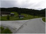 2
2 3
3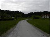 4
4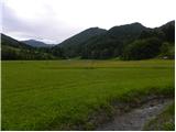 5
5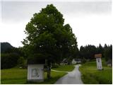 6
6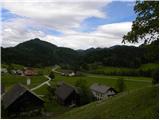 7
7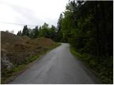 8
8 9
9 10
10 11
11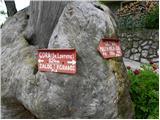 12
12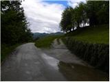 13
13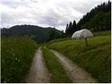 14
14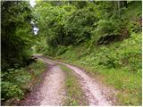 15
15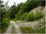 16
16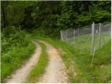 17
17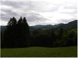 18
18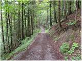 19
19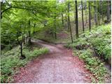 20
20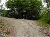 21
21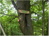 22
22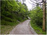 23
23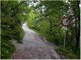 24
24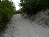 25
25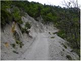 26
26 27
27 28
28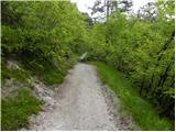 29
29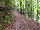 30
30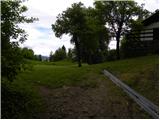 31
31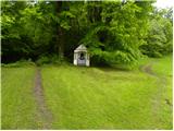 32
32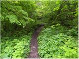 33
33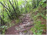 34
34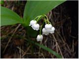 35
35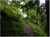 36
36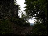 37
37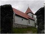 38
38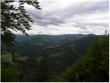 39
39 40
40
Discussion about the trip Zalog - Polhograjska Gora (Sveti Lovrenc) (gentle path)
To post a comment you must log in:
If you do not yet have a username, you must first
register.