Zalog - Storžič (below Psica and through southwest groove)
Starting point: Zalog (600 m)
| Latitude/Longitude: | 46,32810°N 14,36300°E |
| |
Route name: below Psica and through southwest groove
Walking time: 4 h 40 min
Difficulty: easy marked way
Elevation gain: 1532 m
Elevation difference along the route: 1610 m
Map: Karavanke - osrednji del 1:50.000
Recommended equipment (summer):
Recommended equipment (winter): ice axe, crampons
Views: 4.700
 | 1 person like this post |
Access to starting point:
From the Ljubljana - Jesenice motorway, take the Kranj west exit and continue following the road towards Golnik. Shortly after the village of Tenetiše, we will notice signs for the village of Goriče, which direct us right onto a local road. A little further ahead, we reach the next junction, where we continue right towards the villages of Trstenik and Preddvor. We do not follow this road for long either, as after just a few metres we will notice a sign reading Zalog, which directs us left onto an ascending road, which we then follow to the mentioned village. In the middle of the village, slightly before the church, we will notice a road that turns right from the main road. Head onto this road, along which we soon notice the markings. Follow this road for another approximately 1 km, then park at one of the parking areas along the road.
Route description:
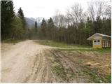
From the starting point we continue along the road next to which we parked; it becomes increasingly worse and leads us higher to the NOB monument, where we leave it and continue the ascent to the right along an ascending cart track. At the place where the cart track along which we continue the ascent turns left, we will notice a small path on the right side that begins to ascend more steeply through the forest (the start is not marked).
The path, along which we notice sparse markings, then takes us past a small chapel to a poorly marked junction, next to which on a scenic rise we notice a pleasant bench.
From the viewpoint we continue along the path that ascends slightly to the right (left Mala Poljana) and enters the forest after just a few steps, where it begins to ascend steeply. The path soon crosses onto a wide overgrown ridge, along which it then continues for quite some time.
The relatively steep path, which higher up turns somewhat to the right, then brings us after a while to a wide cart track, where we join the path from Povelj.
We continue straight along the ascending cart track, which takes us past the “refreshment stand” to the place where a marked hiking path branches off to the left from the cart track. We can continue the ascent along the mentioned hiking path, which ascends over grassy slopes, or along the cart track, which ascends along the edge of the forest. Both paths merge higher up and bring us without difficulty to the hut on Velika Poljana.
From the hut we continue along a gentle path that ascends across the pasture and brings us in 5 minutes to the saddle between Grebenc and Psica, where there is also a marked junction. We continue right into the forest along the path towards Storžič over Psica (left Mala Poljana). The path begins to ascend quite steeply, then turns slightly to the right and the gradient eases somewhat. This path soon brings us out of the forest and to the path junction under Psica.
At the mentioned junction a very demanding path continues left along the Psica ridge, while we continue right towards the easier path to Storžič. From the junction onwards the path descends transversely several times and ascends again, leading us along the slopes of Psica, from which we occasionally get some views; otherwise, the first part of the traverse mostly runs through the forest. After a further 30 minutes of walking we arrive at a junction where the traverse ends, and we join the path that leads to Storžič through the southwest groove.
We follow the mentioned path left upwards (right downwards Planina Javornik, Povlje; we can also reach the hamlet of Laško and the village of Bašelj) and begin to ascend steeply along the path that leads through the southwest groove of Storžič. We ascend through the mentioned groove, from which we get increasingly beautiful views towards Gorenjska, for another good hour, after which the path turns somewhat to the right and brings us to the southwest ridge of Storžič, where an unmarked path joins us from the right that leads along the mentioned ridge.
We continue along the ridge; the marked path then turns slightly to the right and soon other paths from Dom pod Storžičem and Kališča join us. From here to the summit, which we already see ahead of us, there follows only a short ascent amid wonderful views.
Starting point - Gmajna 0:45, Gmajna - second refreshment stand 0:50, second refreshment stand - Velika Poljana 0:30, Velika Poljana - junction under Psica 0:35, junction under Psica - junction in southwest groove 0:40, junction in southwest groove - Storžič ridge 1:05, Storžič ridge - Storžič 0:15.

Along the route: Velika Poljana (634m), Gmajna (840m), Andrejeva klopca (977m), Druga okrepčevalnica (1198m),
Velika Poljana (1385m), Sedlo nad Veliko Poljano (1406m), Razpotje pod Psico (1595m), Razpotje v jugozahodnem žlebu (1622m), Razpotje na grebenu Storžiča (2048m), Razpotje pod vrhom Storžiča (2114m)
Photos:
 1
1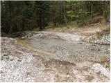 2
2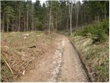 3
3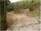 4
4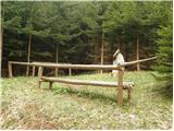 5
5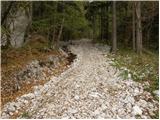 6
6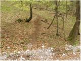 7
7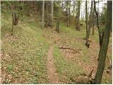 8
8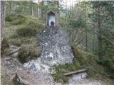 9
9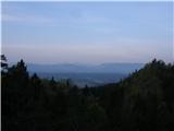 10
10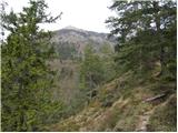 11
11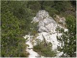 12
12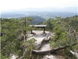 13
13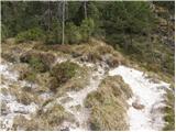 14
14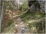 15
15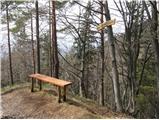 16
16 17
17 18
18 19
19 20
20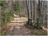 21
21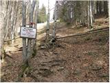 22
22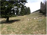 23
23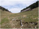 24
24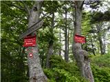 25
25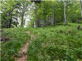 26
26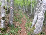 27
27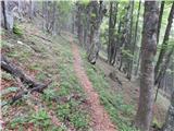 28
28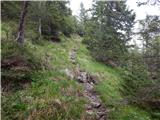 29
29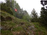 30
30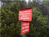 31
31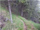 32
32 33
33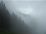 34
34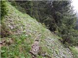 35
35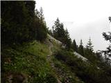 36
36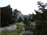 37
37 38
38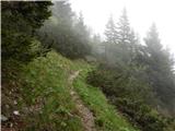 39
39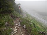 40
40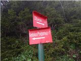 41
41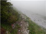 42
42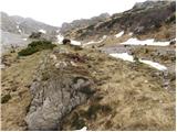 43
43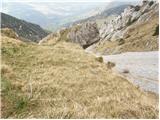 44
44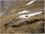 45
45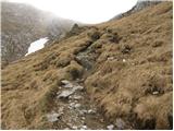 46
46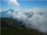 47
47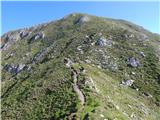 48
48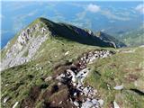 49
49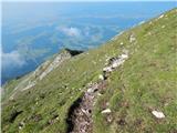 50
50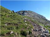 51
51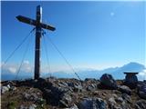 52
52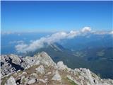 53
53 54
54
Discussion about the trip Zalog - Storžič (below Psica and through southwest groove)
|
| Daaam22. 06. 2016 |
I don't want to be disrespectful to the author of the recent Storžič descriptions, but I would question the point of making those descriptions that are all already in the database, only the combinations are different. Because that way you can create another 50 trips just for Storžič.
|
|
|
To post a comment you must log in:
If you do not yet have a username, you must first
register.