Zaplana (Jamnik) - Vranje pečine (Rajna peč)
Starting point: Zaplana (Jamnik) (640 m)
| Latitude/Longitude: | 45,97990°N 14,24300°E |
| |
Walking time: 40 min
Difficulty: easy marked way
Elevation gain: 2 m
Elevation difference along the route: 50 m
Map:
Recommended equipment (summer):
Recommended equipment (winter):
Views: 2.385
 | 1 person like this post |
Access to starting point:
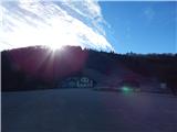
a) First, drive to Vrhnika, then continue driving towards Horjul. Shortly after Stara Vrhnika, we quickly arrive at a junction, where we continue left towards Zaplana. Then drive along the ascending road, following it to the large parking lot at the foot of the former Ulovka ski slope, where we park.
b) From the Old Vrhnika - Logatec road, drive to Zaplana and pass by the parish church of St. Urh and St. Martin. A little further, at the next junction, continue right towards Vrhnika (left Rovte), then drive to the large parking lot at the foot of the former Ulovka ski slope, where we park.
Route description:
From the parking lot, continue along the road northwestwards (if arrived at the starting point via description a, continue straight ahead on the road; if via description b, return along the road in the direction of approach to the starting point), where we soon reach the settlement of Jamnik. Upon reaching a somewhat larger junction, continue slightly right towards Rovte (left is a road sign for Zaplana) and immediately after the junction arrive at the settlement of Mizni dol. In Mizni dol, continue right, then at the log cabin at Janez's, where there is also a stamp (the log cabin is to the right of the marked path), continue along the slightly left road leading further towards Rovte and Raztovke. Walk along the asphalt road to a chapel a few minutes away, from there go slightly right onto a gravel road that leads us along a pasture. The gravel road descends slightly further on and turns into a cart track, along which we ascend more steeply for a few minutes. When the path turns right, it levels out, then at the NOB monument turns left and begins to descend. Lower down, the path leads between two sinkholes, after which it turns right and ascends in about 10 steps to the large cross on Vranja pečina, from where a beautiful view opens up.
The description and photos refer to the conditions in 2016 (December).

Photos:
 1
1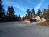 2
2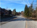 3
3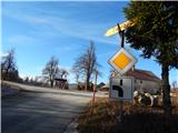 4
4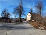 5
5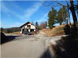 6
6 7
7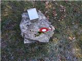 8
8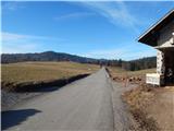 9
9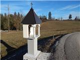 10
10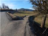 11
11 12
12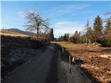 13
13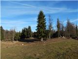 14
14 15
15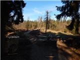 16
16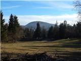 17
17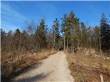 18
18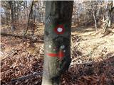 19
19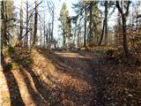 20
20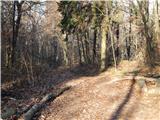 21
21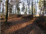 22
22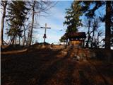 23
23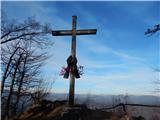 24
24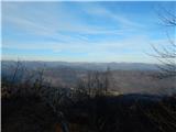 25
25
Discussion about the trip Zaplana (Jamnik) - Vranje pečine (Rajna peč)
|
| grega_p20. 01. 2021 |
Rajna Peč today offered a view only to Trčkov Grič below, everything else was hidden behind mists.
Nice little house/stage up there, useful in the rain. And nicely carved hands by the cross - a lot of chiseling.
|
|
|
To post a comment you must log in:
If you do not yet have a username, you must first
register.