Žarovnica - Ravna Gora (Babice)
Starting point: Žarovnica (240 m)
Route name: Babice
Walking time: 1 h 30 min
Difficulty: easy marked way
Elevation gain: 454 m
Elevation difference along the route: 460 m
Map:
Recommended equipment (summer):
Recommended equipment (winter):
Views: 3.471
 | 1 person like this post |
Access to starting point:
a) We arrive in Croatia via the Gruškovje / Macelj border crossing, then continue driving towards Trakošćan and the town of Lepoglava. In Lepoglava, at the gas station, continue straight towards Višnjica and Klenovski (right to Lepoglava center and Varaždin). Continuing, we will reach the villages of Vulišinec and Kamenički Vrhovec. When we arrive at the sign indicating the start of the settlement Žarovnica, turn left at the intersection towards Kamenica. Continue through Kamenica, then arrive again in Žarovnica. There are two intersections here, and we park near the second one (on the right side there is a tinsmith's shop and there are always many old vehicles nearby).
b) From the direction of Prekmurje, we first drive to Varaždin, from there continue towards Ivanca. At the end of Ivanca, we arrive at Lepoglava, where we turn right towards Trakošćan immediately after the bridge over Bednja, right towards Višnjica and Klenovnik. Then as in the above description.
Route description:
The trail officially starts at the railway station in Lepoglava, but from there to "our" starting point it is 3 hours of walking on an asphalt road.
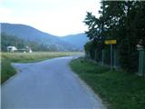
We will start the trail in the village of Žarovnica, where at the second intersection from the direction of Kamenica we will spot white mountaineering markers. From here we go left towards Glažari and Golubi and arrive at a small bridge, where there are also some suitable parking spots. After crossing the small bridge we are in the village of Kameničko Podgorje, and the asphalt path begins to ascend through the village. When the asphalt road starts to descend we continue right into the forest. Through the forest we first walk on a wider gravel road, then from the first junction continue on a narrower track, where the path becomes steeper. Higher up the track turns into a trail, which leads us to the rocky section of Babice. The rocky section is technically not demanding, but dangerous for slipping when wet. At the top of this section there is a junction, where a path branches left to the viewpoint Glažareva pećina, we continue straight upwards (downwards to the Babice rock - not marked).
From the junction we ascend relatively steeply for some time, then the path levels out and leads us to an often quite muddy cart track. We walk on the cart track for a short time, then arrive at a wider gravel road, where the Lapornjak path joins almost imperceptibly from the right.
We will walk some tens of meters on the road, then continue left into the forest, where we reach another branch to the viewpoint Glažareva pećina (the branch is suitable for those who came via the Lapornjak path). We ascend quite steeply for some time, then past an animal feeding spot and hunting observation post arrive back on the road, on which we will then walk for some time. From the road soon another path branches off to the already twice-mentioned viewpoint. A bit further we reach a long bend after which we come to the ridge of Ravna Gora. We walk along the road to one of the belts of coniferous forest, where the markers lead us left. From here we will walk for some time on a narrower trail that continues along the eastern slope just a few meters below the ridge. We continue through the forest, then arrive at a clearing, where the trail is more overgrown. From here a nice view opens to the north, where we see Ptujsko polje and to the east, where the view reaches all the way to Hungary. At the end of the clearing there is another junction, where an educational trail branches off. We continue slightly right and after a few minutes arrive at the Balkon viewpoint, from where it is another minute's walk to the Krešimir Filić mountain hut, from there 5 minutes past the paraglider take-off site to the summit.

Photos:
 1
1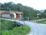 2
2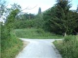 3
3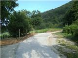 4
4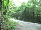 5
5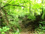 6
6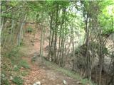 7
7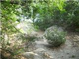 8
8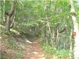 9
9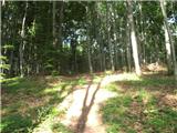 10
10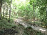 11
11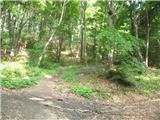 12
12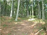 13
13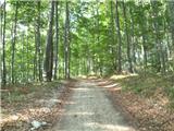 14
14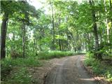 15
15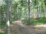 16
16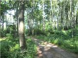 17
17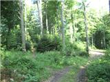 18
18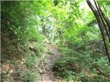 19
19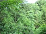 20
20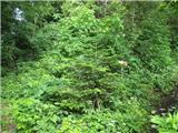 21
21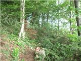 22
22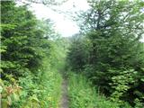 23
23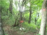 24
24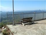 25
25 26
26 27
27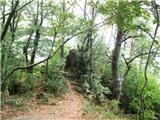 28
28
Discussion about the trip Žarovnica - Ravna Gora (Babice)
To post a comment you must log in:
If you do not yet have a username, you must first
register.