Zavrh pri Trojanah - Reber
Starting point: Zavrh pri Trojanah (609 m)
| Latitude/Longitude: | 46,18380°N 14,87180°E |
| |
Walking time: 45 min
Difficulty: easy marked way
Elevation gain: 269 m
Elevation difference along the route: 269 m
Map:
Recommended equipment (summer):
Recommended equipment (winter): crampons
Views: 12.783
 | 2 people like this post |
Access to starting point:
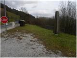
A) From the highway Ljubljana - Maribor, we take the exit Blagovica, then continue driving on the parallel old road towards Trojane. Before we arrive at Trojane, signs for Zavrh pri Trojanah point us to the right onto a narrower local road, beside which we notice signposts for Doline and Stolp na Rebri. We can park already near the intersection, more precisely beside the nearby monument, or we can drive a little higher and then park on a suitable spot beside the road.
B) From the highway Maribor - Ljubljana, we take the exit Trojane, then continue driving on the parallel old road towards Domžale. At the end of Trojane, in the middle of the right bend, signs for Zavrh pri Trojanah point us to the left onto a narrower local road, beside which we notice signposts for Doline and Stolp na Rebri. We can park already near the intersection, more precisely beside the nearby monument, or we can drive a little higher and then park on a suitable spot beside the road.
Route description:
From the starting point, we continue on a narrower asphalt road, from which soon a nice view opens up on Trojane. Higher, the asphalt ends, and we continue on a macadam road in the direction towards Reber, Doline and Golčaj. Only a little further, the road turns to the right and passes into the forest, through which it starts ascending steeper. After a good 10 minutes of additional walking, the road flattens and brings us to an intersection, by which there is a smaller sign.
Here we continue slightly left (slightly right Doline) and continue on a moderately ascending road, on which we quickly arrive at the next junction at a larger quarry.
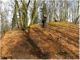
Here we continue sharply left in the direction of Reber (left downwards Kolovrat, straight hamlet of some houses, right downwards Golčaj) on the path which continues on a relatively steep cart track. On the mentioned cart track we walk only some 10 m, then blazes point us to the right on a marked footpath which starts ascending through the forest. A relatively steep path brings us higher on a forested ridge, on which we soon reach two forepeaks, and after a further shorter ascent also the peak Reber, on which stands a wooden lookout tower.

Photos:
 1
1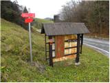 2
2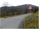 3
3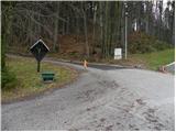 4
4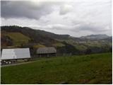 5
5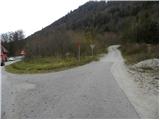 6
6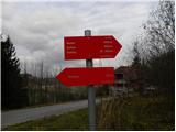 7
7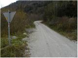 8
8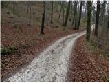 9
9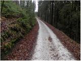 10
10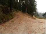 11
11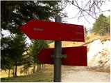 12
12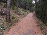 13
13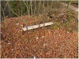 14
14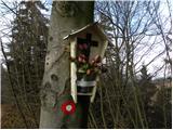 15
15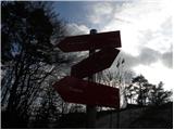 16
16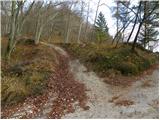 17
17 18
18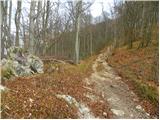 19
19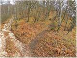 20
20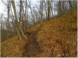 21
21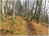 22
2223
 24
24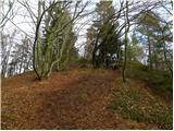 25
25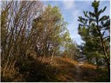 26
26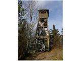 27
27 28
28 29
29
Discussion about the trip Zavrh pri Trojanah - Reber
|
| grega_p1. 11. 2014 |
Nice hike with easy access, which can also be shortened at will, as you can drive by car all the way to the quarry.
We also have the option to turn sharply left at the first junction (picture 11) and head straight uphill - this shortens the detour offered by the marked path.
The views are beautiful in all directions, from the Posavje hills (Kum, Zasavska gora, Cicelj...) to the Kamnik Alps (especially the Grintavec ridge gains its significance).
If you detour to Trojane after descending, I recommend the gibanica, which is really incredible...
|
|
|
|
| bruny1. 11. 2014 |
I don't know  why shortcuts. Personally, I started the path at Konšak, the hotel in Trojane, otherwise the road is a bit tricky because there is no sidewalk. Best to activate the old good SCT, maybe there are still some healthy kernels in the bankruptcy mass or the Italian Impresa Grassetto, if it still exists, which built the Trojane tunnels. There is a quarry and ,,by the way,, they make an extension of the highway to the quarry and maybe additionally with annexes even a funicular or gondola to the viewpoint tower - all for easier, simple access... All together with credits indirectly to public debt and that's it. why shortcuts. Personally, I started the path at Konšak, the hotel in Trojane, otherwise the road is a bit tricky because there is no sidewalk. Best to activate the old good SCT, maybe there are still some healthy kernels in the bankruptcy mass or the Italian Impresa Grassetto, if it still exists, which built the Trojane tunnels. There is a quarry and ,,by the way,, they make an extension of the highway to the quarry and maybe additionally with annexes even a funicular or gondola to the viewpoint tower - all for easier, simple access... All together with credits indirectly to public debt and that's it.
More as a joke than seriously. I agree with the gibanica, it's good...
|
|
|
|
| grega_p1. 11. 2014 |
The shortcut is of course a choice that warms us up more on cold days, as it is steeper - and it also passes by a nice hunting observation post.
Otherwise (as in life too), every path is the right one on which we enjoy...
|
|
|
|
| bruny2. 11. 2014 |
It is incorrect to "promote" the official path description with some quasi-shortcuts. No problem, of course they are used, there is no need to publish them publicly and I emphasize this again in the official path description. The response regarding the hunting observation post is also rather so-so. They are often erected in some agreement between the actors, especially along hiking trails, so that everyone is somewhat satisfied... both hikers and hunters, and above all it concerns wildlife.
If it were stated in the conditions, I wouldn't comment, also basically free movement is allowed except where explicitly restricted or prohibited.
Regarding warming up, it is also part of the Rokovnjaška hiking trail among other things, one could extend it and certainly warm up well over good 50 kilometers along the entire possible route...
|
|
|
|
| bruny31. 12. 2019 |
Ascent and descent along the described path today on St. Sylvester's Day. The viewpoint tower is closed due to dilapidation. It was sometime around noon...
|
|
|
|
| mirze11. 01. 2023 19:07:48 |
|
|
|
|
| Hribolazec817. 02. 2024 21:40:50 |
bruny, those of us who don't know the path go by those available described here on hribi.net, unfortunately there's no path described from Trojan, and we also avoid unmarked ones because often even the marked ones are very poorly marked 
I haven't been yet, don't know the area, no path description elsewhere, so I'm hesitating between starting points Zavrh pri Trojanah or Kolovrat, which are said to have marked paths
|
|
|
|
| docepe28. 02. 2024 06:20:04 |
From Kolovrat it's not marked, only the junction is marked, but you can't get lost. From Zavrh it is marked, because the European path E6 (red-yellow circles) passes by here.
|
|
|
To post a comment you must log in:
If you do not yet have a username, you must first
register.