Završniško jezero - Smokuški vrh (via Brezniške peči)
Starting point: Završniško jezero (630 m)
| Latitude/Longitude: | 46,40720°N 14,14610°E |
| |
Route name: via Brezniške peči
Walking time: 3 h
Difficulty: partly demanding unmarked way
Elevation gain: 492 m
Elevation difference along the route: 600 m
Map: Karavanke - osrednji del 1:50.000
Recommended equipment (summer): helmet
Recommended equipment (winter): helmet, ice axe, crampons
Views: 37.153
 | 4 people like this post |
Access to starting point:
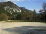
From the Ljubljana - Jesenice motorway, take the Lesce exit, where at the roundabout turn onto the old road towards Žirovnica and Jesenice. After a few km of driving, drive past the junction where the road to Žirovnica branches off to the right. After crossing the Završnica viaduct, notice the turn-off on the right-hand side onto which you turn (sharp right). Immediately encounter a small junction where you go left, at the next one (after approx. 50 m) right, towards Završnica. After a short descent the road rises slightly for a while, then levels out and leads to the place where a gravel road branches off to the left towards Valvasorjev dom. A little further on, on the right notice a large parking lot located at the beginning of the artificial Završnica lake. This is our starting point.
Route description:
From the parking lot head across the concrete bridge spanning the lake. On the other side, notice to the right a forked path leading into the forest. Take the left (upper) one, by which you ascend towards the top of the ridge. The path soon disappears, but head somewhat left towards the top, where eventually you come upon a fairly wide path leading right towards the ridge top. Upon reaching it, a view opens to the other side, where Žirovnica and Moste are located, from where the path also approaches from the south side. Turn left (towards the east) along a pleasant, well-trodden trail on the ridge towards Mali Vrh. Soon a view opens back towards Jesenice to the west, while on the left in the valley you can partially observe the lake in Završnica.
At the signposts continue straight towards Gosjak (right to Sveti Lovrenc). Soon the path descends slightly from the top of Mali Vrh and then levels off for a while. On the right edge of the ridge, beautiful viewpoints occasionally beckon. On the left side of one of them observe interesting cliffs (Peči), past which the path leads on the right side further along the ridge towards the next peak Gosjak. Before ascending to it, come across a landmark (cross) and bench on the left. Here a path from the valley crosses ours, but continue straight along the ridge, where you encounter rocks over which you scramble somewhat and thus first on the left and then on the right side of the ridge climb to the top of Gosjak, where for the first time you see Smokuški vrh somewhat closer. Later on the right notice another viewpoint with a bench located above Doslovče, somewhat further on the left a small hut and then a water reservoir (here a wider path from Doslovče crosses Gosjak). Continue the path steeply uphill to the right of the reservoir, where soon you again encounter rocks over which you partly clamber while ascending the so-called Golovec. You are at the narrowest part of the ridge. The steepness of most of the rocky ridge during the ascent of Golovec eases only 2-3 times slightly, the demanding scenic path finally climbs steeply one last time towards Smokuški Vrh, where first come to a nice bench with a logbook, after a further 15 min of walking where the ridge already widens, then to the trail's endpoint - a scenic point with "benches" on the summit position of the ridge.
During ascent and descent from Gosjak and Golovec, in wet conditions there is a great risk of slipping!

Photos:
 1
1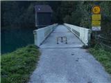 2
2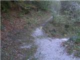 3
3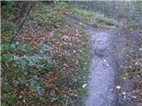 4
4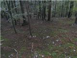 5
5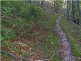 6
6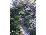 7
7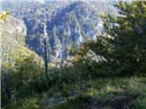 8
8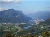 9
9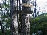 10
10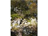 11
11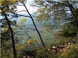 12
12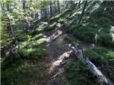 13
13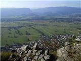 14
14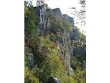 15
15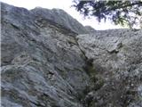 16
16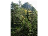 17
17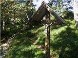 18
18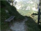 19
19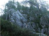 20
20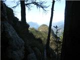 21
21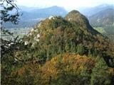 22
22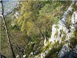 23
23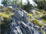 24
24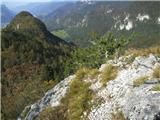 25
25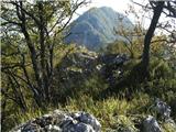 26
26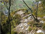 27
27 28
28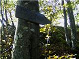 29
29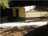 30
30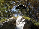 31
31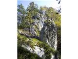 32
32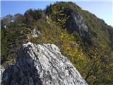 33
33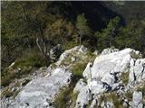 34
34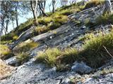 35
35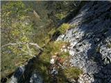 36
36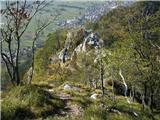 37
37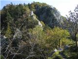 38
38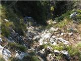 39
39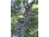 40
40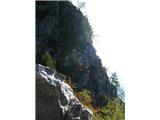 41
41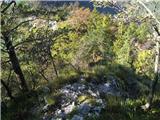 42
42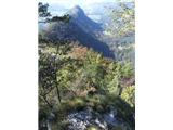 43
43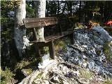 44
44 45
45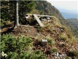 46
46
Discussion about the trip Završniško jezero - Smokuški vrh (via Brezniške peči)
|
| klavdipo5. 04. 2010 |
Is it possible to find a stamp on these peaks too (at least Smokuški vrh)?
Best regards
|
|
|
|
| Gorazd G5. 04. 2010 |
Just now I'm preparing a post about this ridge for gore-ljudje, but unfortunately even with the best will I don't remember if there's a stamp on any peak. Also in my personal logbook nothing is written about it. There are definitely (at least) two logbooks. On the ridge below the highest point (Jecola 1080 m) and at the church of St. Lovrenc below Mali vrh. But I assure everyone that the ridge is interesting enough even without stamps.
Probably heinz will know more 
|
|
|
|
| Parkeljc5. 04. 2010 |
Exactly one month ago I hiked the ridge from the reservoir in Žirovnica to Sv. Peter and descended to Krpin, but I didn't notice a stamp on any peak along the way.
|
|
|
|
| Bojan_A5. 04. 2010 |
I know there's a box with the logbook at the summit with a bench. Whether there's a stamp inside or not, I haven't checked. Stamping means nothing to me. Nice photos and interesting experience mean more to me.
This year I was there in February and covered most of the path in snowshoe running style. But I found the final solution for the return. The problem is that once you're at the end of the ridge you're more or less condemned to the road through Kašarija. Last time I found a path that branches off to the right downhill right after Smokuški vrh. It splits countless times afterwards, but with some sense of orientation (keep to the right and watch not to climb too high again) this path nicely takes you through the forest to the water tower. There go up the stairs, through the small tunnel and right after it along the path to the right, and you're back at the dam in Završnica.
Another variant for the return is descent to Završnica, but I haven't gone there yet.
|
|
|
|
| klavdipo5. 04. 2010 |
Thanks to everyone for the answers!
Best regards
|
|
|
|
| heinz6. 04. 2010 |
A bit late (like some description author) I'm responding, but clearly I'm only first regarding the description.. Everyone wrote just as I would have, namely that this ridge is worth experiencing - even without a stamp.
I believe there are many, many, too many, or huge number of peaks, mountains and plateaus.. not only here - in Slovenia, but all over the world, that don't have stamps, yet they are still and still worth, not just mention, but our visit. The best for me was (certainly) where there were no books and stamps..
The B.P. ridge is one of the simplest goals you can imagine at the moment.
Also one of the most interesting.
Almost the entire description (hope not too extensive yet) is above..
Best regards heinz!
|
|
|
|
| starakapa7. 04. 2010 |
On all the description pictures I noticed that the mentioned peaks are located in the KAMNIŠKO-SAVINJSKE ALPS. Is that true!!!???
Maybe I'm wrong when I think that these peaks are in the KARAVANKE.
best regards Starakapa
|
|
|
|
| Bojan_A7. 04. 2010 |
Yes, you read correctly. That's also what it says on my blog. Brezniške peči are the beginning of the Kamniško-Savinjske Alpe, to which they geologically belong. Only geographers wrongly classify them among the Karavanke.
|
|
|
|
| starakapa7. 04. 2010 |
Thanks, I'm glad I learned something new.
|
|
|
|
| kolobar7. 04. 2010 |
Another descent solution (from today):
Start from Moste, along the ridge to the summit, descent to the east and along the marked path over Tolsti vrh to Poljska planina. From Poljska descent to Tičkova koča, from there to Valvazorjev dom and descent to Završnica and back to Moste.
|
|
|
|
| heinz8. 04. 2010 |
I agree that the start from Most (proximity of the shop and buffet) is even more interesting than the one described above, only with parking space and finding the start of the path (in the street) there might be a problem.
With this variant the walking time extends by about 45 min.
The third option starting from Završnica is to the right back along the ridge (stream on the right) through the small tunnel to the Moste water reservoir (20 min), from where we climb to the ridge and then continue towards Sm. vrh or Sv. Petr...
|
|
|
|
| Bojan_A8. 04. 2010 |
I always start in Moste. I park the car in front of Mercator or gostilna Trebušnik.
The tour time doesn't extend at all if you already turn right into the village itself in Moste, about 100-200 m after the railway crossing. There, at a house with a small sand pit, you find a very poorly visible and somewhat awkward path start. After 5 minutes you're on the ridge and then follow Heinz's description. This way you start your tour even closer to the beginning of the ridge and get a little climbing pleasure as a reward (which can also be bypassed).
|
|
|
|
| heinz8. 04. 2010 |
Yes, there are quite a few of them.. otherwise it's worth exploring personally, as it's hard to go wrong much. You can't notice everything in one day anyway, or on the first try.
I just read a very interesting contribution by Gorazd about GBP on gore-ljudje. I recommend reading!
http://www.gore-ljudje.net/novosti/54001/#19700101010000
|
|
|
|
| darh18. 04. 2010 |
Of course, our visit to Brezniške peči still awaits us, but that's why last Sunday we did the second half of the tour suggested by kolobar and despite light snowfall it was really pleasant.
|
|
|
|
| Majdag22. 05. 2011 |
...The ridge is very varied, there are quite a few rocky sections of the path. The views are wonderful, especially in weather like today, interesting and beautiful, hi Majda
|
|
|
|
| JusAvgustin22. 05. 2011 |
the ridge can be extended all the way to sv. Peter. Nice ridge for beginners, possibly to a less demanding unmarked path total length under 7km.
|
|
|
|
| marezt22. 02. 2016 |
Hello...if I branch off to the right at the water intake (viewed from Završnica) I should reach Rodine...is that correct?
|
|
|
|
| heinz20. 03. 2017 |
In my opinion, the pegs and staples on GBP are unnecessary.
|
|
|
|
| Roman2929. 05. 2018 |
Since the peaks of the Kamnik-Savinja Alps were hidden in clouds on Sunday 27.5.2018, the trip from Završniško jezero to Smokuški vrh via the Grebena Brezniških peči was just perfect. Regards
|
|
|
|
| Majdag19. 04. 2019 |
GBP from the start above the houses in Moste to the end, descent to Begunje. The trail is not overly difficult, for those with stamina because it's long. Not easy either, for someone not used to rocky terrain and walking on it. Don't underestimate the ridge, even though it's only just over 1100 m. The trail is beautiful, trees are budding and primroses are blooming. Spring time is the most beautiful for this ridge.
It always fascinates me anew.
https://jelenkamenmajdag.blogspot.com/2019/04/reber-zeleni-in-v-pecinah-avrikelj-cveti.html
|
|
|
|
| Jusk23. 01. 2020 |
Great trail, sometimes quite adrenaline-pumping, narrow ridge, scrambling on rocks, steep sections.. beautiful views over Gorenjska and distant mountains met some hikers along the way, back to Završnica from Smokuški vrh along the road, so I made a nice loop
|
|
|
|
| strelec195420. 02. 2021 |
Today on the ridge quite warm for this time. I met the first herald of spring, almost stepped on it. It honestly surprised me.
|
|
|
|
| šoni30. 05. 2023 14:00:11 |
The elevation difference along the path is stated incorrectly, it exceeds 600 m.
|
|
|
|
| Tadej30. 05. 2023 17:07:30 |
Thanks for the notice, I have corrected it.
|
|
|
|
| Majdag11. 04. 2026 10:20:58 |
Nina nicely..
|
|
|
To post a comment you must log in:
If you do not yet have a username, you must first
register.